Moist stable snow + old avalanche, cornice & ice debris.
24th February 2021
Covid -19
The Scottish Avalanche Information Service issues information to support permitted activity under current Scottish Government guidance.
Please be aware of current mandatory travel restrictions in Local Authority areas within Scotland and respect local communities by referring to Scottish Government guidance and safe route choices for exercise. For further guidance please refer to the following information for hillwalkers and climbers and snowsports on ski and board.
This blog is intended to provide hazard and mountain condition information to help plan safer mountain trips.
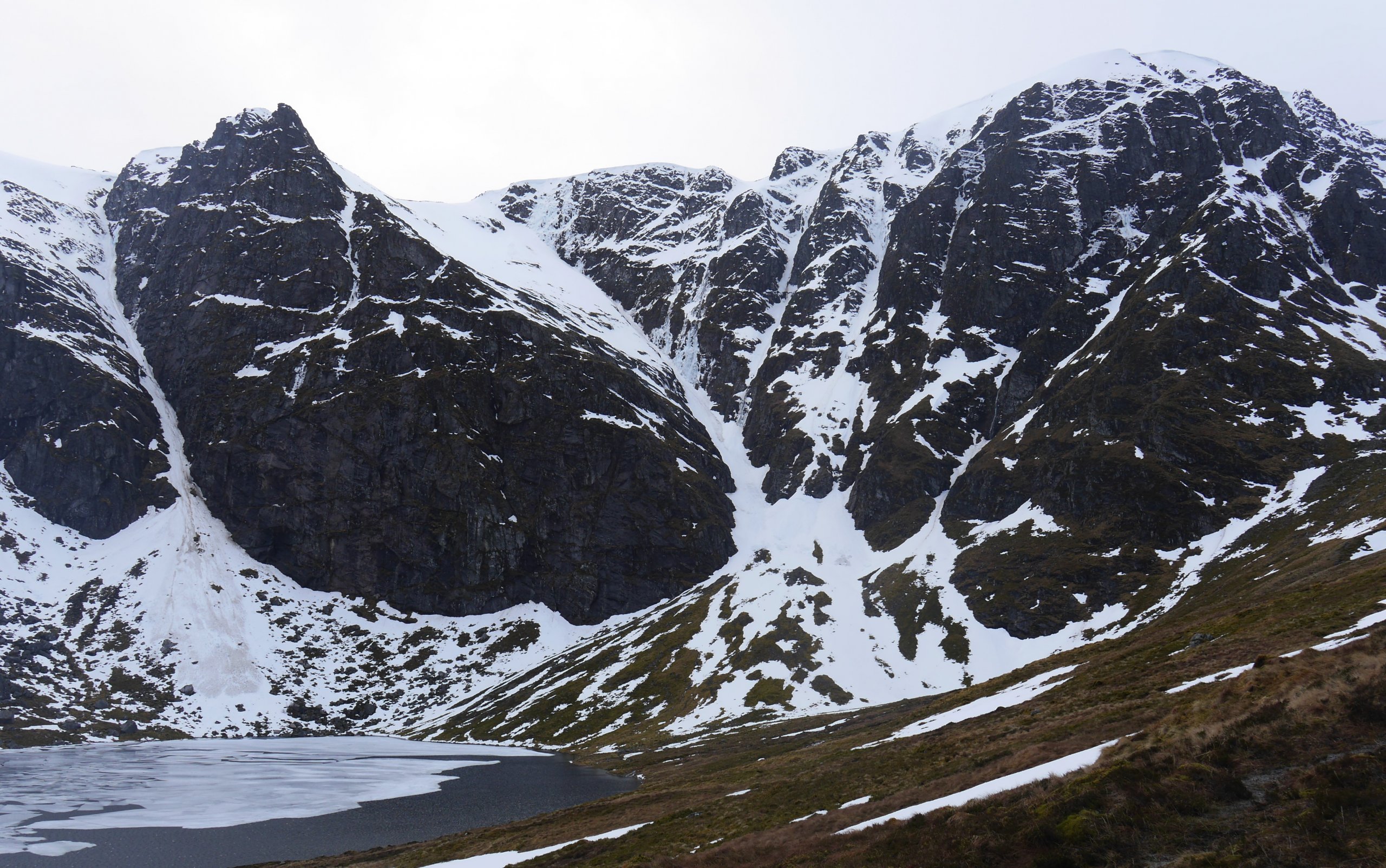
(Above) The crags and gullies of upper Coire Ardair. Much blacker crags and much depleted snow cover after the recent very mild and wet spell. The remaining snowpack is thoroughly moist from top to bottom but reasonably well stabilised in most places. Fair amount of older and more recent avalanche debris lying at the base of crags and gullies. The debris lying below Raeburn’s Gully (left of photo) and running out almost to the lochan is composed of avalanche debris that’s emanated from some of the ledges on Pinnacle Buttress, plus some cornice debris from much higher up the gully itself. Some large chunks of blue ice are also tangled up with it, the ice having fallen off from the notable blue icicle which is an occasional but ephemeral feature in the upper part of the gully. The remains of the hanging blue icicle are just visible high in the gully (far left of shot), though the colour doesn’t show well.
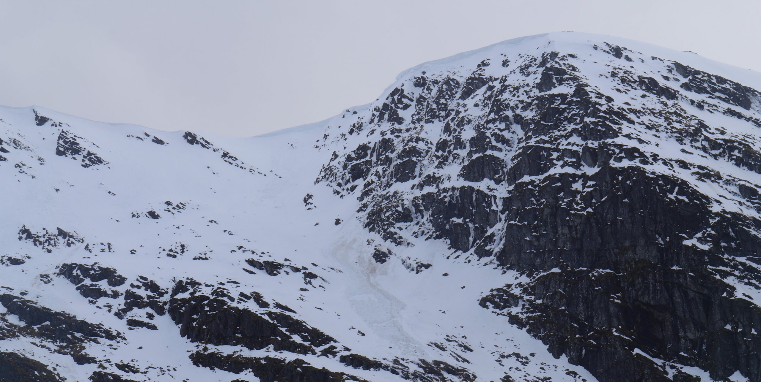
(Above) Bellevue Buttress, Coire Ardair. More avalanche debris here, too, probably from overnight Monday/Tuesday. The avalanche released immediately below the cornice line and ran down over the steep crags. No evidence of cornice collapse in this instance.
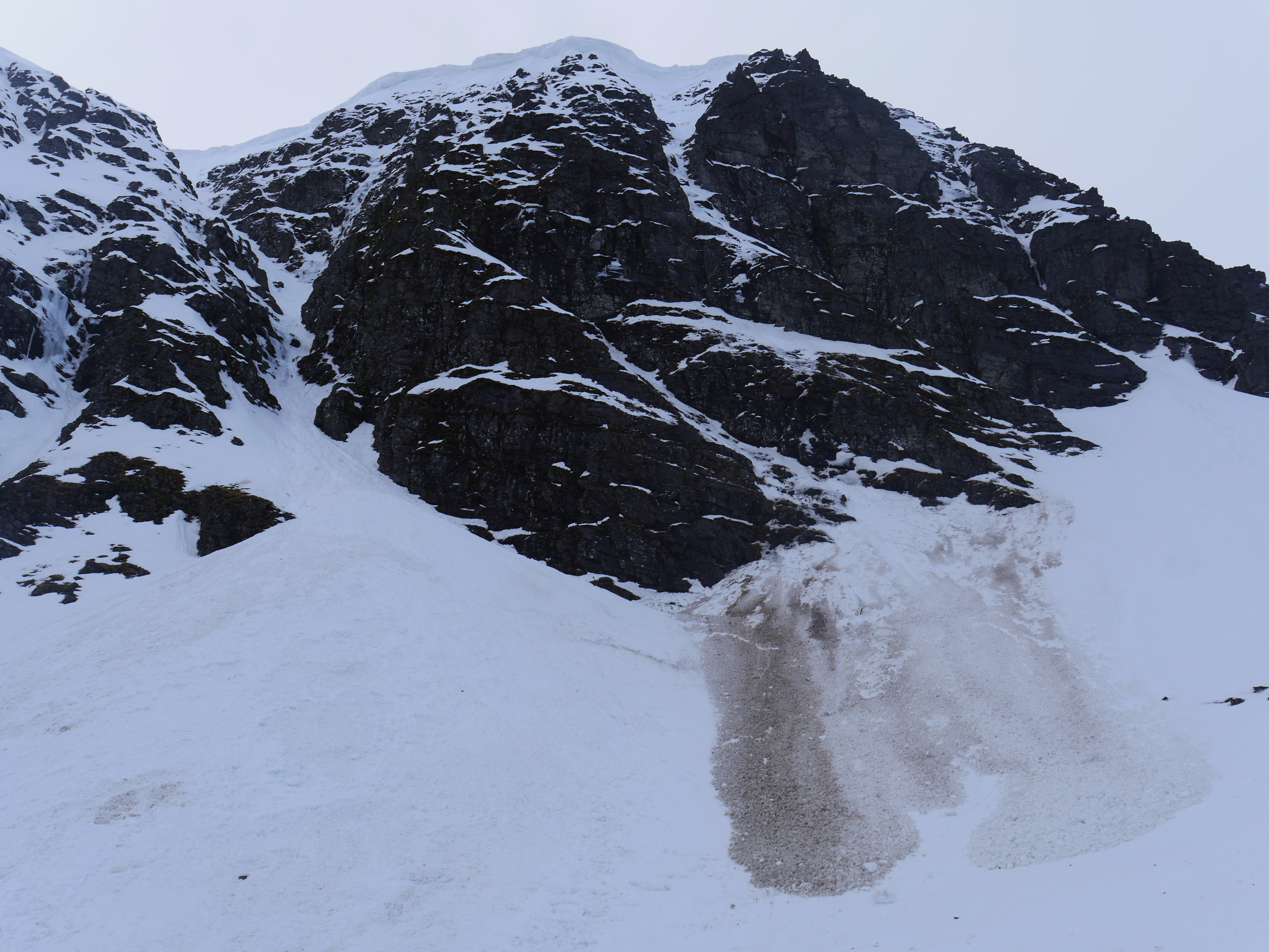
(Above) The Inner Coire of Coire Ardair with ‘Cinderella’, the prominent gully, left of centre. More fairly recent avalanche and cornice debris again from Monday/Tuesday. Crownwall just visible in the obvious snowy bay top and centre of the shot. A considerable number of large moist cornices remain in place in quite a few places in upper Coire Ardair.
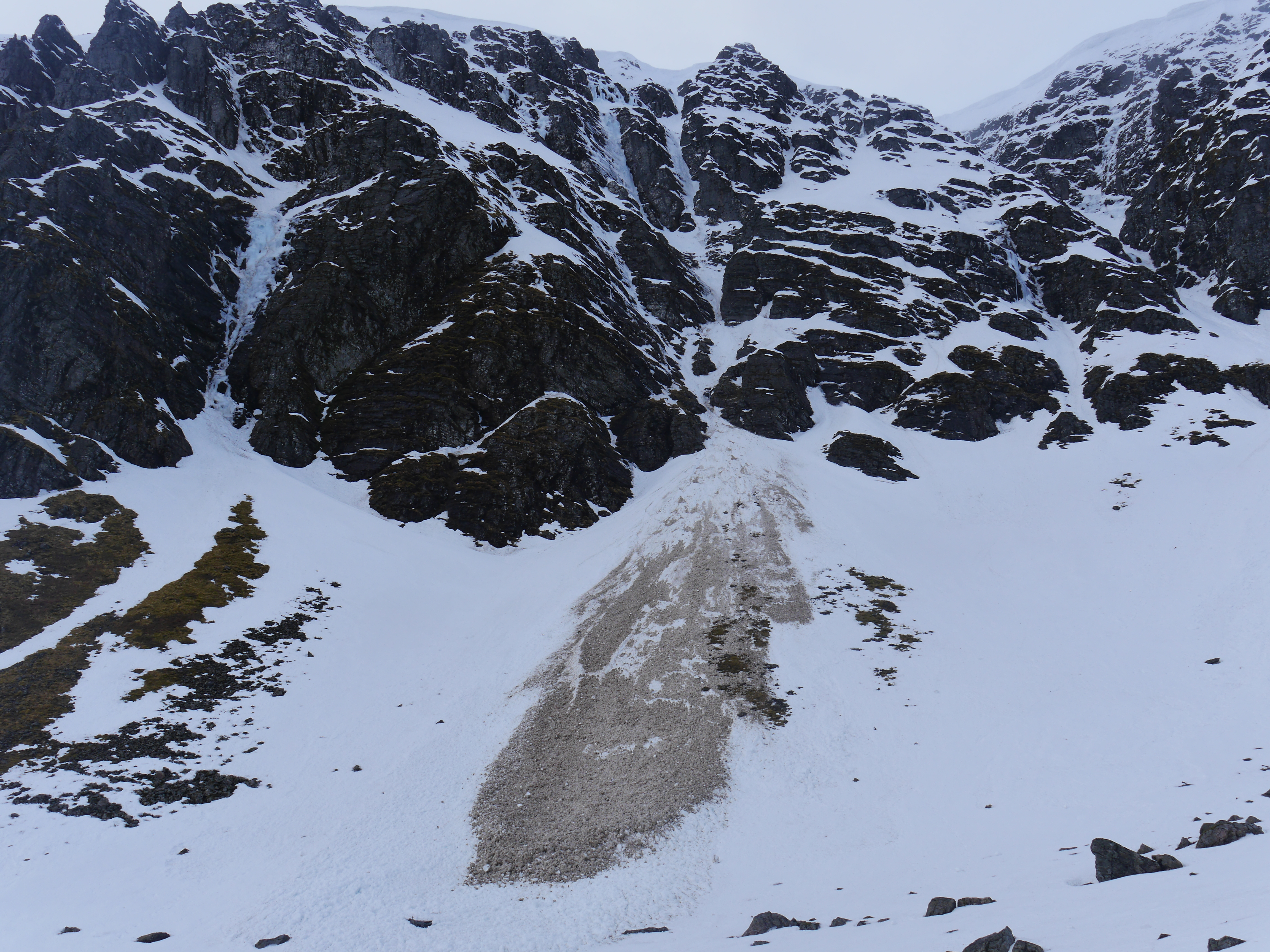 (Above) Same again with similar timings this time below ‘The Wand’ and ‘Diadem’, also in the Inner Coire.
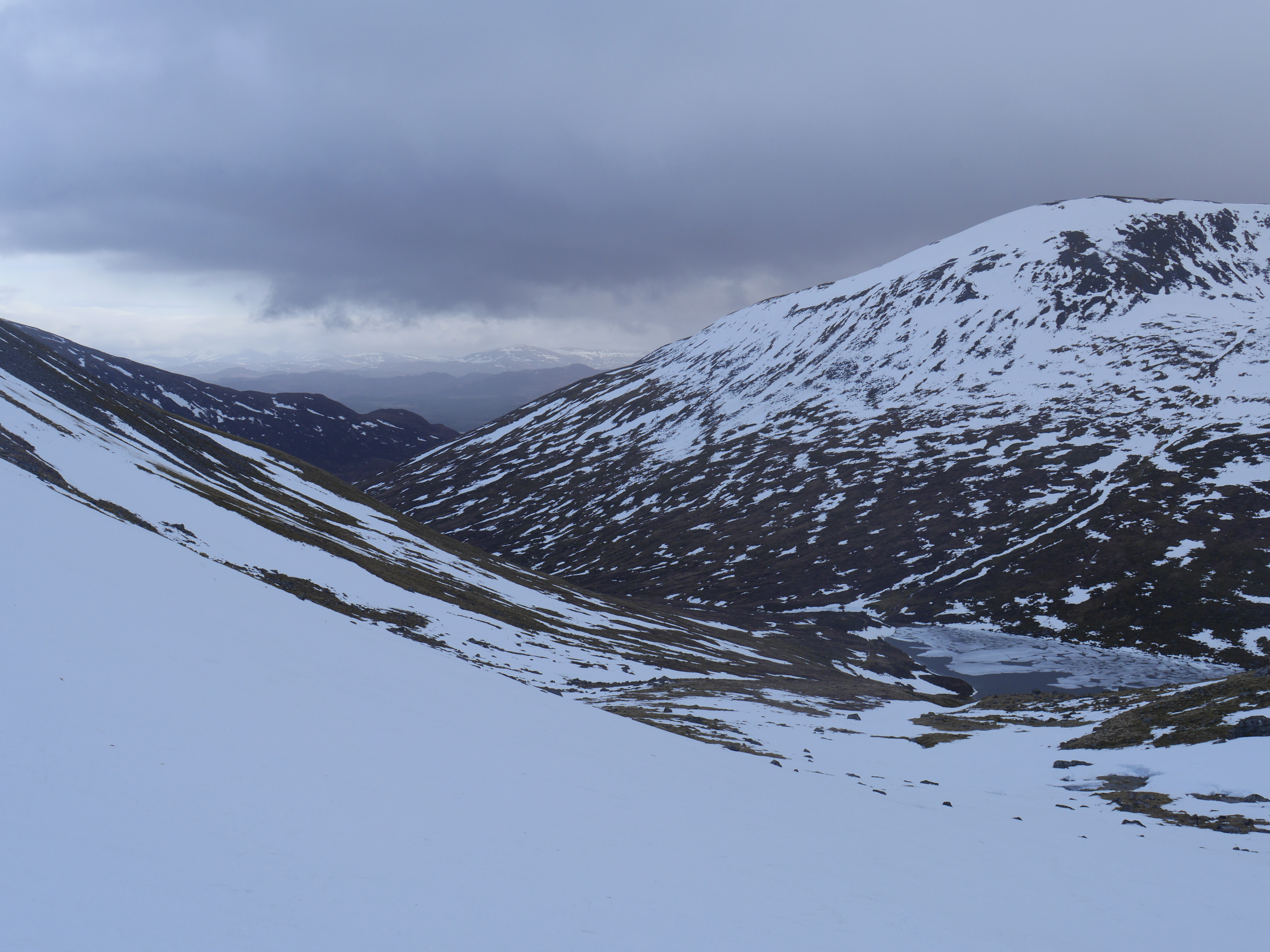 (Above) Looking out from the Inner Coire into Coire Ardair with Lochan a Choire on the right. Best snow cover is now above about 800m to 850m depending on aspect, though ribbons of snow in gullies descend to lower altitudes.
Change in the weather tomorrow, Thursday, with cooler temperatures and some snow showers during the day. New but localised accumulations of windslab expected to be in place high on lee slopes by the end of the day.
Comments on this post
Got something to say? Leave a comment


