Winter’s final flourish?
7th May 2021
‘Unseasonal’ conditions here at Creag Meagaidh today! During the course of the day we had it all from warm sun through to really quite wintry snow showers. Good snow cover, too, and deep in places. Best cover was above 750m but snow was lying down on the main Coire Ardair path first thing though melted away during the afternoon.
In view of the above not in the least surprised to find evidence of very recent avalanche activity.
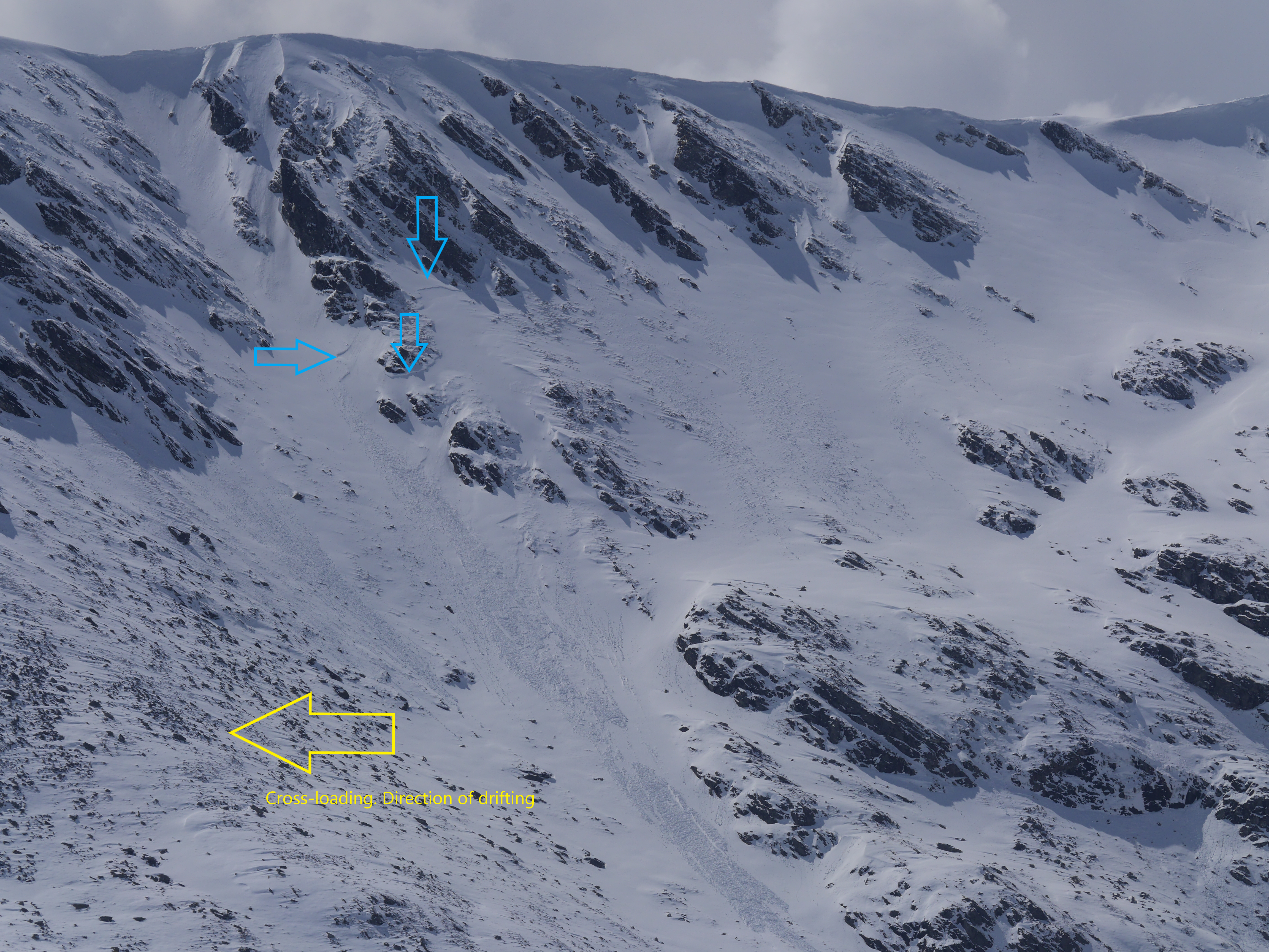 (Above) The steep north-facing slopes to the east of Bellevue Buttress. The sky line is at 1060m. These slopes had been pretty effectively cross-loaded over the past few days by local westerly winds and the avalanche activity triggered by a rise in temperature during the morning. The crownwall was an interesting one. The blue arrows (above) indicate the meandering nature of the avalanche crownwall and flanks. This one slid at around 10am this morning just as it became exposed to the influence of the sun.
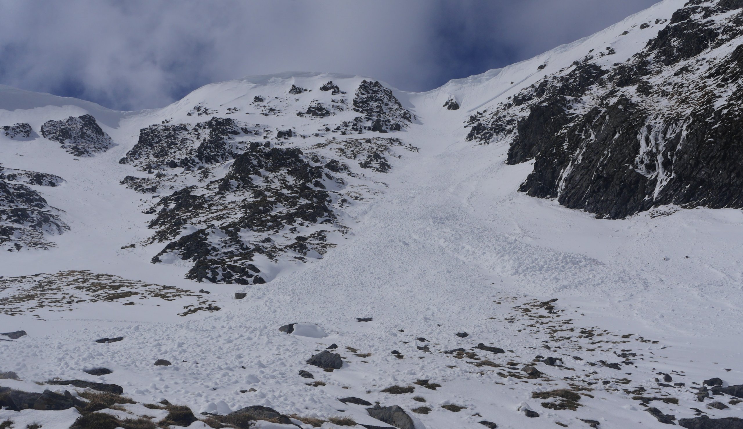 (Above) Cornice triggered size 2 dry slab avalanche on an ESE aspect at about 10am in Coire Chroiochairein. 40m wide, 50cm deep crownwall running out 200m. Again, this one attributed to warm temperatures during the morning.
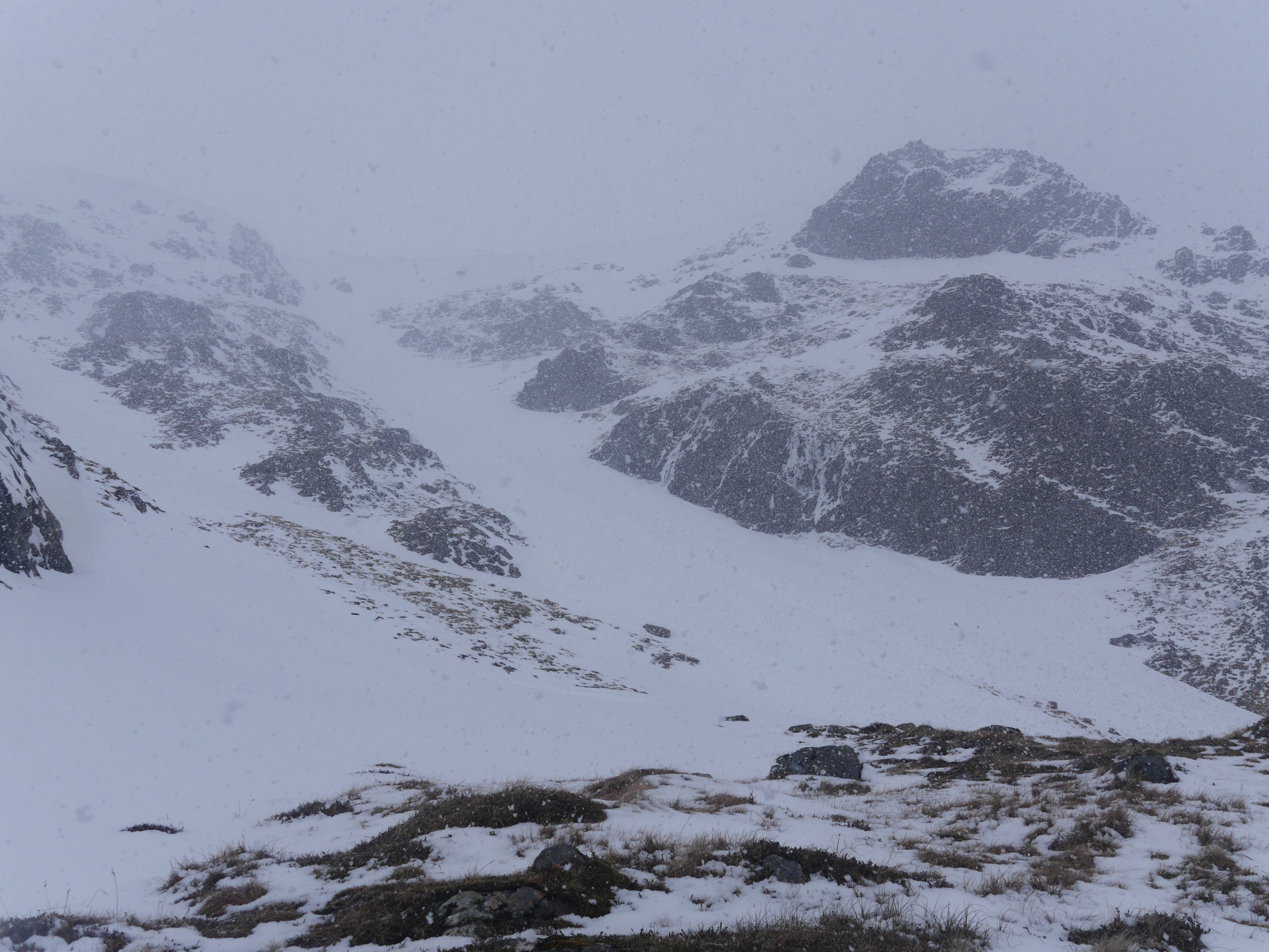 (Above) ‘Shades off, hood up and goggles on! A 15 minute snow shower put a thin layer of snow down in most places above 800m.
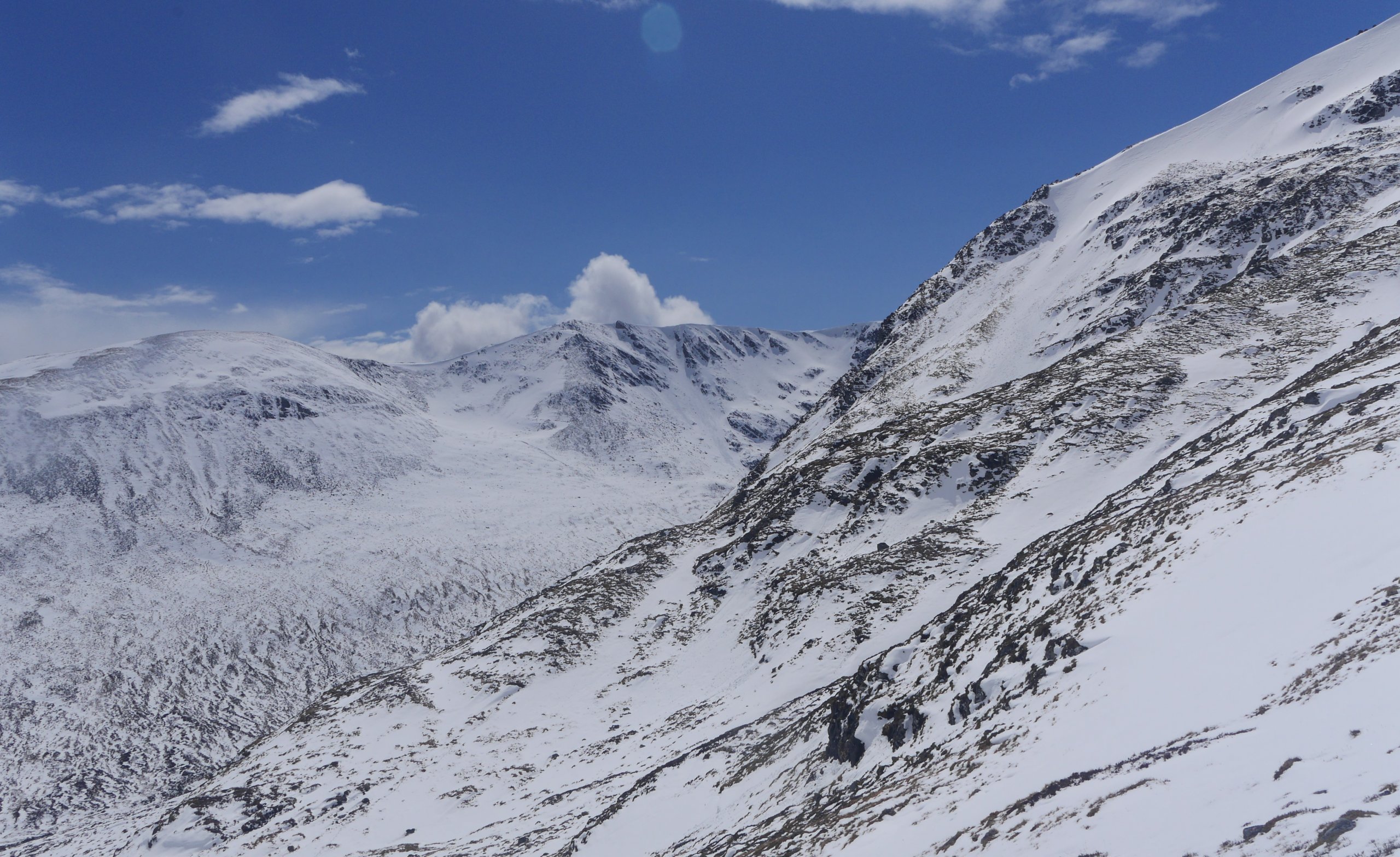 (Above) Good visibility restored shortly thereafter! The view out of Coire Chriochairein towards Sron a Ghoire, Coire nan Gamhna et al.
 (Above) Really quite large and fragile looking cornices above steep ESE aspects in Coire Chriochairein at the moment.
 (Above) A view of the Post Face of Coire Ardair this morning. Note the position of Centre Post – the central one of the 3 prominent steep gullies on this broad buttress.
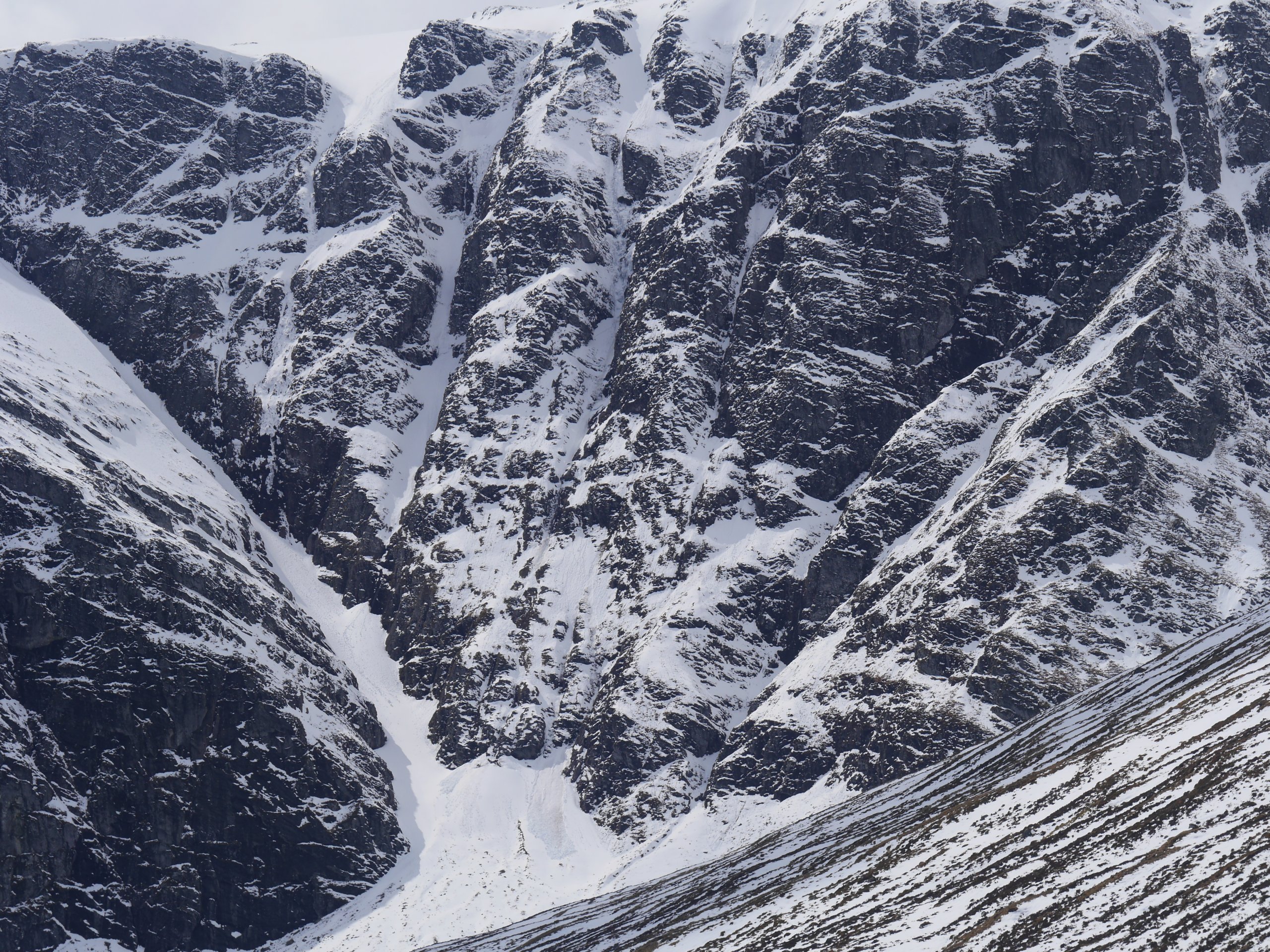 (Above) 1230pm. Avalanche debris below Centre Post. Again, triggered by sustained warming from the sun. If you look carefully you may be able to spot the crownwall about half way up this steep east-facing gully.
Cold temperatures deep in the snowpack expected to maintain weaknesses and marginal stability on N to ESE aspects above 900m on Saturday. Better stability on less steep ground and at lower altitudes in most other places. Watch out for those cornices! Much stronger winds and a few snow showers will deposit new windslab on NW aspects but only of significance towards the end of the day.
Comments on this post
Got something to say? Leave a comment


