M is for Malik
29th January 2022
A particularly burly day was experienced today across the Creag Meagaidh area and much of Scotland, as Storm Malik sweeps in. Interestingly, this storm has been designated M for Malik by the DMI (Danish), while the next named by the Met Office will be C for Corrie as per convention.
Exceptional storm to hurricane force winds have been the norm at higher elevations with Cairn Gorm measuring a maximum gust of 147 mph today.
Although such wind speeds are not record breaking by any stretch, they are infernal and unrelenting in the mountains as anybody who has been at their mercy can attest. The clues were there to a wild day in the mountains with a solitary traffic cone being blown down the Main Street in Newtonmore this morning.
Shortly after leaving the car my experience was similar, staggering in the gusts I was left dented, scuffed and hollow inside, much like the solitary orange cone. Not wishing to be left to the fate of the windspeed alone, I decided to stay at lower elevations for the duration of the day.
Some very high windspeeds have also been recorded around Scotland’s coasts with 142 mph recorded at Fraserburgh in Aberdeenshire in 1989. So it is not just the mountains.
For this reason I often look at the METAR (Meteorological Aerodrome Report) for RAF Lossiemouth or Inverness Airport at Dalcross. Arguably, the weather is nearly always better on the Moray Firth.
Today the midday alert popped up on my phone as:
METAR EGCS 291150Z 29030G43KT 9999 VCSH FEW026 BKN038 BKN050 07/04 Q1010 RMK BLU
You can automatically convert this, but it is a nice exercise to do it manually. Assuming I am not too rusty:
METAR = The type of report. EGCS is RAF Lossiemouth identifier. 29th of the month at 1150 Zulu (GMT). Wind from 290 degrees at 30 knots (35 mph), gusting 43 knots (49 mph). 9999 is something to do with visibility. VCSH is showers in the vicinity. FEW026 BKN038 BKN050 a few clouds at 2600 ft, broken cloud 3800 ft and broken cloud at 5000 ft. 07/04 temperature is +7 degrees Celsius and the dew point is +4 degrees celsius. QNH1010 is the pressure at 1010hPa. RMK BLU = Remarks Blue (which is a military code for general conditions of operation).
So fairly windy out at the coast even in the lee of the mountains to the west.
Weather and aviation aside tomorrow should be wintery with snow falling above 550 metres. This will overlie bare ground in many areas, while above 850 metres poorly bonded windslab will accumulate throughout the day. The picture will look very similar to previous days initially, then with the most intense snow in the afternoon. We will therefore see a transition from a low hazard to a moderate hazard by the afternoon.
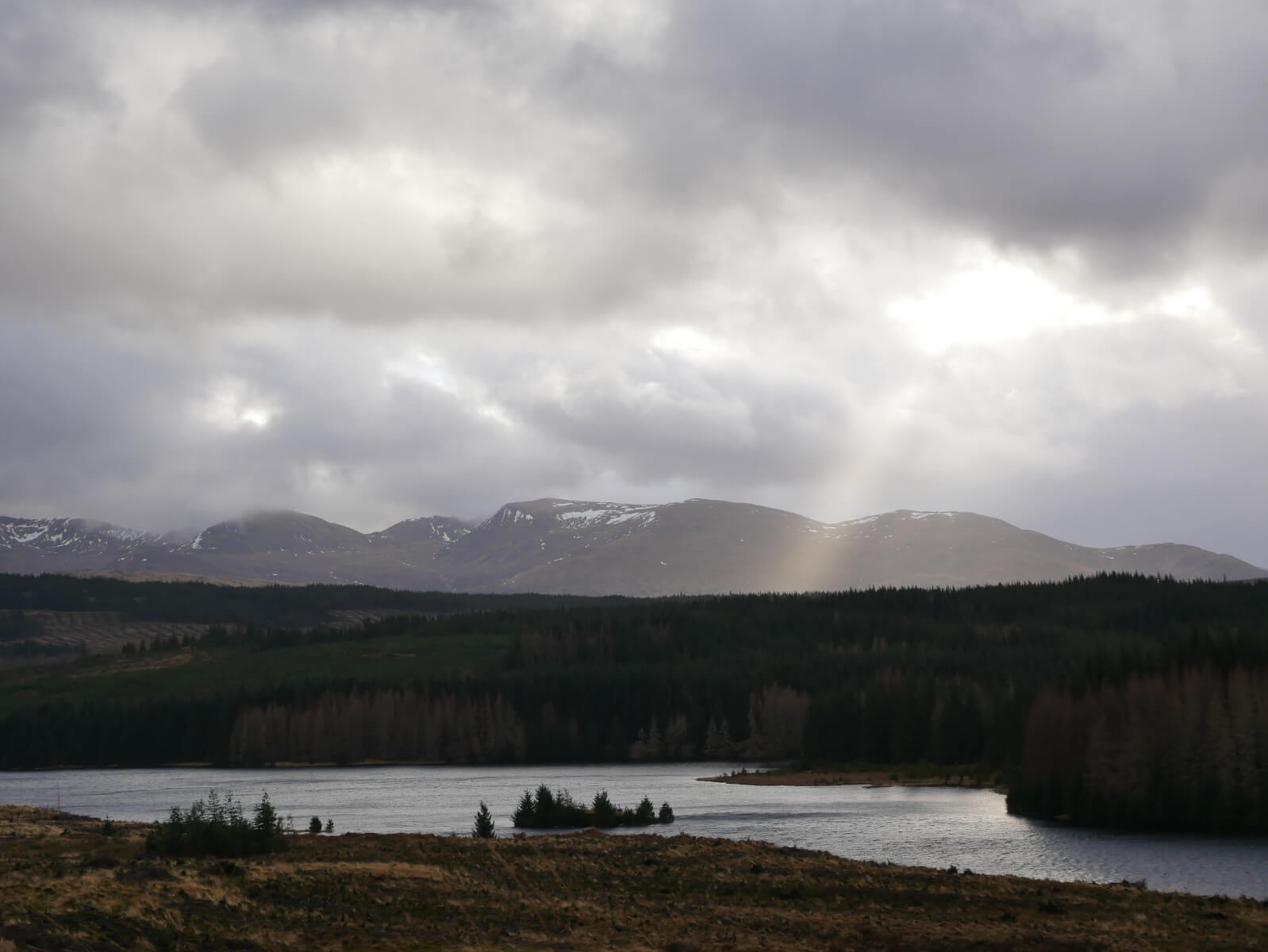
Shafts of sunlight breaking through the cloud during a brief absence of showers. The isolated summits go Geal-Chà rn, Aonach Beag, Beinn Eibhinn and Mullach Coire nan Nead.
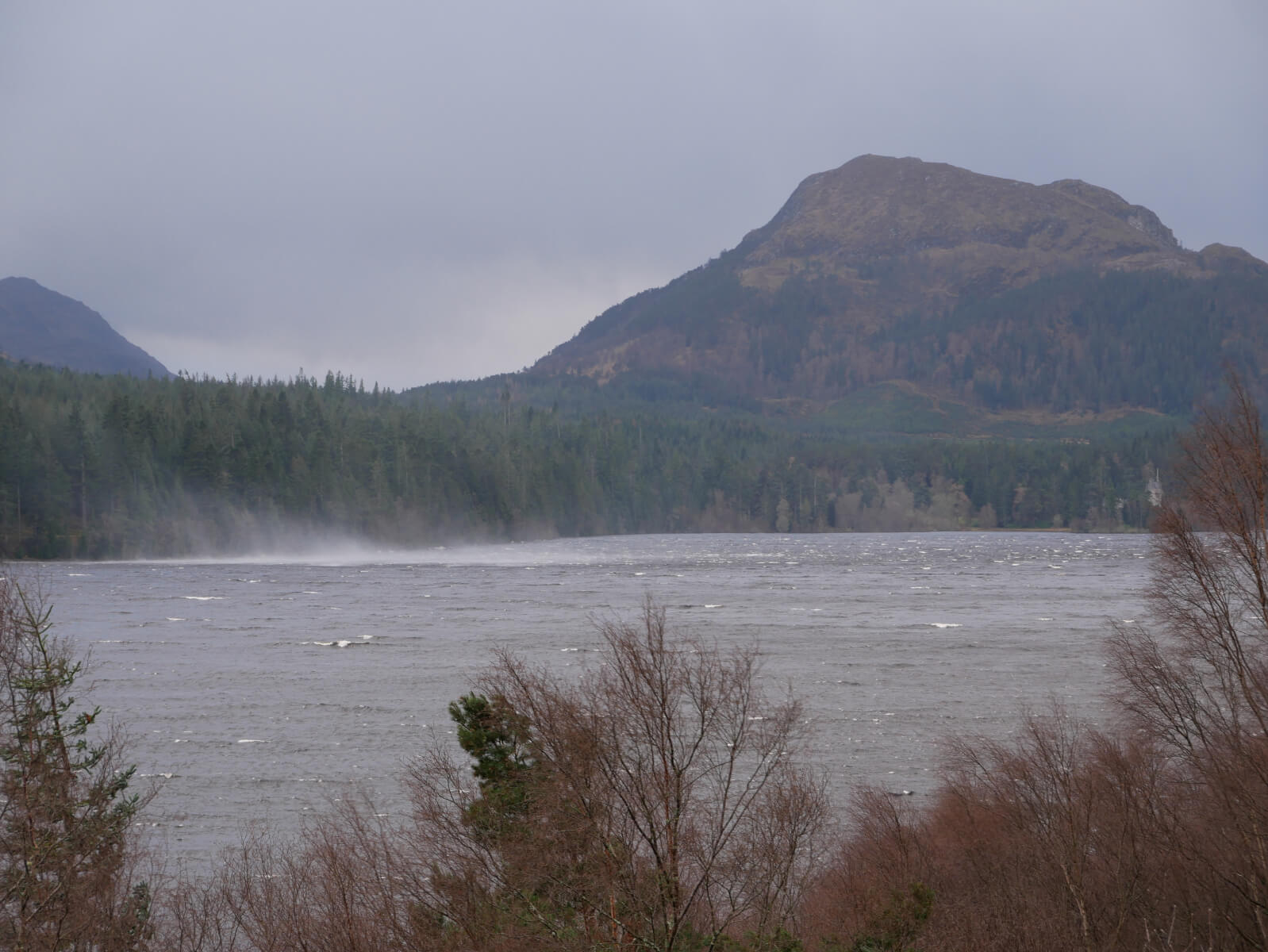
Loch Laggan complete with plumes of water driven up by the wind. Ardverikie and Binnein Shios in the background.

The smallest of snow patches hanging on on Sròn a’Ghoire above Aberarder. This area holds snow readily and has been the scene of some of the largest avalanches in the Creag Meagaidh area.
Comments on this post
Got something to say? Leave a comment


Colin
29th January 2022 8:31 pm
Another great report. Even in Lancashire the winds were brutal as experienced on my fell run (aka – struggle) today. Keep up the good work, still chance of some winter conditions yet!
meagaidhadmin
30th January 2022 8:28 am
Thanks Colin, A return to winter looks likely for the coming days.
ATCO
30th January 2022 9:54 am
The 9999 visibility component decodes as 10km or more. 10km being max visibility reported. 6000 would mean 6000m (6km) visibility. There’s more but you’ll find full details in CAP746 which can be found online. See also TAFs ( forecasts) and for Scotland consider Lossie, Inverness, Aberdeen, Dundee, Perth, Glasgow, etc depending which area you’re interested in.
meagaidhadmin
30th January 2022 3:36 pm
ATCO, Thanks. Thought it was vis, could have done with 10km+ on the mountain yesterday. I do like a good guidance document so will download CAP746.
Keith Horner
30th January 2022 1:11 pm
In Edinburgh, the wind speed was intense for most of Saturday, with debris and young children being blown along the streets like the proverbial tumbleweed….. the sound of the wind roaring across our cupula was quite scary. Certainly not a day to be high in the mountains but seems like these intense storms are becoming much more frequent than I can remember.
meagaidhadmin
30th January 2022 3:39 pm
Quite a lot of debris around Keith. In fact a quick check of the Northern Cairngorms blog and it looks like the Newtonmore road cone may have made it to the Ciste car park? http://ncairngormsblog.sais.gov.uk/2022/01/storm-malik/ You may be right with the storms, it certainly feels like quite a few have been stacked up after the relatively stable high pressure of late.
rhys
30th January 2022 2:26 pm
are any of the ice routes in there looking like they are shaping up? thanks
meagaidhadmin
30th January 2022 3:45 pm
Rhys, Afraid to say that the classic ice routes are in the loch. There isn’t a great deal of snow high up the gullies to feed significant ice development at the moment. But hope that will change in the coming days. There are some good mixed routes though given sufficiently frozen turf…
Keith Horner
31st January 2022 1:12 pm
I suppose road cones are entitled to a bit of sightseeing after standing beside a road for most of their lives……