The Great Divide: Scotland’s watershed
17th January 2022
Little known fact: part of Scotland’s watershed passes through the Creag Meagaidh area.
This great divide wriggles its way from Peel Fell on the border with England in the Southern Uplands to Duncansby Head in the top right-hand corner of Scotland. 1200km across peaks, ridges, and bealachs. And peat bogs. Yes, many, many peat bogs.
 (Above) Of course, there are books about it now. Both worth a read, each giving a slightly different perspective. It’s a route for the committed walker with Yeti-gaiters (still available?) and inextinguishable enthusiasm for out-of-the-way places.
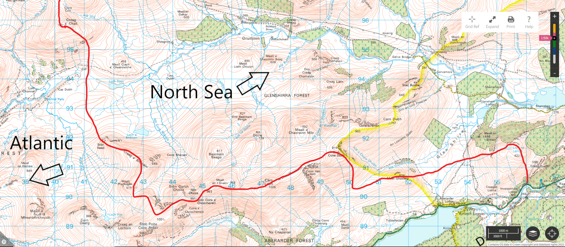 (Above) The red line denotes the watershed. Those of you who are intimate with the detailed hydrology of the area will instantly see the obvious error. Points awarded to those who spot it (sadly, no prizes).
So, a jaunt up Glen Roy for quite some distance today to look at some snow (very little of interest) and check out the watershed on the backside of Creag Meagaidh.
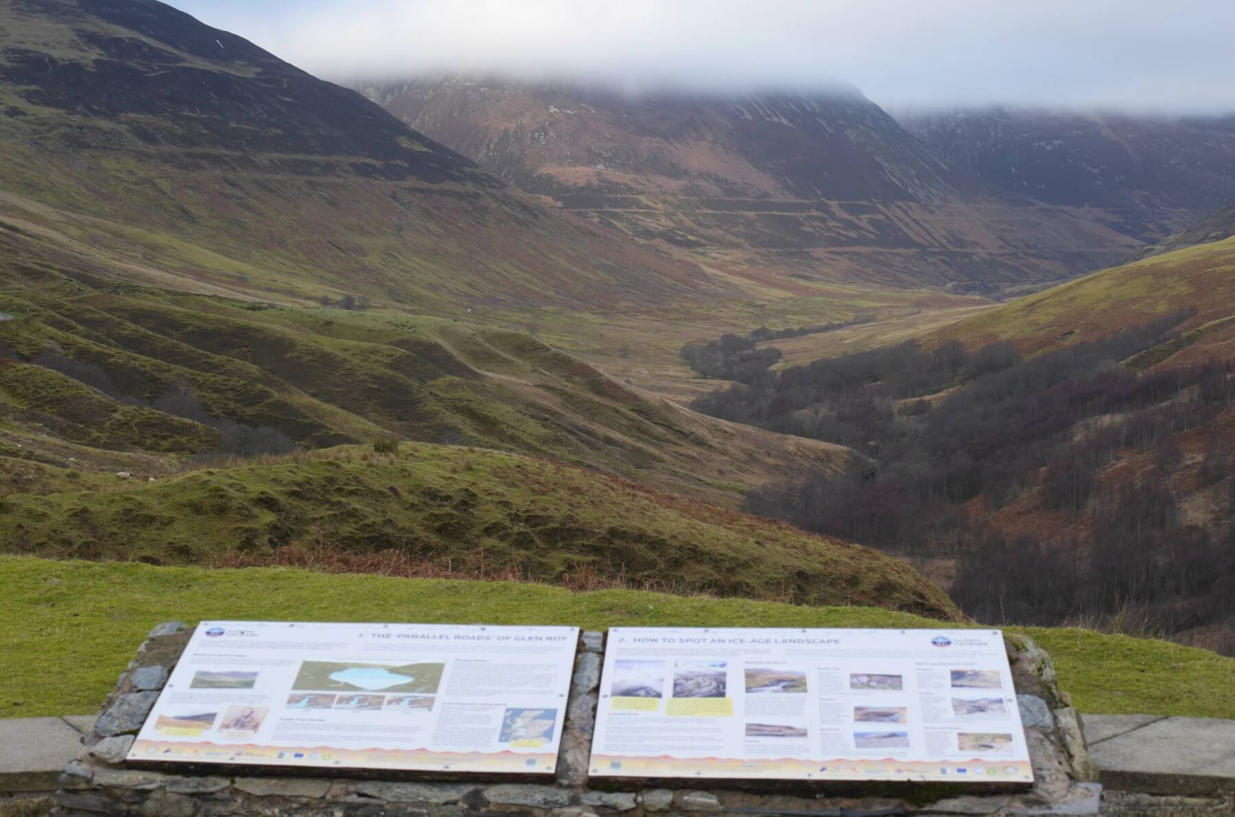 (Above)Â The Parallel Roads of Glen Roy within the Lochaber Geopark and accessed from Roybridge. The origin of these ancient shorelines was one of the few things Charles Darwin got wrong. A very good leaflet about the Glen Roy Parallel roads is available here: https://www.scottishgeology.com/find-out-more/publications/#glen_roy
 (Above) Executive summary, as seen in the Glen Roy car park.
 (Above) Creag a Bhanain – the highest point on the skyline – and Sron Nead just beneath it. The watershed tracks down these two peaklets, across hummocky drift and peat bogs on its way to the very broad bealach just west of Loch Spey. The area here feels wild and remote, with terrible underfoot conditions in many places, and if I’m honest it feels just a bit God-forsaken. However, our wild spaces are a diminishing resource and under threat from energy-related infrastructure so need to be cherished and protected, at least for their wildness & remoteness if nothing else.
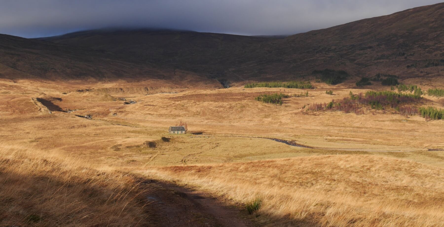 (Above) Luib-Chonnal bothy in the upper River Roy drainage basin and 2 km west of the watershed. Was a good place to bail-out to today for a quick sandwich and a brew after a bog-fest to/from Sron Nead.
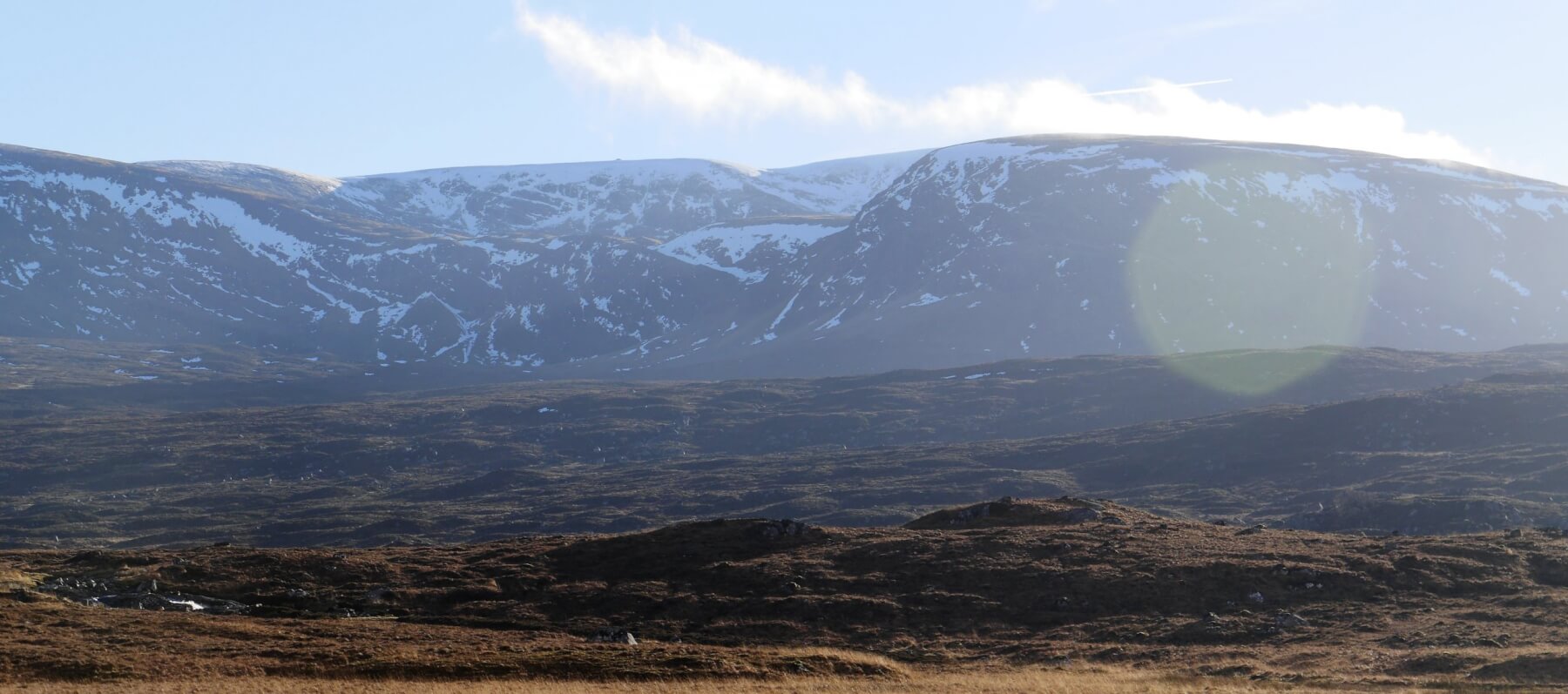 (Above) Looking south to the backside of Stob Poite Coire Ardair. Loch Roy beneath the whitest, snowiest slopes of Creag an Lochain near the top of the skyline. The Window is just on the other side of the highest point of the horizon. Milder at height today with a slight softening of snow later in the day but with good stability in all locations.
Comments on this post
Got something to say? Leave a comment


Keith Horner
18th January 2022 1:40 pm
Great stuff – good to see you diversifying into detailed hydrological analysis of your reporting area and showing some of your more unfrequented regions during periods of lack of snow cover.
Should the watershed not cross through the summit of Creag a Bhanain at the 849m spot height, rather than slightly lower down its westerly slopes, unless of course water can flow uphill in the Creag Meagaidh area?
meagaidhadmin
18th January 2022 4:27 pm
Ahh, Creag a Bhanain…that’s a minor slip of my hand whilst using Microsoft ‘Paint’! Water running uphill – a lot of weird stuff happens at Creag Meagaidh but it has yet to defeat the laws of physics!
The hydrological anomaly (or ‘error’) I referred to in the text beneath the map extract is to do with water running from the reservoir behind Spey Dam nr Glenshero Lodge into Loch Laggan. The waters of the upper Spey were captured and sent westwards back in the
1930s1940s to help service the power requirements of the aluminium smelting plant in Fort William. So, some Spey water has a more or less direct route into the Atlantic.There’s a tunnel running from the Spey Dam reservoir into Loch Laggan terminating very close to the 4×4 Centre at Kinloch Laggan; thus a manmade alteration to the watershed which the authors of the two books quite rightly ignore. (A prominent plaque is located close to the first layby west of the 4×4 Centre that commemorates the life of one of the workers who died during the construction of the pipeline/tunnel.)
No points, Keith, however, you’ve earned a Gold Star for your acute observations!
Keith Horner
18th January 2022 5:13 pm
Ah – what a fountain of knowledge you are – very informative and I doubt many people will know that. Probably just one of several similar diversions implemented during the ‘golden age’ of hydro-electric development which changed the natural hydrological pattern of various parts of the Scottish landscape.
Can we expect a subsequent post on the traditional movement patterns of red deer through the forecast area or a synopsis on General Wades road building activity amongst the headwaters of the Upper Spey……..
meagaidhadmin
18th January 2022 5:46 pm
Anything is possible, Keith, if the hills get any browner through a dearth of snow!
I think we ticked the ‘General Wade’ box a year or two ago? (I’ve just checked, yes we did!)
dr doug small
19th January 2022 6:08 pm
Are you aware of Dave Hewitt’s book – “Walking the Watershed”?
He was – after all – the first.
http://gdl.cdlr.strath.ac.uk/hewwat/hewwatcontents.html
There is a cover jpeg
http://gdl.cdlr.strath.ac.uk/hewwat/hewwatcover.jpg
meagaidhadmin
19th January 2022 6:34 pm
Thanks for those links, Doug.
Grant Duff
20th January 2022 5:50 pm
I might be wrong but I think the Kinloch tunnel was completed in the 1940s but never mind it’s a very interesting set up along with the tunnel at the lower Pattack Falls the feeds from the Mashie.
You certainly had one of your bigger days out and I 100% agree the area is wonderful but feels somewhat god-forsaken! I was up by Geal Charn on the very south of your patch today and it felt more like the end of October than January.
Fingers crossed for the end of the month!
meagaidhadmin
20th January 2022 7:14 pm
Having looked more carefully at the dates, Grant, I think you’re right.
Correction added.