Perfectly wintry.
15th January 2018
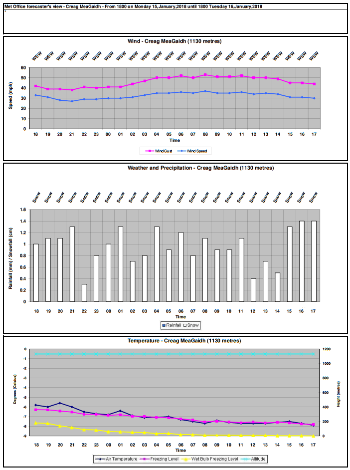
Had one of those rare and perfectly wintry weather forecasts from the Met Office in the SAIS Creag Meagaidh email inbox this afternoon – for tomorrow, Tuesday. Exceptional because of its perfect metrics for wind, snowfall and temperature. Gladdens the heart of an avalanche forecaster! Edit:Â Probably for all the wrong reasons…
Anyway, have a look.
Perfect for what, you may ask? Explanation later. First the other metrics.
Check out the wind (over summits): steady 30-35mph, gusting 45-50mph and from the WSW. Utterly perfect speed for the wind transport of snow and windslab development. (Anything below about 15-20mph is not as good but a lot depends on snow lightness/density, which is normally a product of temperature and humidity). A lot of this snow is going to be landing in ‘all the right places’ (although they’ll be the ‘wrong places’ until some time after it stops snowing/drifting, if you get my drift..).
Now consider the precipitation. All of it snow, throughout the night and all day on Tuesday. None of your miserable mingin’ wet, sleety stuff either. Proper cold snow.
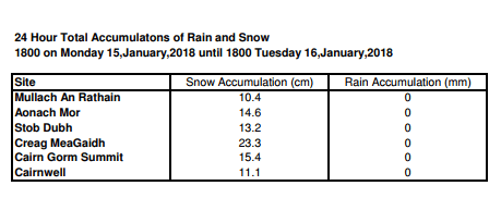
Quantity ‘bragging rights’ go to Creag Meagaidh, too. (Snow falling out of the sky in cm below, not drifted amounts).
Very cold temperatures in prospect. No yo-yo-ing freezing level. It’ll fall to and stay at 250m, giving projected summit temperatures of -7.5 degrees C..
Perfect because, well, wintry weather’s good isn’t it? Maybe not so good in the short term due to the objective danger of avalanches (see the SAIS ‘Meggie forecast for Tuesday), but a substantial dump of snow on our North to East aspects will, sooner or later, improve the climbing and/or ski touring conditions. Should go without saying that Tuesday’s not a great choice for either of those activities due to unstable snow and poor overhead conditions. Having said that, newly scoured slopes and ridges will be better stabilised though of course it will be blizzardy up high.
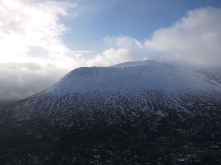
 (Above) Was in Balloon Gully today. On the sidewall of Coire Ardair looking towards the Post Face. Weather cheered up only sporadically, enough for one photo opportunity.
There was a relatively brief overnight meltdown plus rain at all levels which resulted in some wet snow instability. The wet snow surface quickly morphed into crust, then it snowed a bit. New slab was developing on most N to E lee slopes during the day and it’s here where we’ll see most new unstable windslab over the next 24hrs, possibly longer.
 (Above) Sron a Ghoire: drifting snow with windslab beginning to build – and stability declining – as the day progressed.
The wintry weather is expected to last throughout Tuesday/Wednesday and into Thursday.
Comments on this post
Got something to say? Leave a comment


roger clare
15th January 2018 7:58 pm
Thanks for this very interesting information. Let’s hope the forecast is accurate and then winter stays for a while! Not a little envious of the snow fall amounts you’re expecting compared to over here in Glenshee! Always enjoy your blog. Thanks again.
meagaidhadmin
15th January 2018 8:11 pm
Thanks for your comment, Roger. Glad you enjoy the blog.
Most of the other portals of the Met Office seem to be saying the same thing re. wintriness for northern Scotland but we’ll have to wait & see, of course.
Glenshee – what a great ski area. Envious of your extended high level terrain!
Wishing you a white winter.