Spring = Winter
6th March 2023
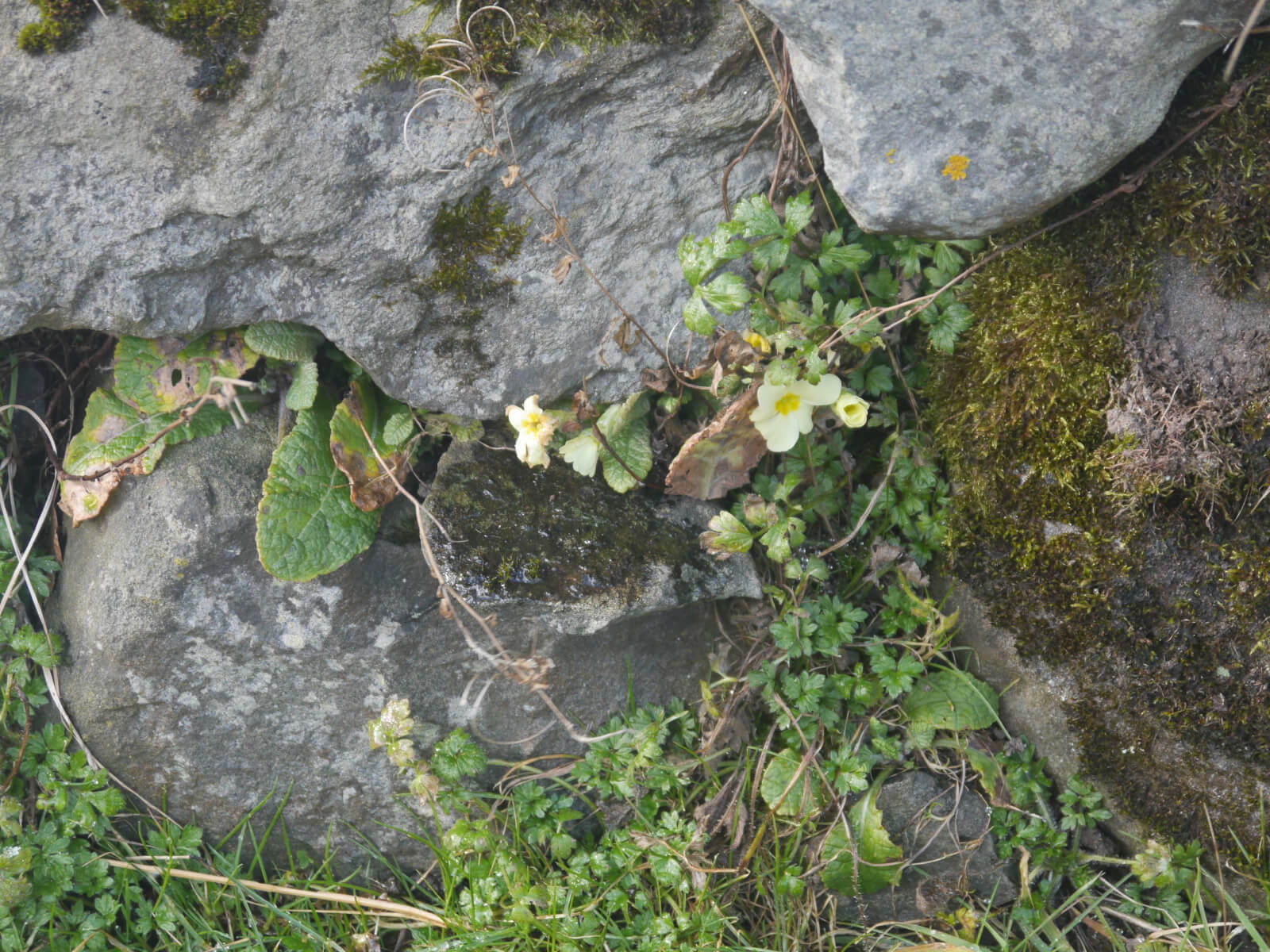 (Above) Primula in bloom today near the staff car parking area up at Aberarder Farmhouse. Spring is here!
…Premature evaluation!
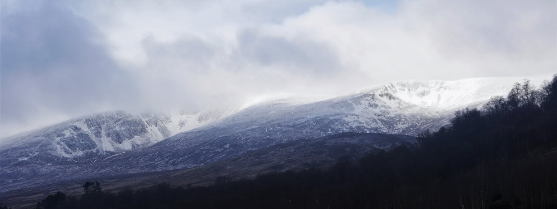
 (Above) Looking west towards Sron a Ghoire et al this morning. Passing showers created a gloomy atmosphere for quite a lot of the day.
 (Above) L to R: Coire nan Gall and Coire Dubh. Lots of exposed rock and heather, at least below 700m in the photo. Very cold temperatures and light snow showers were the order of the day, though the sky did brighten at times between showers.
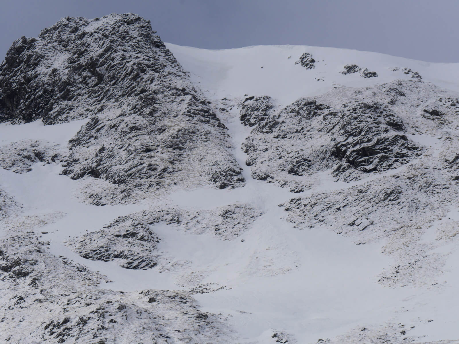
 (Above) More signs that we’re still in winter’s grip. Avalanche activity in Coire Chriochairein this morning. Pretty sure it was cornice triggered and slid shortly before I arrived on the scene as the debris was remarkably fresh. Quite a wide crownwall – about 30m which extended to the right of the rocky boss top right centre of the photo. 30-40cm deep and running out 80m. (My polarising lens filter tends to darken blue skies a bit dramatically but does render the avalanche debris quite well.) The next photo gives better context.
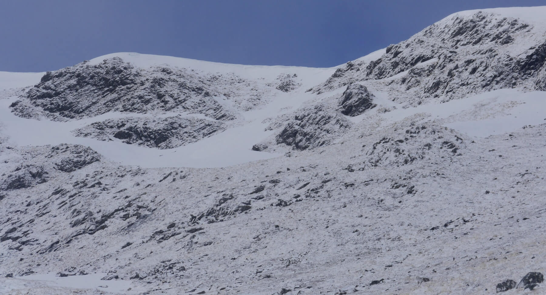 (Above) This shot gives a better impression of the snow cover we have at Creag Meagaidh at the moment. The avalanche debris is in the shallow gully top centre of the photo. The skyline is at circa 970m. We have patchy old, mature snow-ice in the last 100m or so running up to the plateau on the SE aspects in the photo. Today’s unstable snow was limited to the last 15m of that and was up to 40cm deep or thereabouts. Quite a localised distribution of hazard then, at least today.
As a rule of thumb, in the first instance, new snow accumulating on bare ground tends to offer less hazard avalanche-wise than snow drifting onto snow-ice. (That’s a rule of thumb, not a golden rule! Bare ground once covered with new snow can then become a sliding surface/weak layer for subsequent layers to avalanche on. Timing and layering is everything.)
 (Above) East-facing aspects in Coire Chriochairein.
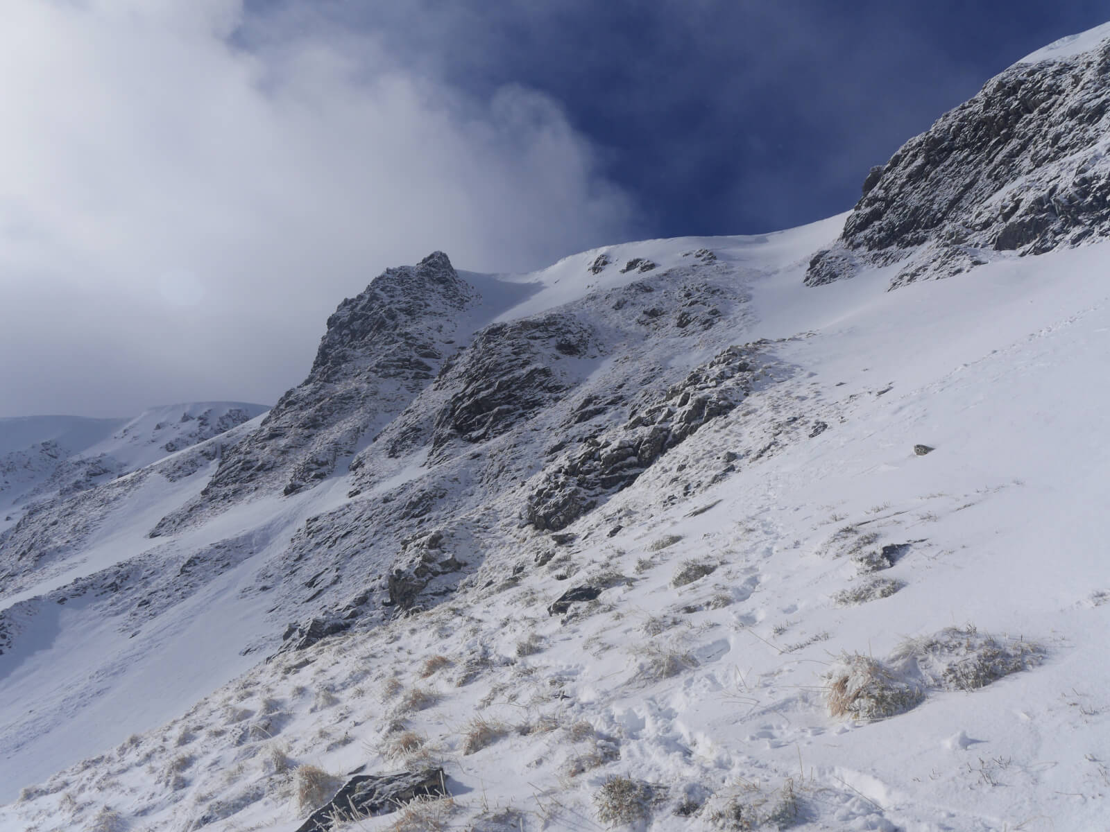 (Above) Timing is everything? I waited fifteen minutes for the clouds to clear and shower activity to cease to get this shot! Coire Chriochairein again with the tower from the last photo left of centre.
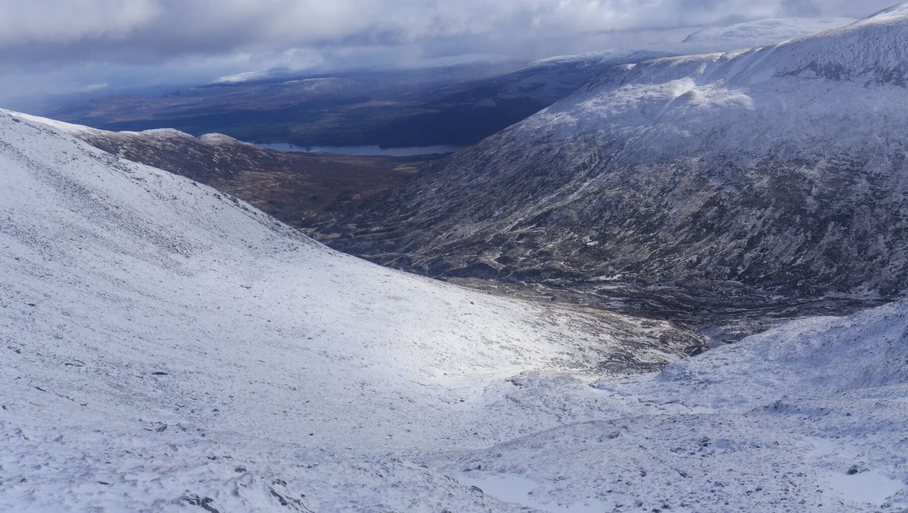 (Above) Looking back down to Coire Ardair from Coire Chriochairein. A cover of 4cm of fresh snow above 700m today.
Only a little more snow for us in the forecast with quite light winds, too, but becoming bitterly cold. Expecting to see more weak windslab high on lee slopes, not extensive but less localised than today. Fragile, relatively low-density (aka weak) cornice growth is anticipated over these places as well.
Wrap up warm!
Comments on this post
Got something to say? Leave a comment


