Carn Liath
3rd January 2026
Snow showers continued overnight and throughout the period today, with poor visibility at higher levels. Undeterred, today’s sortie took me to the summit of Carn Liath at 1006 metres.
The snow cover is a world apart from just two days ago, allowing a round trip on ski. The descent from the summit into Coire Chrannaig was satisfactory save for the appalling visibility. Adequate cover down to 600 metres, balanced with hummock hopping, and walking below 500 metres.
Today’s snow profile site was at around 980 metres on the South-East facing slopes below the summit. Unsurprisingly given the strong North-Westerly flow, around 120-200cm of snow has accumulated here in the lee of an abrupt break in slope. Widespread windslab is present above 900 metres, and this harbours multiple weaknesses. This is most places quite soft, which correspondingly means there will be limited propagation of weaknesses, and large avalanches are unlikely in steep terrain. That said, this still warrants a Moderate Hazard Category, and under steady drifting windslab is likely to become more widespread.
Windslab has been deposited in gullies in recent days (see images below), and these areas, along with the coire rims are best considered with a high index of suspicion.
In addition, the summits immediately east of the core Creag Meagaidh area are expected hold both greater amounts of snow, and experience more significant drifting. In this North-Westerly flow organised showers seem to have penetrated through the Corrieyairack Pass, with the winds accelerating down the Upper River Spey (near Garva Bridge). Correspondingly, the forecast hazard category may be greater in this area. Visitors to the Glen Markie and Monadhliath hills are recommended to also check the Northern Cairngorms report.
To contrast this, reports from parties on Carn an Fhreiceadain and Beinn Bhreach to the north of Kingussie have described largely wind scoured terrain, resulting in tricky ski conditions…
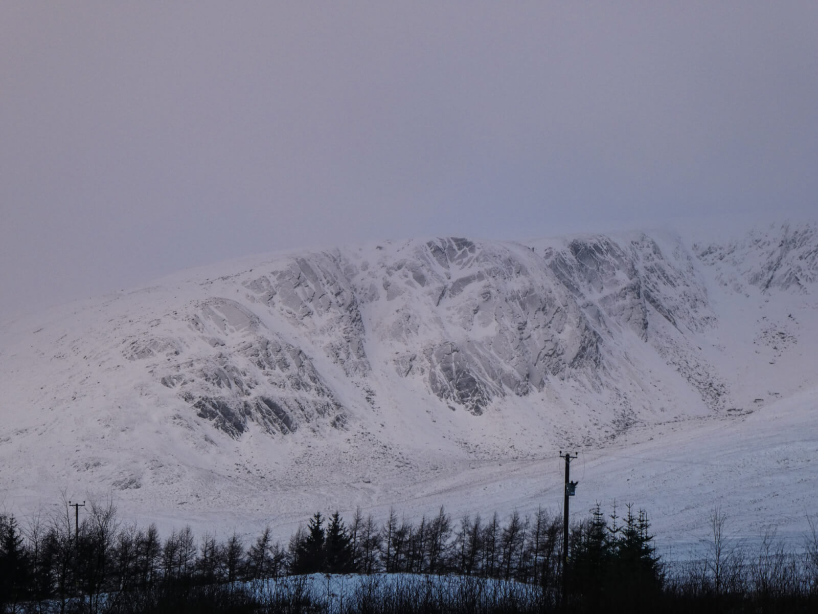
Coire nan Gall in the morning light. Snow was pretty much absent three days ago in this coire.
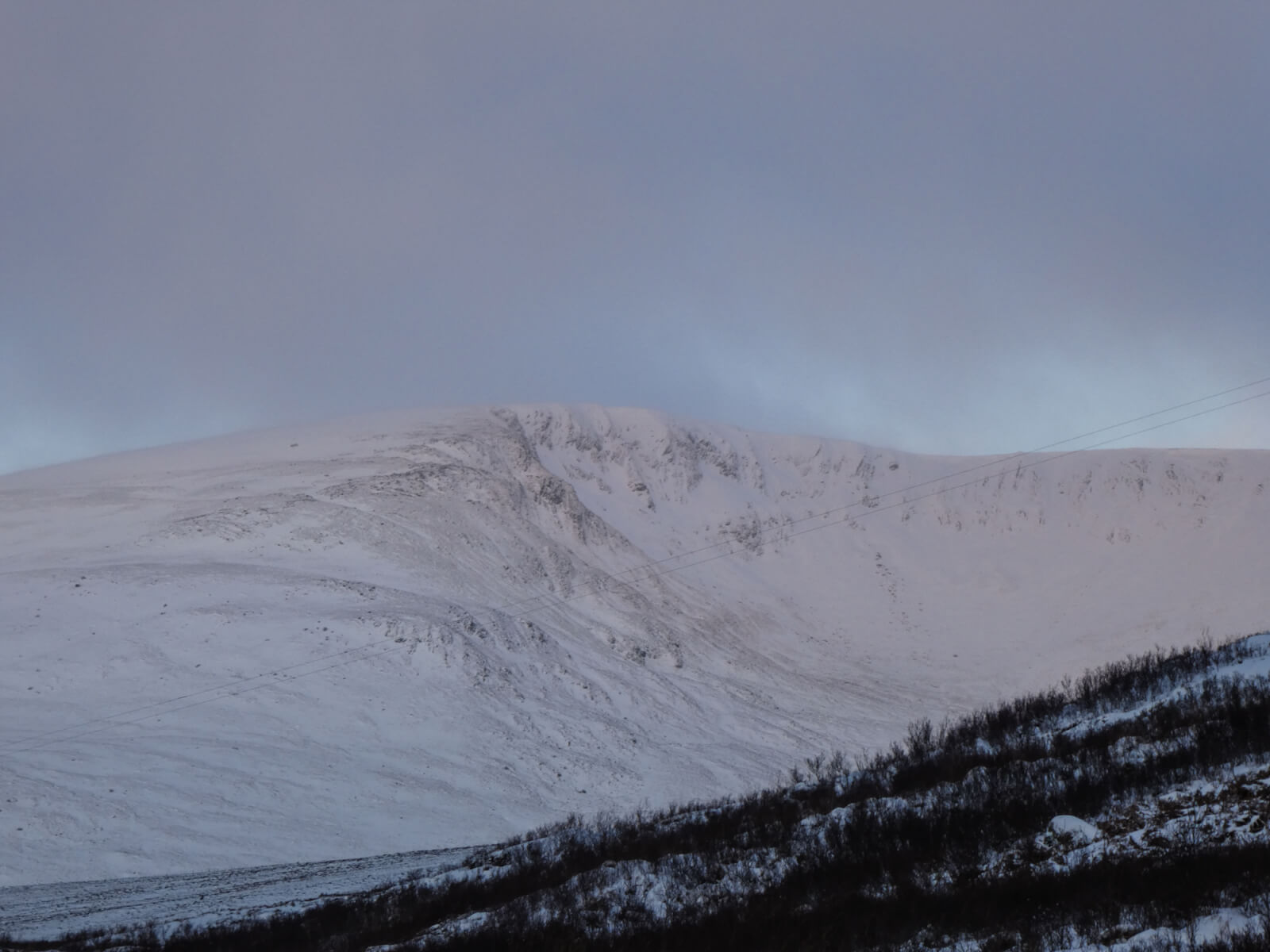
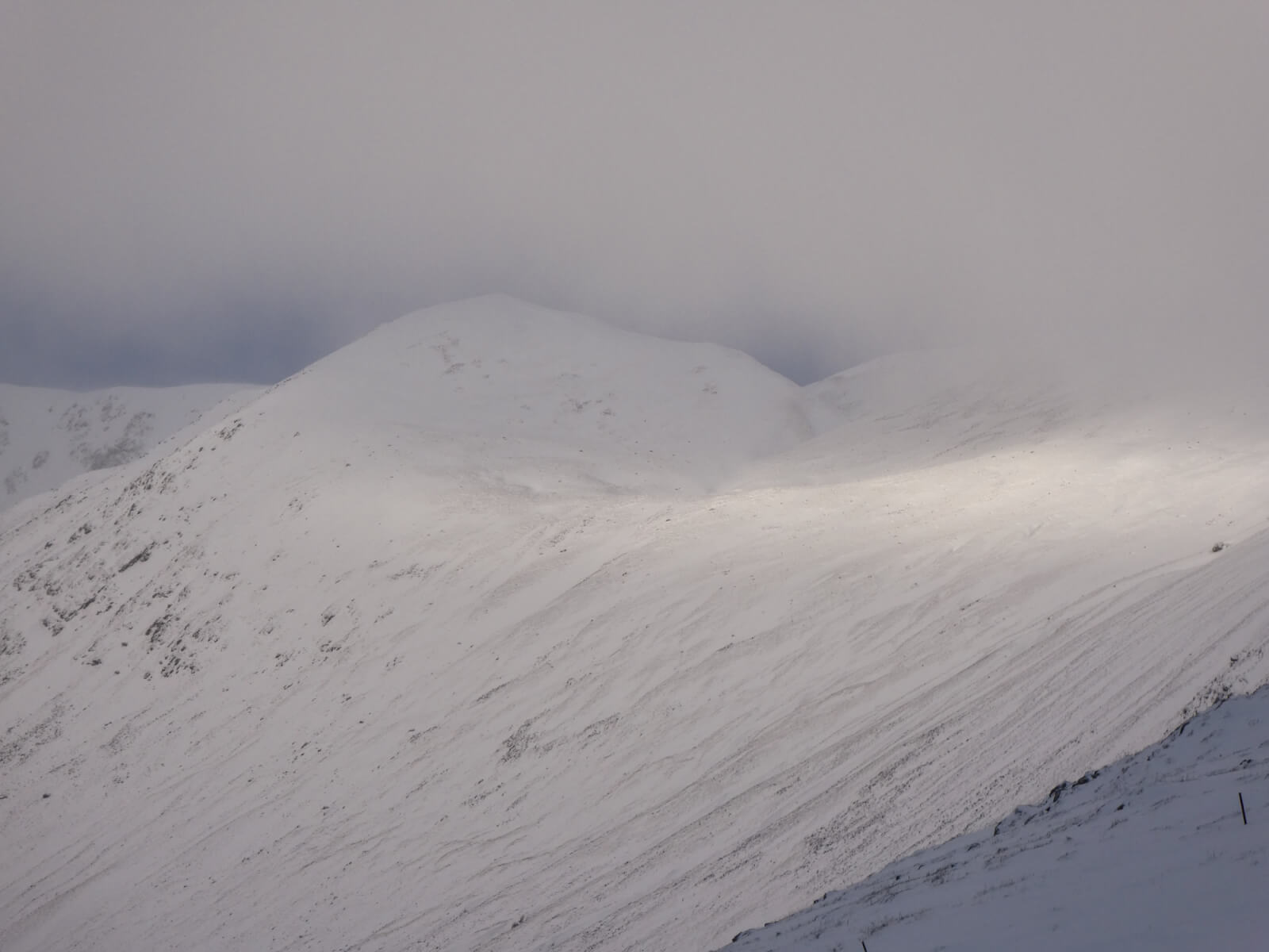
The small summit of Stob Coire Dubh. Note the fresh snow in this coire, centre right.
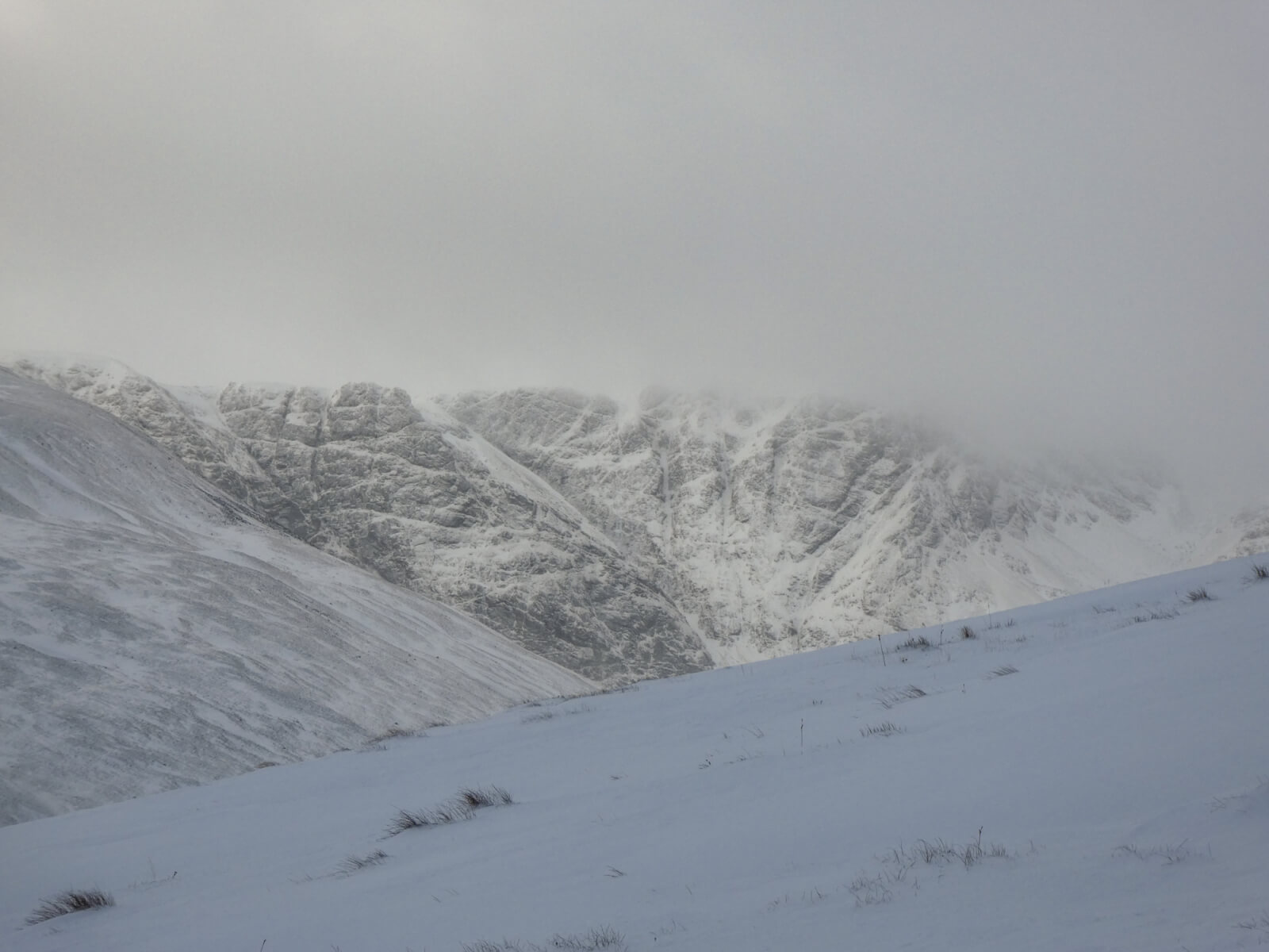
Looking into the Post Face of Coire Ardair. Easy Gully is in the centre of this image running diagonally left to right – clearly some snow has been deposited here in the last 48 hours.
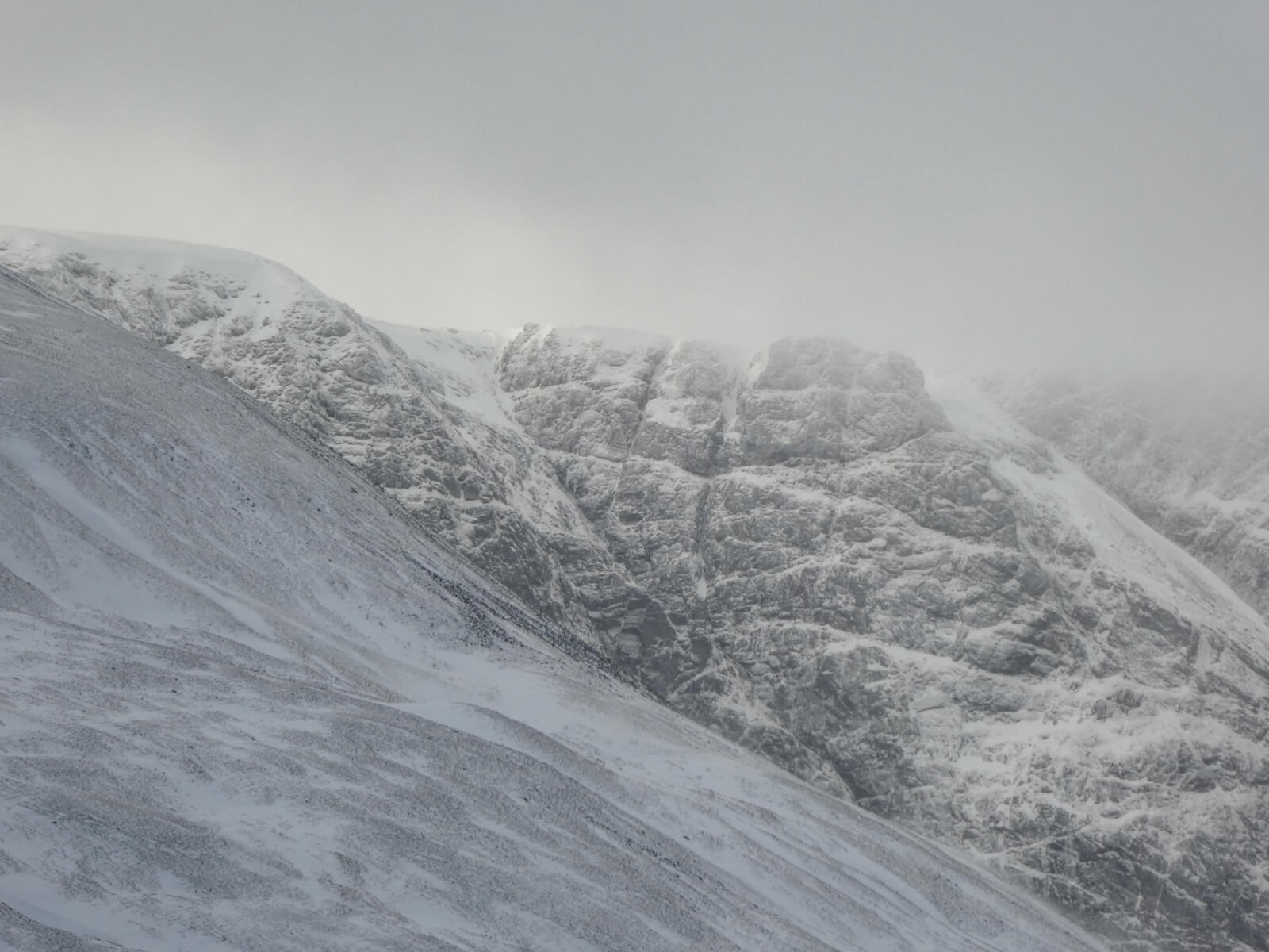
A closer image with Raeburn’s Gully (left) and Easy Gully (right). Some new accumulations and cornices visible in this image around the coire rim.
The summit Sron Coire a’Chriochairein and the obvious gash I believe sometimes referred to as the “Mini Window”. The geology of Creag Meagaidh and surrounding area seems to lend itself to these features often labelled as ‘Dirc’s’ on the OS Map e.g. Dirc an Uillt Fhearna. I have often wondered if they indicate igneous intrusions e.g. pegmatite which is common on Creag Meagaidh but the geological map doesn’t seem to support this…
Comments on this post
Got something to say? Leave a comment