Fabulous Friday!
6th March 2026
After a thoroughly miserable Thursday I emerged blinking into the sunshine today. Some overnight snowfall leavened the scenery too. Sun & snow: a great combo!
About 5cm of snow fell out of the sky over the past 24hrs, most of it carried on moderate NW winds. There was some new localised windslab on E to S aspects – and a thin general covering of snow above 750m – but despite the cold air temperatures this bonded up quite quickly by midday. The old patchy snowpack was bullet-hard at altitude and is expected to stay that way during Saturday.
We have no precipitation in the weather forecast but there may be some drifting of snow from plateau areas. The assumption is that what snow we have on the ground now will have been exposed to quite a lot of solar radiation by the end of Friday and should be reasonably resistant to the ravages of the wind tomorrow. However, if the winds turn out to be a wee bit stronger and the snow a little colder than anticipated then it’s possible we may get somewhat more extensive accumulations of windslab on NW to NE facing lee areas above 950m than indicated in the avalanche forecast. So, a bit of a squeaky bum judgement call today for tomorrow. If there is more drifting, a upwards adjustment of the hazard category may be necessary.
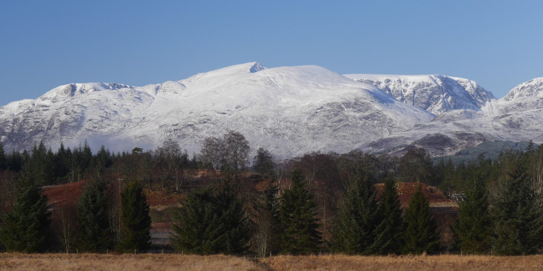 (Above) The Big Picture. Sron a Ghoire, the Post Face of Coire Ardair and The Window prominent. Thin cover of fresh snow at all levels this morning but some disappeared from lower elevations later.
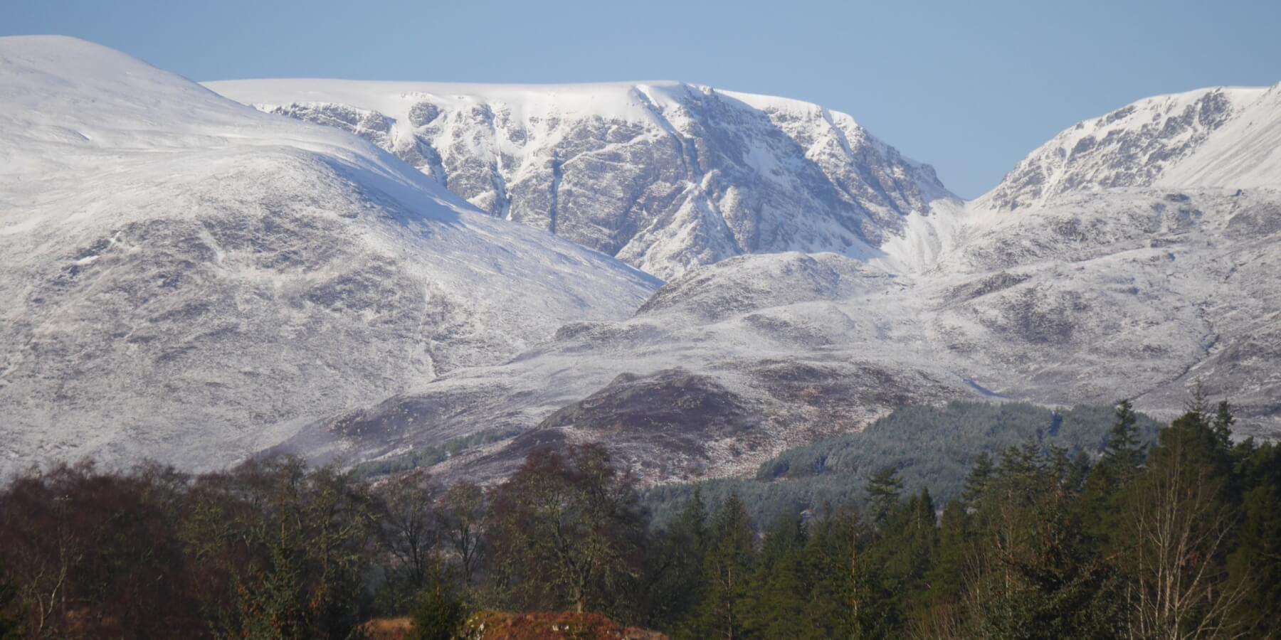 (Above) Inset of the Post Face of Coire Ardair and The Window.
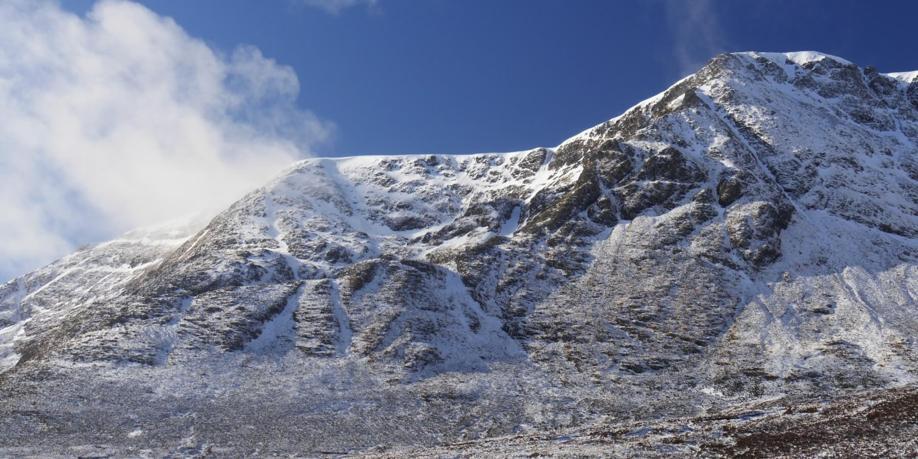
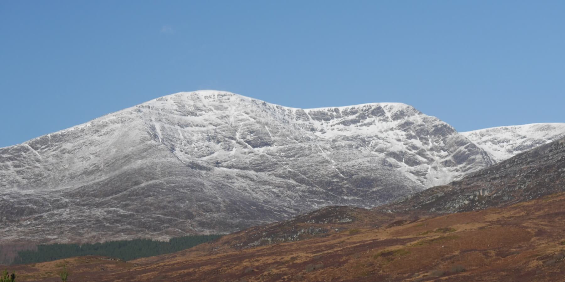 (Above) Beinn a Chaorainn this morning. These sun-exposed aspects looked a little blacker by early afternoon, especially the East Ridge far right.
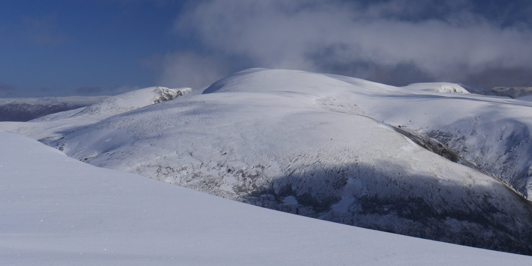
 (Above) The shaded N-facing aspect of the East Ridge of Beinn a Chaorainn the nearest horizon. Looking quite white with what appears to be a reasonable amount of snow-ice. However, this side of the ridge did retain more snow but it flatters to deceive a bit as quite of lot of old snow-ice disappeared during the last sustained thaw. Better at higher altitudes though.
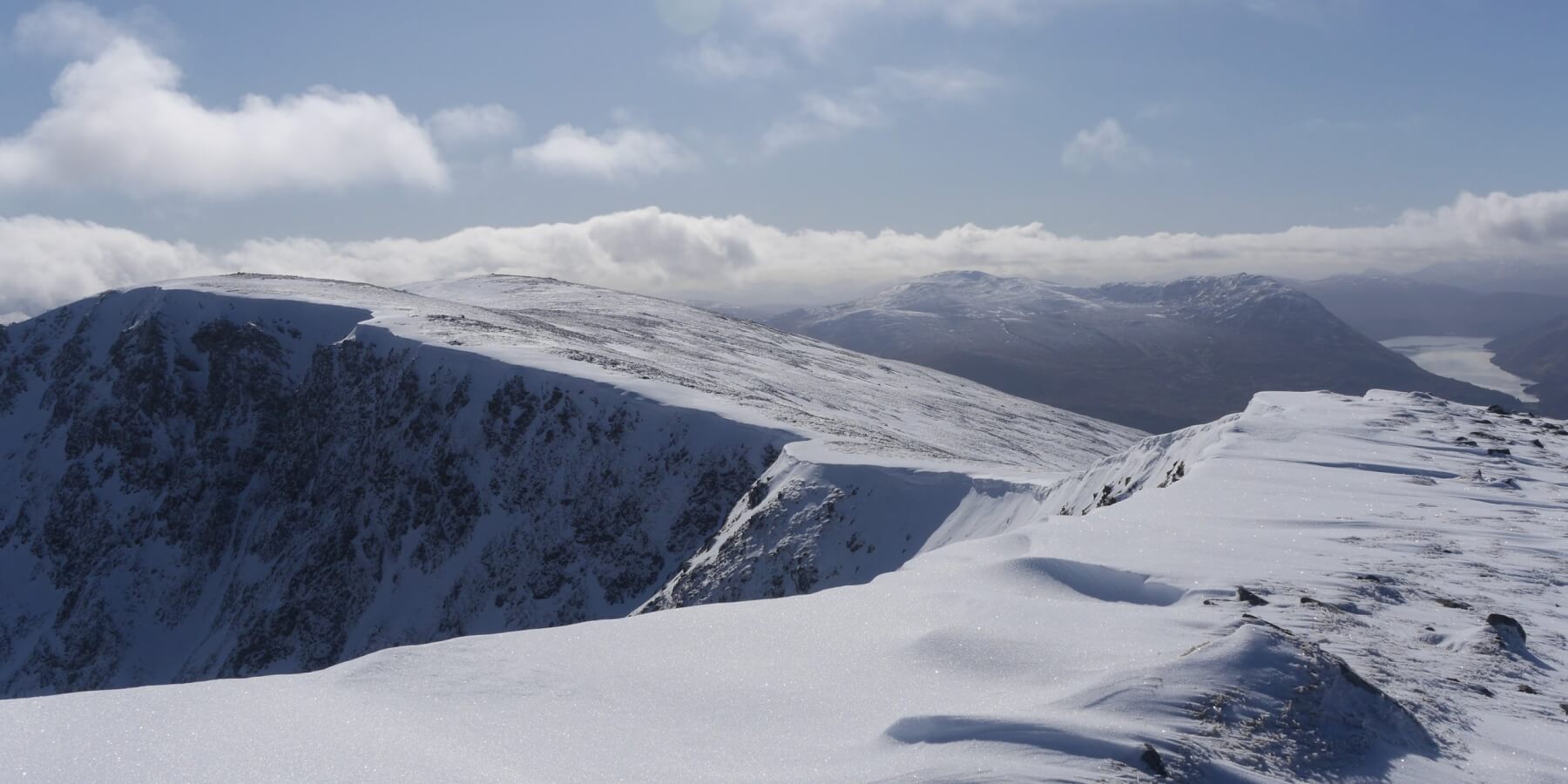 (Above) Part of the rolling whaleback of Beinn a Chaorainn’s multi-summit area. Recently drifted snow lies immediately below the rim on this ESE-facing coire (Coire na h-Uamha) but only extending down 8m or 9m and maxing out at 20cm in depth and tapering quickly down to a few cms. Little or no new cornice development noted.
 (Above) A view across to Creag Meagaidh summit and its extensive plateau. Left of centre is Stob Poite Coire Ardair with its rocky crags; the well-defined, incised bealach, The Window, just below it.
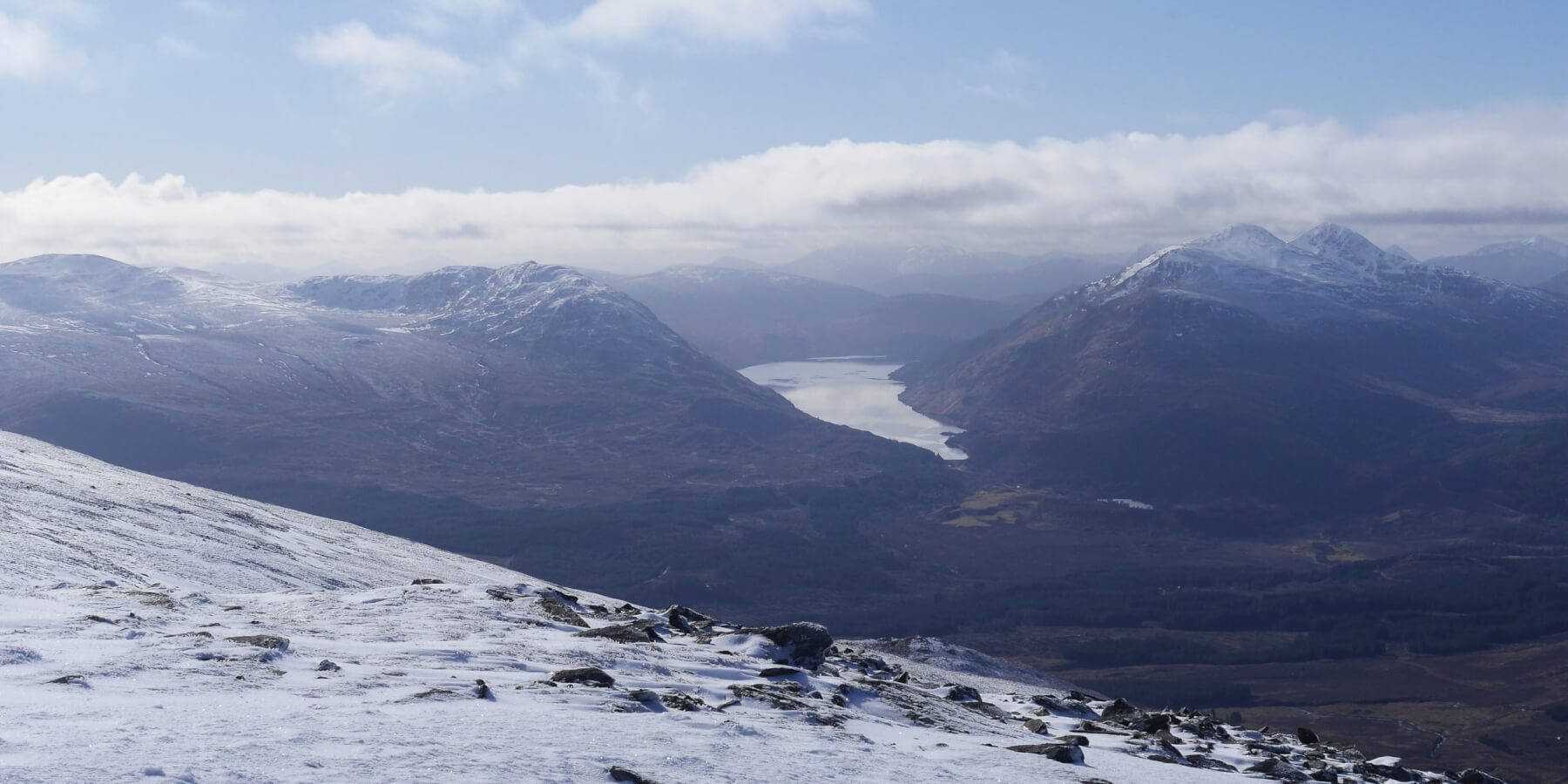 (Above) The view across to Loch Treig – overlooked right by the twin pap-like peaks of Stob a’ Choire Mheadhoin and Stob Coire Easain.
Comments on this post
Got something to say? Leave a comment