British Summer Time.
29th March 2026
Sudden powerful and overwhelming squalls. Heavy rain. Sleet. Deep snow atop deep slush. Punishing showers of graupel. Later, drifting snow.
Summer’s here!
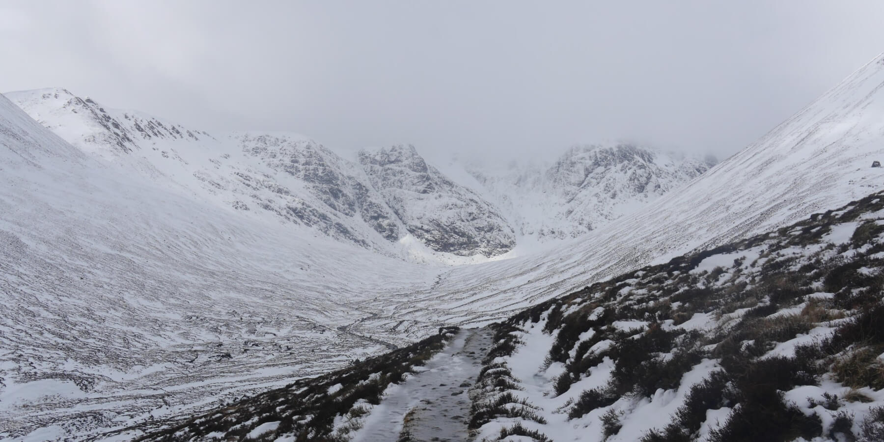 (Above) Upper Coire Ardair. A wet and thoroughly unpleasant place in the early part of the morning. Very wet and slushy main footpath, looked river-like in places due to the run-off.
No surprise there was a lot of avalanche activity today. Persistent snowfall overnight and into the morning followed by a brief and sudden meltdown is almost a textbook set up for snow instability. Wintry temperatures did recover by about midday which helped heal the snowpack above 900m after it had been purged of instability. The hazard level went from Considerable at around 10.30am to Moderate shortly after midday. This rapid change is not untypical in the Scottish mountains. Later the snowfall returned, as did drifting, which is expected to extend right through the night and into Monday morning upping the hazard level once again to Considerable.
Below are some brightly lit shots from today. The camera, it lies! There was 25 minute window in the weather when the sun made sporadic appearances, the rest of the time it was the usual ‘Scottish’.
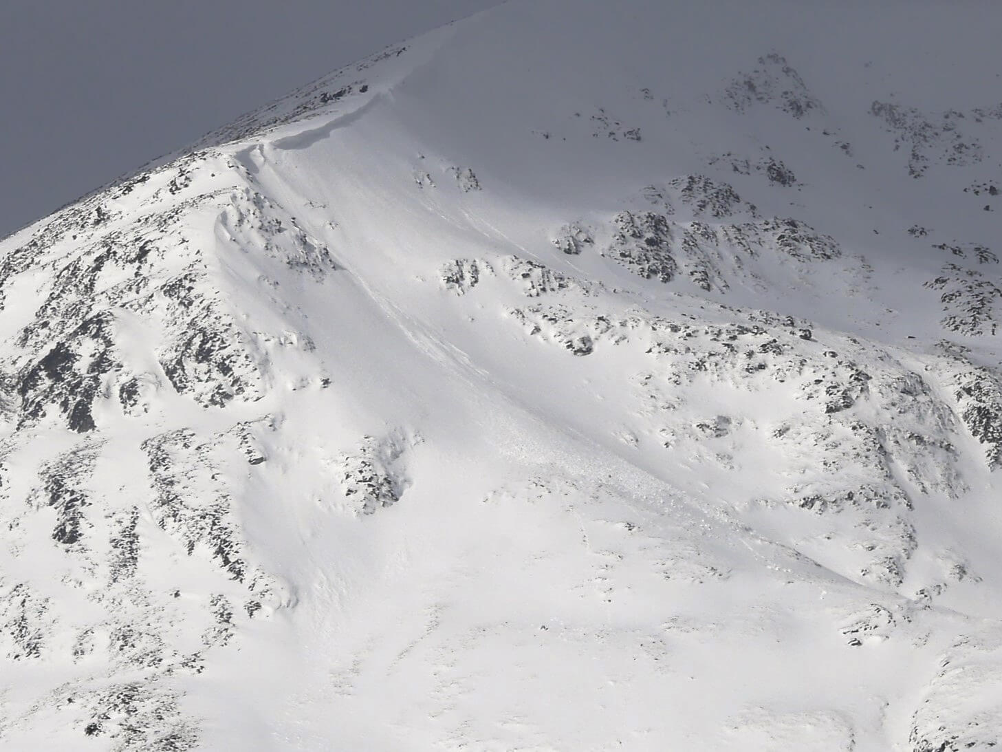 (Above) East aspect in Coire Chriochairein. Small (Size 0.5) cornice triggered avalanche at approx 10.30am this morning, a consequence of the drifting/temperature spike/rainfall combo.
 (Above) Raeburn’s Gully. Coire Ardair. Size 0.5 loose snow avalanche debris here emanating from where Ritchie’s Gully parts company with the parent gully.
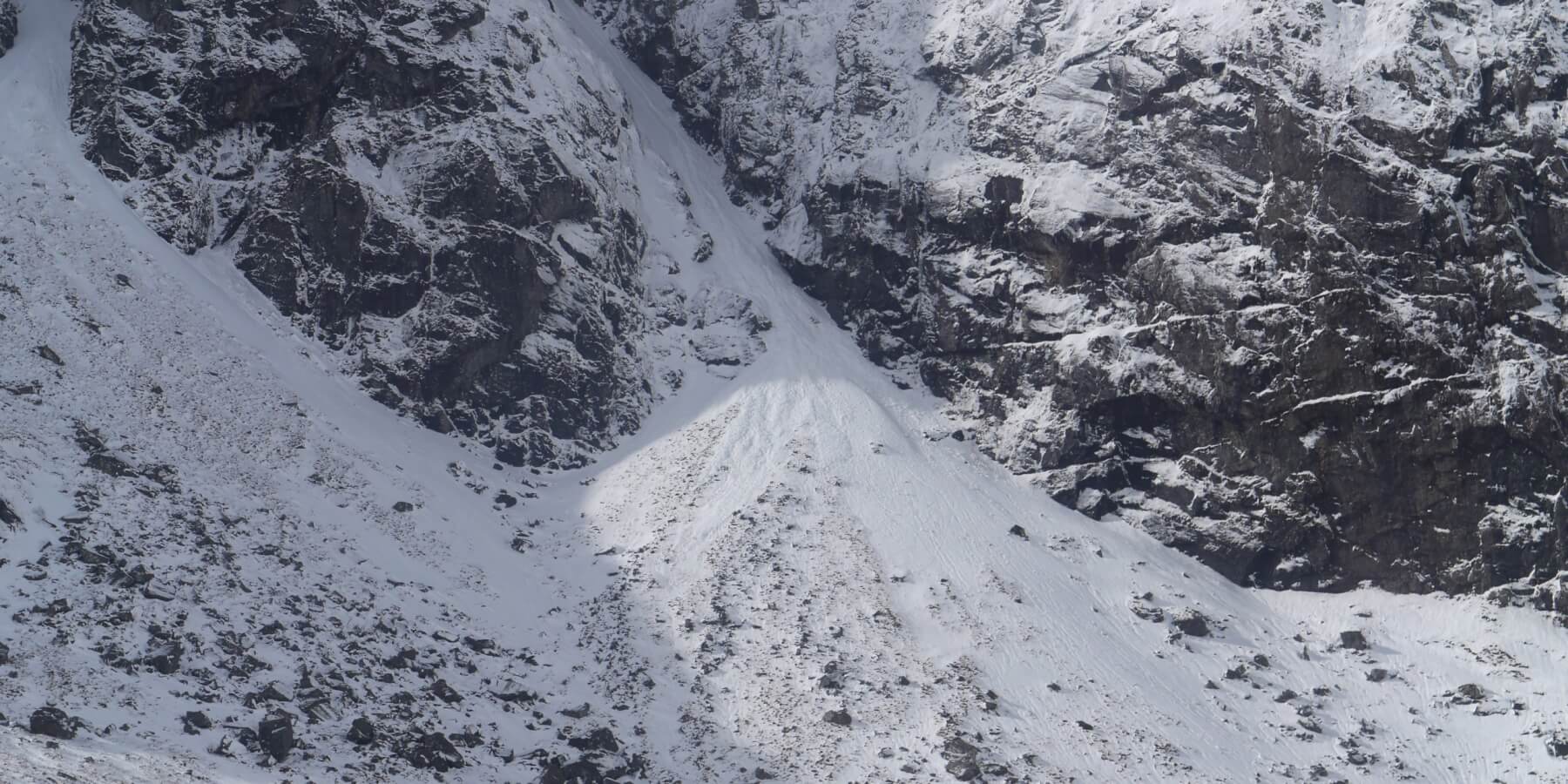
 (Above) The entrance to Easy Gully, Coire Ardair. Avalanche debris below Centre Post and South Post (hidden). Both small, about Size 0.5.
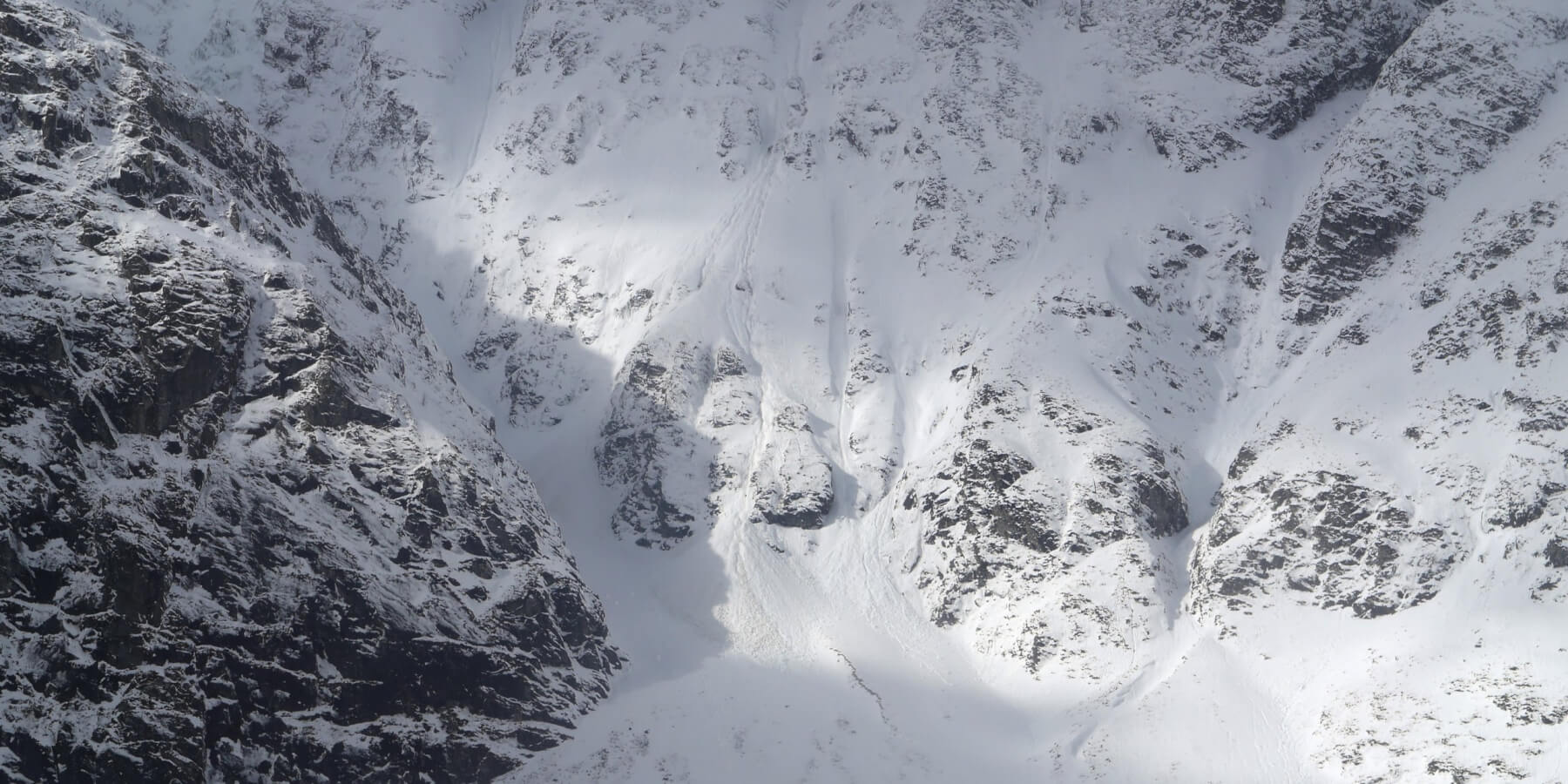
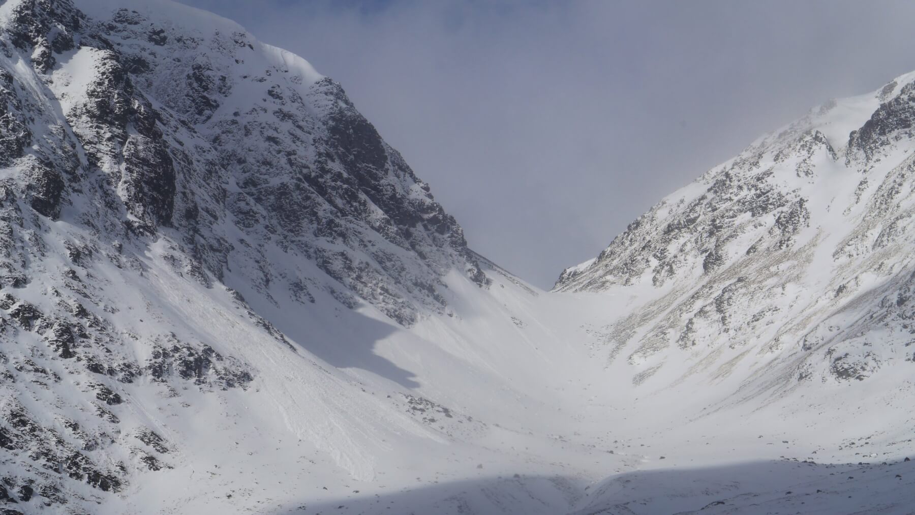 (Above) The Inner Coire and The Window, upper Coire Ardair. Avalanche debris from a Size 1.5 event below The Pipes. The debris 50m wide here divided in the runout zone and very nearly reached the path many take when approaching The Window et al from Coire Ardair.
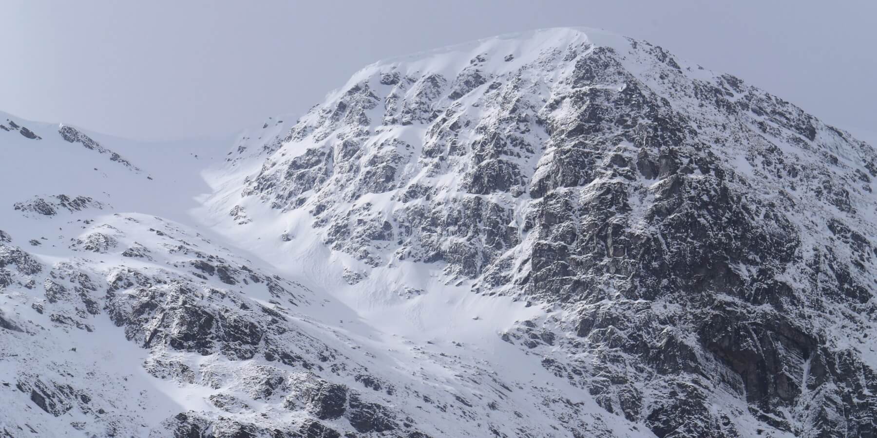 (Above) Bellevue Buttress, high above Coire Ardair. Bits and pieces of cornice debris beneath this high crag. Cornices persist in many places; colder temps will have arrested any instability after the minor meltdown but they are expected to grow again overnight.
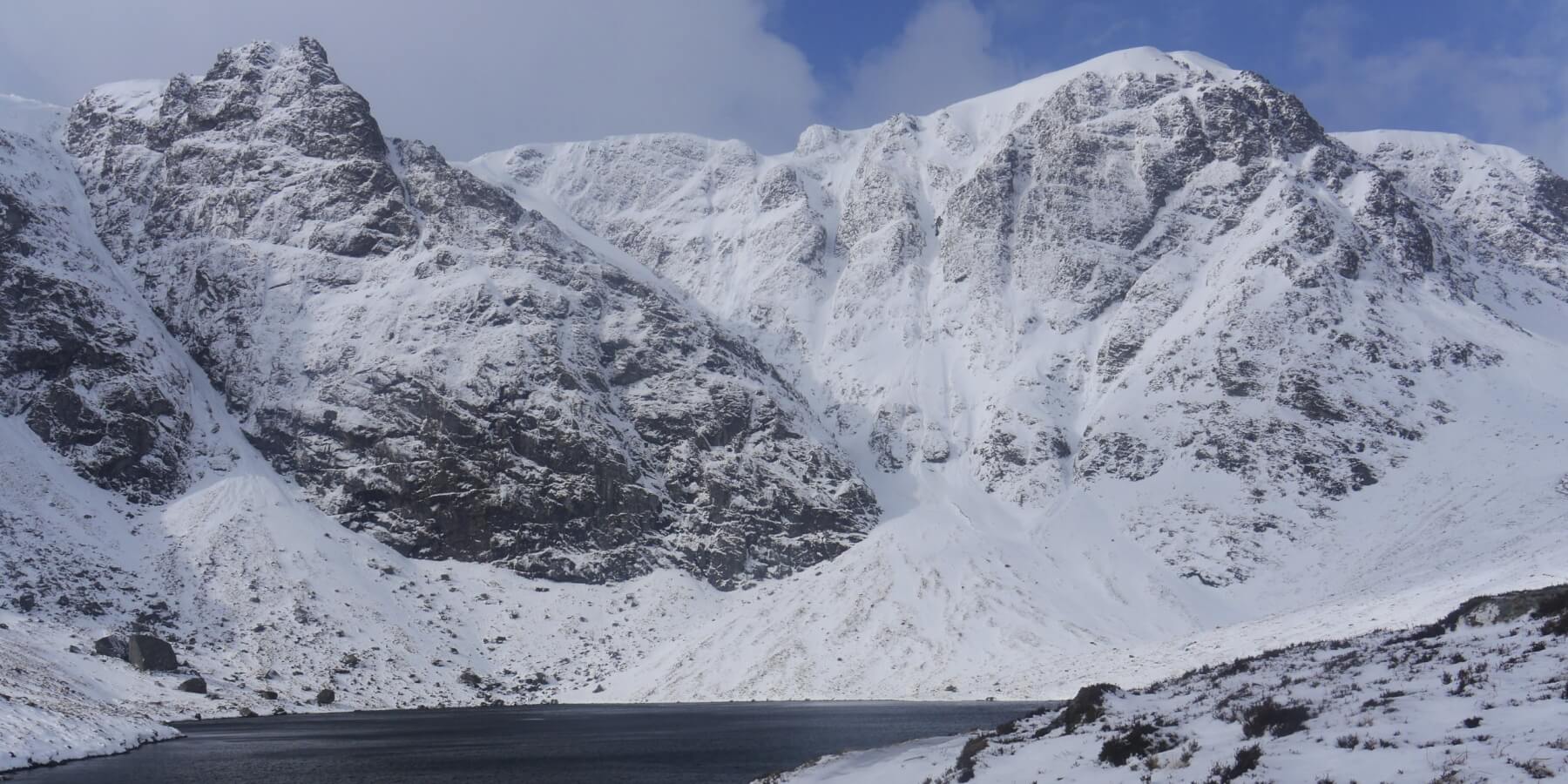 (Above) The crags and lochan at the top end of Coire Ardair. The blue sky an unexpected temporary bonus punctuated the generally terrible overhead conditions.
Comments on this post
Got something to say? Leave a comment


KEITH HORNER
29th March 2026 7:26 pm
Photos reading fine today. So this is summer – the weather obviously has a warped sense of humour…. Seems like today probably had the most avalanche activity of the season noted – the Inner Coire event looks particularly substantial.
meagaidhadmin
29th March 2026 7:37 pm
Yes, probably the most avalanches in one day at our patch this season and that’s not counting snow that may have fallen off over on Beinn a Chaorainn.