The week Friday 23rd to 29th Jan.
29th January 2009
 (Above). The Post Face today. Most gullies lines are complete but haven’t been ventured up for some time and might be worth avoiding at present – see photo below. Ice is certainly evident and should outlast the forthcoming thaw if it isn’t too prolonged.
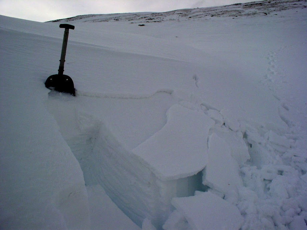 (Above). The pit today. Done at about 850m on a NE aspect. The surface layer sheared away really easily when I dug the shovel into the snow above the pit. Elsewhere, there’s up to 25cm of this stuff at gully heads and at the top of corrie backwalls – it’s not extensive but would be enough to knock you off your feet if you triggered it.
Since the big snow event last week-end itâs stayed cold and thereâs been the odd top up of snowfall. Most deep snow lies on North-West through North to East aspects and some of it is very deep, especially above 750m where there are really deep drifts. Thereâs good enough and deep enough snow cover in places to have a ski tour with a final descent through trees – yes, glade skiing! Iâm not saying where because âThe Manâ, who has been ensuring that the nation has an uninterrupted supply of oil & gas from the
Weâve got some snow coming through overnight then some rain and a 2500m freezing level for Friday. The weather picture has bee pretty complicated since Monday and the Met Office have toiled manfully to predict it for us but have struggled at times. Anyway, there is some new slab about at present and this is unlikely to settled down until after the predicted melt-down.
Comments on this post
Got something to say? Leave a comment


