Saturday. The best day of the week-end?
20th December 2014

Avalanche debris in what we call Balloon Gully, Coire Ardair. Debris drifted over during the day.
Several avalanches overnight and during the morning in, or close to, our area. Quite a lot of snowfall overnight above 600m with drifting, but rain at lower levels.

Steep east face of Sron a Ghoire today.
(Above) NE flank of Sron a Ghoire, summit at approx 800m. Significant sheltered accumulation zone and deep build up of new snow overnight.
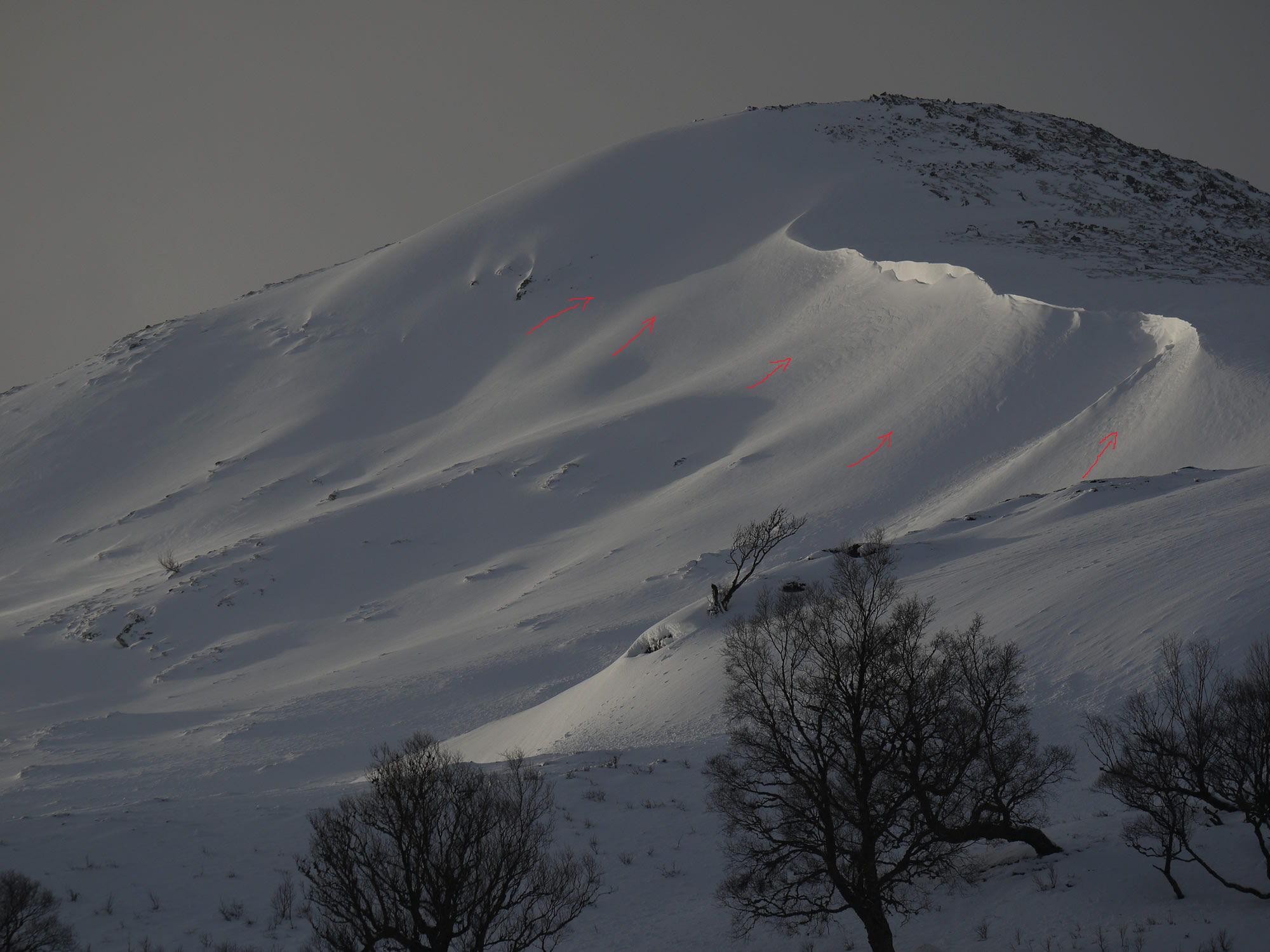
Detail of E. face of Sron a Ghoire showing overnight build up of windslab (red arrows)
(Above) Detail of Sron a Ghoire. Red arrows show the amount of new wind deposited snow that blew in overnight. The big, deep ramp of snow above the arrows and beneath the cornice line wasn’t there on Friday.
Big change in the weather tomorrow with persistent rain and mild temperatures expected to induce instability in all recent snow accumulations.
Sunday looking like a pretty miserable hill day.
Comments on this post
Got something to say? Leave a comment


Grant Duff
20th December 2014 5:08 pm
Love the graphics, such a clear indicator for a novice like me. Cheers
meagaidhadmin
20th December 2014 5:32 pm
Glad you found it useful.
Many thanks for your comment.