Snake eyes.
12th February 2015
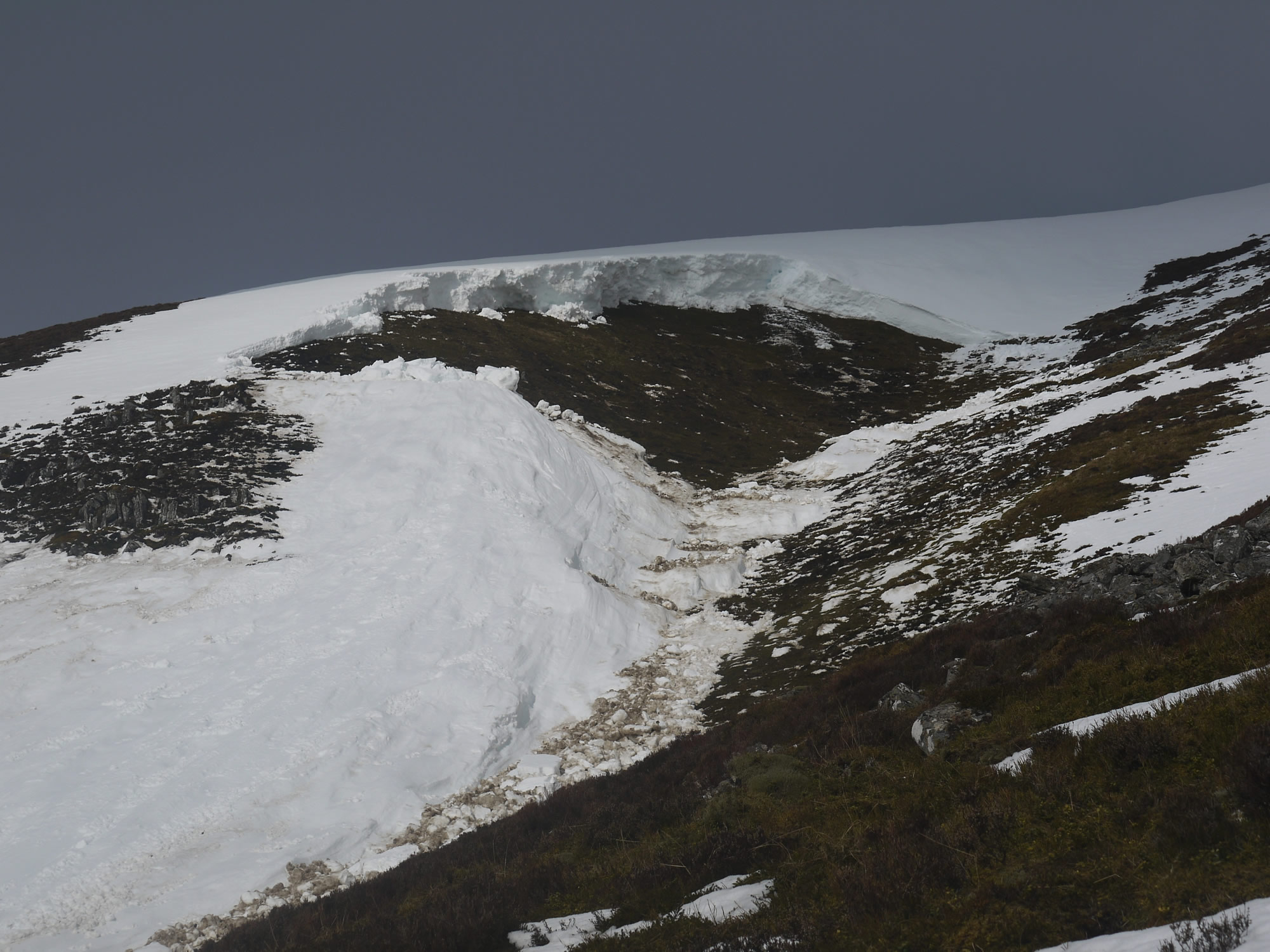
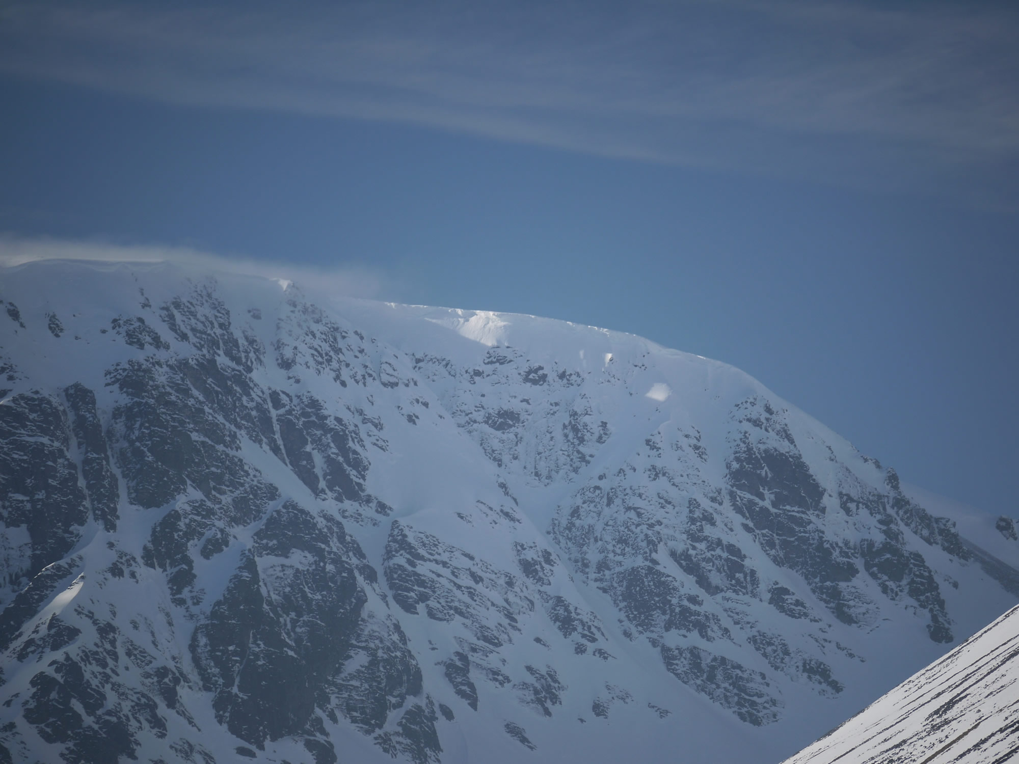
Crownwall & part of the avalanche track above the mature birch in Coire Ardair.
Creag Meagaidh rolls ‘snake eyes’ in the full depth avalanche crapshoot! This size 3 event occurred yesterday afternoon during relatively mild conditions (although it wasn’t exactly ‘shirt-sleeves, Raybans & Factor 30’ weather by all accounts) and must have been quite a spectacle. The crownwall is 1m to 3m high, approx 80m wide and ran out 300m down to the top of the mature birch tree-line.

Looking down the debris tip. The debris terminated about 200m uphill from the main Coire Ardair path.
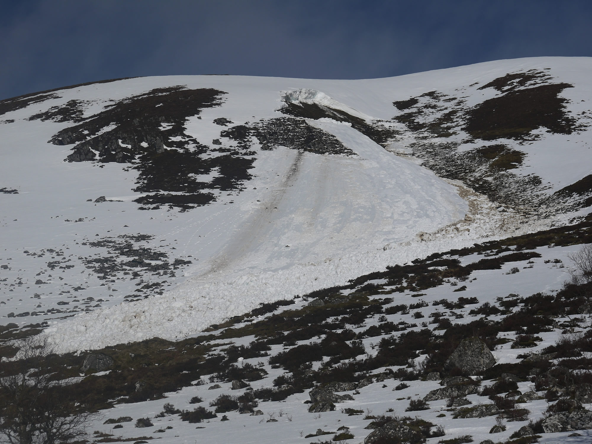
The full depth avalanche and debris tip in context.
The crownwall is at approx 780m and on a SE aspect. There are several other more common full depth avalanche paths at Creag Meagaidh – two or three on Sron a Ghoire, a few in Coire Choile Rais and the Moy Corrie. I’ve seen debris from full depth activity in Coire nan Gall, Coire Dubh and, notably, on Beinn a Chaorainn over the years, but never at this place in Coire Ardair. I guess the thing is that if the ground is steep enough with enough snow on it and the temperature/weather regime is conducive, then full depth avalanches can occur pretty much anywhere in our mountains. Predicting them?…Where are those dice..?
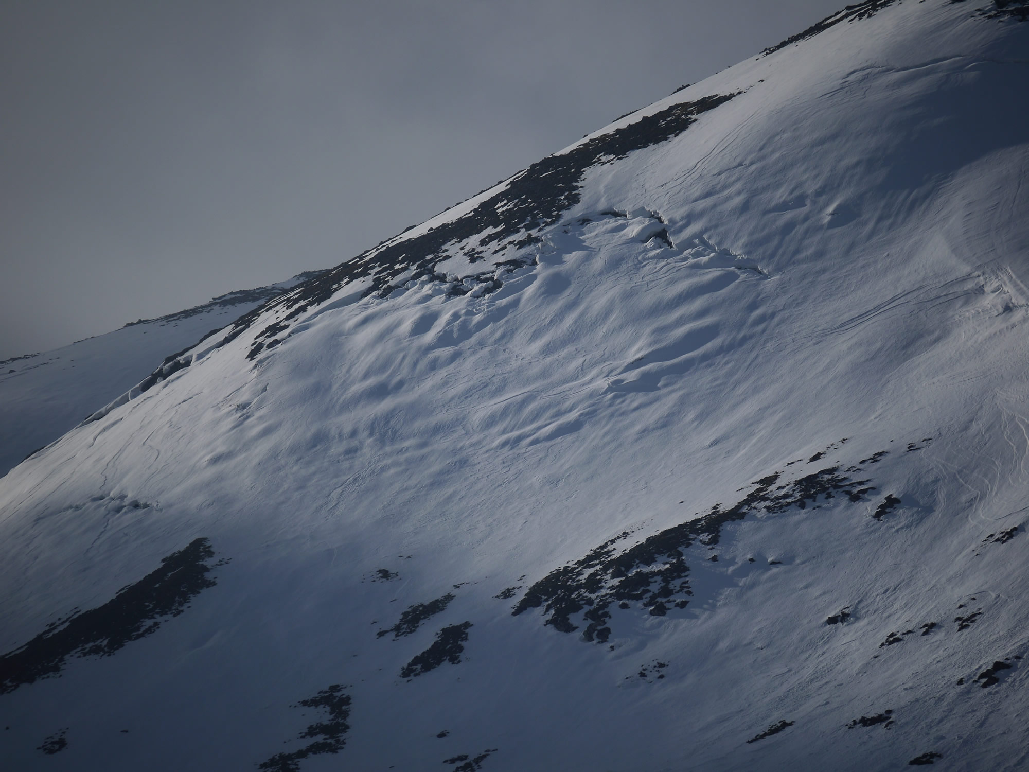
Glide cracks on Sron a Ghoire at about the same altitude as the Coire Ardair avalanche and less then 2km away.
There’s some photos in a recent post of Sron a Ghoire glide cracks. Well, they’re more developed now and the ‘downstream’ buckling much more prominent than previously – and this is the same aspect as the Coire Ardair event. Forecasted colder temperatures ‘should’ help stem the flow of meltwater at the ground/snow interface and help stiffen the slab a little…but sometimes the stiffening of the slab can induce other stresses that promote collapse….Watch this space!
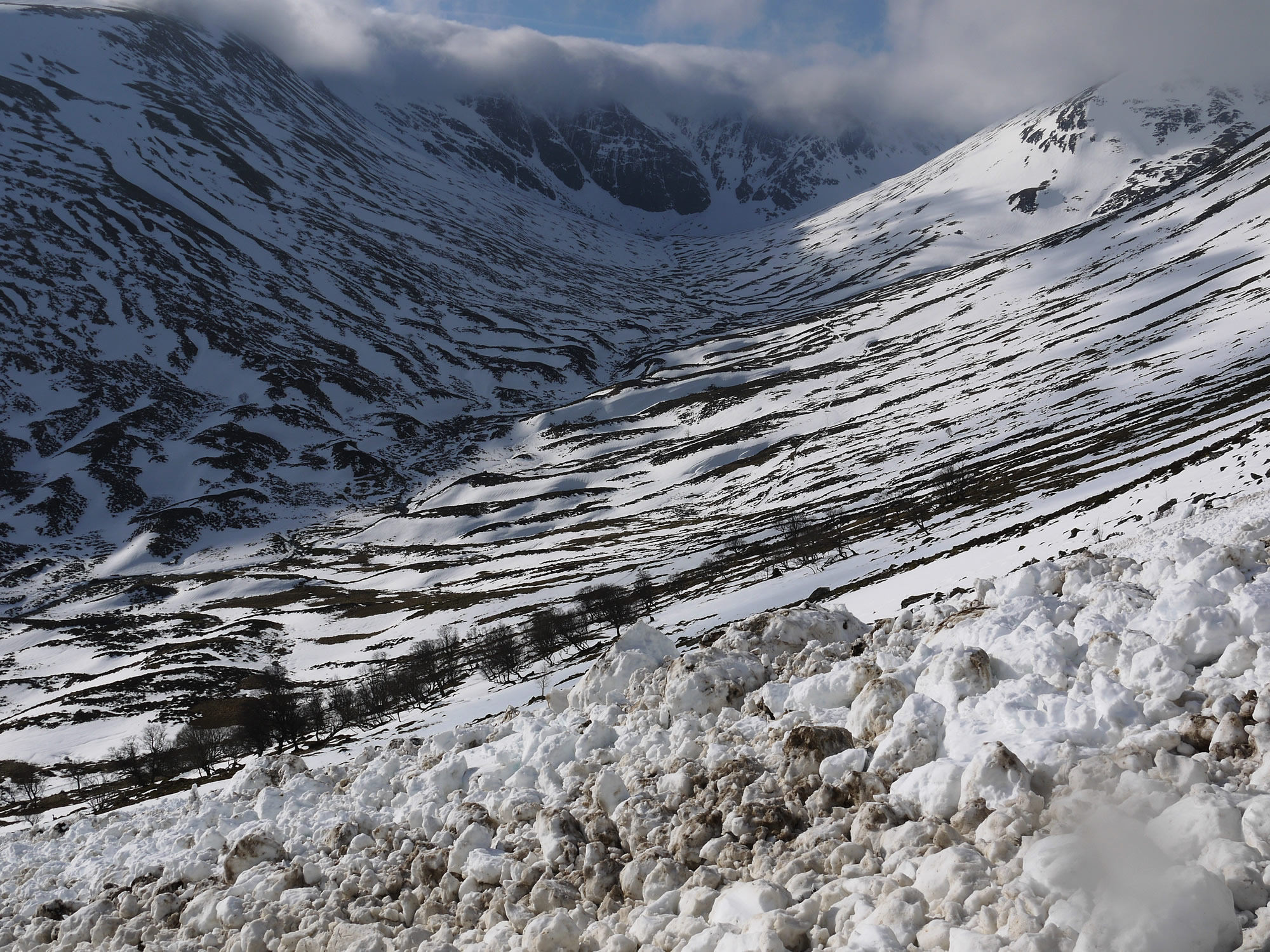
Looking towards the Post Face.

Coire a Chriochairein. Cornices above East to South aspects continue to shed chunks.
Not so obvious in the photo above but quite a few cornices are continuing to collapse in places, especially sun-exposed East to South aspects.
Cornice-line still visible above part of ‘Cinderella’ in the Inner Coire of Coire Ardair.
Comments on this post
Got something to say? Leave a comment


mike barnard
12th February 2015 6:35 pm
Weren’t there a couple of large full depth avalanches not far from this spot during the 09/10 season? Went right over the path and took out a good number of trees.
meagaidhadmin
12th February 2015 7:27 pm
Hi, Mike,
Many thanks for your comment.
There was indeed a very large avalanche event at this spot in March 2010 however it wasn’t a full depth event.
If you look at the blog for 1st & 2nd March 2010 you’ll see the aftermath of that particular avalanche. It certainly was huge with a crownwall in excess of half a kilometre long & 2-3 metres high in places, but it wasn’t a full depth event. There had been significant basal weakening of the snowpack, attributed to a relatively thick layer of heavily facetted crystal (close to being fully formed depth hoar) in combination with a layer of wind-transported broken surface hoar crystals. It was a distinctly unstable combination! If you look carefully at the photos you’ll see that the bed surface was snow, not the ground. It was close to the ground but not at the ground – a fine distinction and a bit academic, I know, and possibly only of interest to avalanche geeks like me! Full depth avalanches fail ‘full-depth’ at the ground/snow interface, hence their moniker.
Anyway, yesterday’s avalanche was big but doesn’t compare to the 2010 event. The trees escaped a battering by about 50m yesterday whereas 5yrs ago 150yr old mature trees were uprooted and snapped off and debris was about 6m deep in places: evidence of the damage caused is still visible to this day beside the Coire Ardair path.
Grant Duff
13th February 2015 10:10 am
Very impressive photos and its good to know the March 2010 avalanche is still talked about it was a monster.
Jim Hall
13th February 2015 9:42 pm
I was climbing Ritchies Gully at the time and was very surprised when we spotted the aftermath on the walkout. The snow and cornice in the gully felt pretty solid and indeed the SAIS forecast was reassuringly low that day. Does anyone know the precise time of the slide?
meagaidhadmin
13th February 2015 10:36 pm
Thanks for your comment, Jim.
The simple answer to your question is no one can be precisely sure when the avalanche released, or at least if someone saw it go they haven’t yet contacted us with relevant info. Another respondent who was in the Coire Ardair that day was certain it hadn’t released in the morning but saw debris through the cloud and mist on the walk out at about 4pm.
Best guess would be 2-3pm?
Jim Hall
15th February 2015 12:55 pm
It’s just that when we were gearing up at the rescue box (11am-12am), I thought I heard a strange sound, like a loud sigh, but not a rumble, and quite short. My partner didn’t hear it.
The other point is that it may be worth mapping known avalanche traps and using these as a complement to the orthodox avalanche condition analysis and forecast, ie they should be places to avoid under any forecast conditions. The problem is that ski-tourers have an affinity for big blank snowfields.
Those are excellent maps comparing it to the 2010 event, by the way.
meagaidhadmin
15th February 2015 5:11 pm
Hi Jim,
Thanks for the extra detail about the Coire Ardair full depth avalanche.
The digital mapping of current avalanches, as well as known avalanche paths, may well happen in the not too distant future. I’ve been told SNH have already used the latest LIDAR technology (I think) to map the whole of Coire Ardair (and maybe the rest of the Creag Meagaidh NNR too) down to a very fine resolution indeed. There was talk a year or two ago of overlaying the live data of our avalanche forecasts onto their digital dataset to create a avalanche forecast map for Creag Meagaidh that would be accessible to the public and could be updated each day. The idea definitely has ‘legs’ but there would be technical, digital and web-based challenges to overcome, to say nothing of the cost implications. At the moment it is an idea ahead of its time but I’m sure it will happen one day.