Fade to grey
10th February 2017
 (Above) Welcome to my monochrome world. A photo from the Coire Ardair footpath looking across the (somewhat raddled) birch on the shoulder of Sron a Ghoire, with The Window in the far distance. 1050m cloudbase all morning.
 (Above) Mirror-like Lochan a Choire, surface only disturbed by a developing layer of ice on the far side. Very calm in Coire Ardair all day.
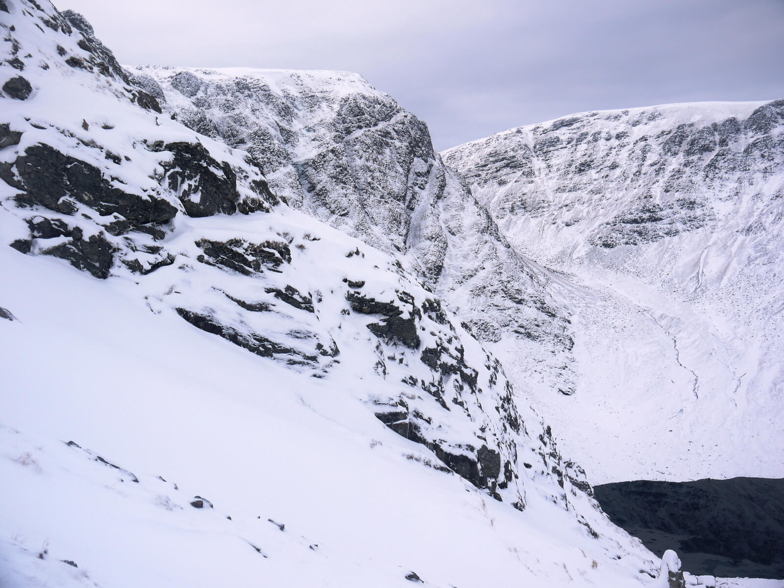 (Above) The outlook from a gully just to the east of the top of Bellevue Buttress. The shoulder of the Post Face (opening pitches of Staghorn Gully recognisable) and the entrance to the Inner Coire, both clearly visible. Was very quiet and pretty much wind-free. Could hear clearly the voices of hillwalkers down by Lochain a Choire some 300m below me and 1km away. The ripply shadows on the lochan are actually the developing ice floes.
 (Above) Top of the skyline 1050m – Â a NNW aspect. One of the gullies near Puist Coire Ardair where the formal element of the snow observations were carried out today. Didn’t quite ‘top out’ but had a good poke around in the entrance to the short, steep gully. Interesting facetting noted in the snowpack here giving rise to easy shears and localised instability. Instability is more widespread on steep NW and NE aspects. Also of note was the widespread early facetting in the rest of the general (and shallow) snow cover on all aspects and at all altitudes. It’s been really cold for a few days so the facetting isn’t surprising. At the moment it’s no big deal since the weakening snow layer supports only a thin surface layer which amounts to little or no hazard. If this weakening layer gets buried under a heavy overburden of drifted snow (windslab) then it’s likely to present more significant problems. If the wind speeds breach a critical threshold on Saturday there will be drifting and snow transport into these areas and care will be required wherever there’s new build up – in all likelihood South West to West aspects. See the report for details.
 (Above) Skies cleared from the east later in the afternoon to bring some welcome light to the landscape and colour to the sky. Coire Chriochairein pictured. Note the extensive (but relatively thin) general snow cover in most locations.
 (Above) Sron a Ghoire’s moment in the sun this afternoon. This is an East and South East aspect; right hand skyline at circa 800m. General thin snow cover extends down to 500m in most locations.
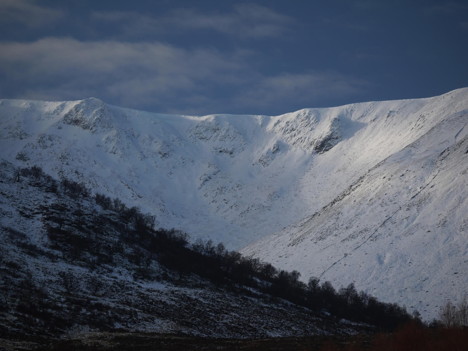
 (Above) Beinn a Chlachair receiving low-angled sunlight this afternoon, with Binnean Shuas nearest and in shadow on the right.
Comments on this post
Got something to say? Leave a comment


elaine
10th February 2017 7:27 pm
Excellent again. Can now see what I might get tomorrow. The forecast is good but seeing photos and your blog postings are really invaluable. Thanks again
meagaidhadmin
10th February 2017 7:30 pm
Thank you, Elaine.
Glad you find it useful. We aim to please!
Best regards.
Matt
10th February 2017 7:47 pm
Agreed such a valuable resource for planning weekend adventures.
Conditions favourable for ski touring?
meagaidhadmin
10th February 2017 8:16 pm
Ski touring wouldn’t be my choice! Although there are good-sized drifts here and there, the overall cover just isn’t optimal for skis at the moment. Those with masochistic tendencies may be able to scope out a little high level touring but the descents would be definitely sub-optimal! There’s just no real base worth speaking of.
The Southern Cairngorms may offer somewhat better ski touring at present. Check out their most recent blog posting.
Hope this helps!
Matt
10th February 2017 8:30 pm
It does greatly, big thanks for taking the time to reply. Keep up the excellent work âï¸