Incoming
20th January 2021
Covid -19
The Scottish Avalanche Information Service issues information to support permitted activity under current Scottish Government guidance.
Please be aware of current mandatory travel restrictions in Local Authority areas within Scotland and respect local communities by referring to Scottish Government guidance and safe route choices for exercise. For further guidance please refer to the following information for hillwalkers and climbers and snowsports on ski and board.
This blog is intended to provide hazard and mountain condition information to help plan safer mountain trips.
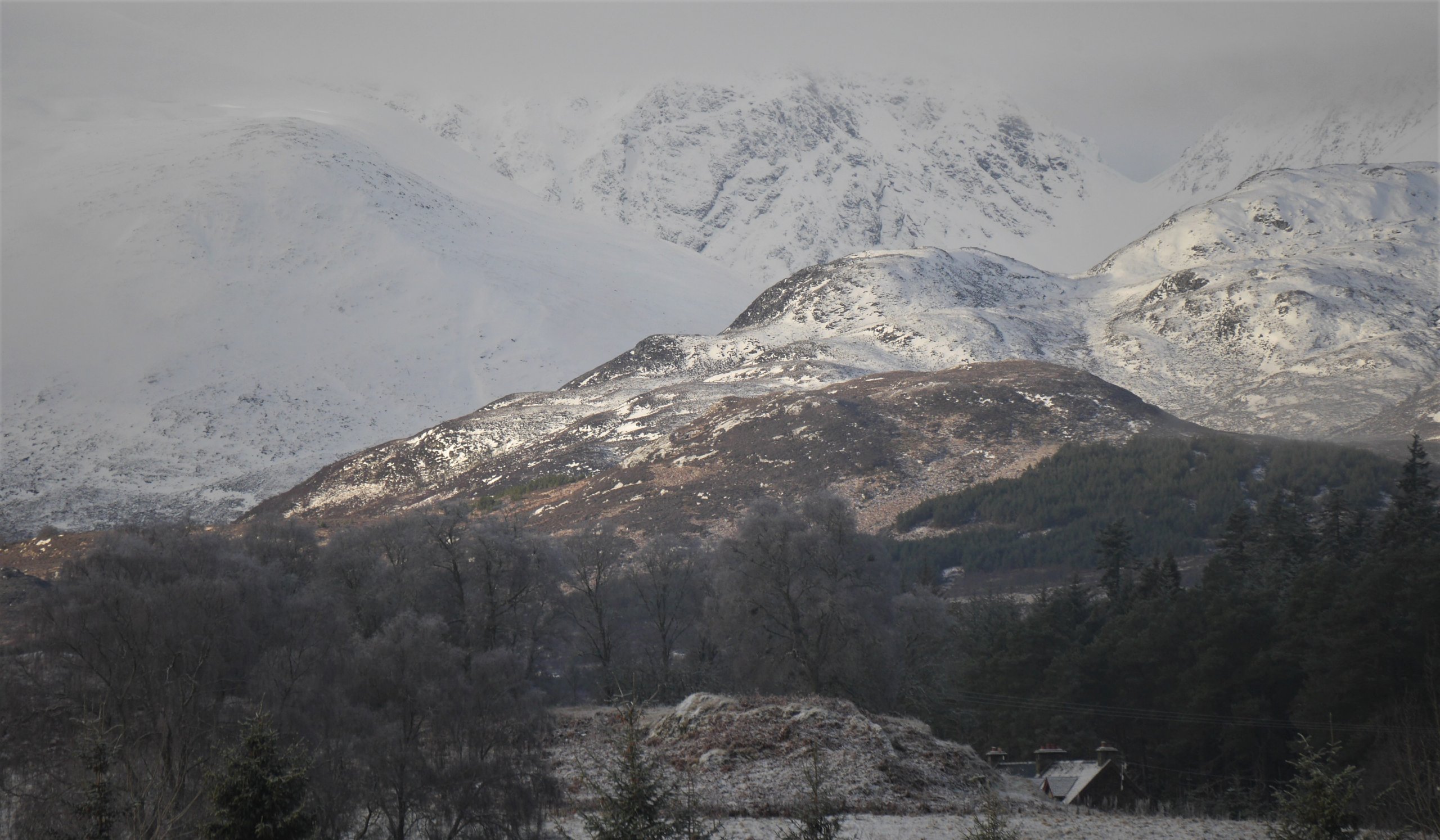
(Above) L to R: Sron a Ghoire, the Post Face of Coire Ardair and The Window this morning. 5cms of fresh snow on my car this morning near Kingussie but only a thin dusting in the car park at Creag Meagaidh, though a bit more at the eastern end of our patch. Cold with very little wind today.
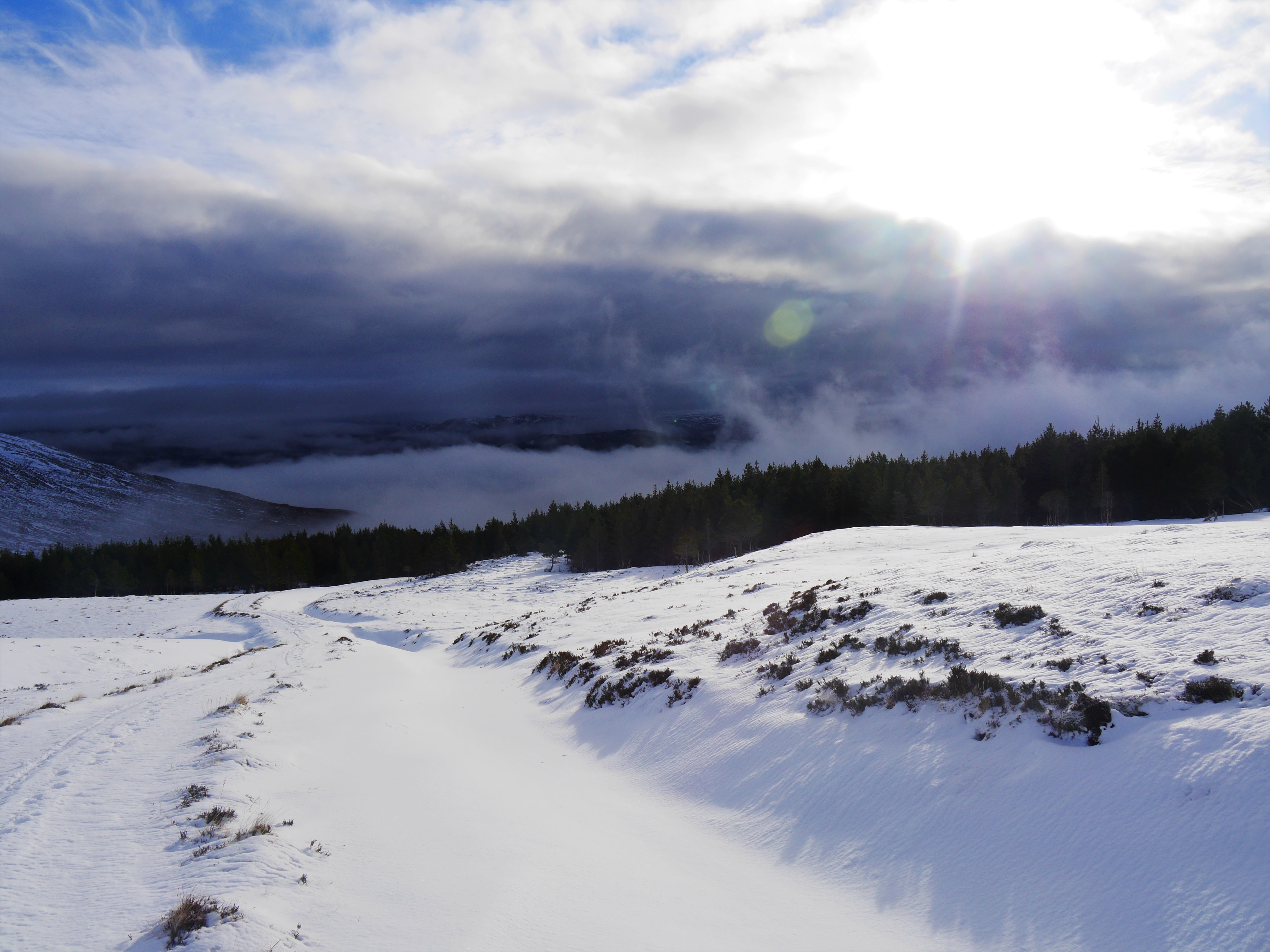
(Above) The main drag up to Beinn a Chaorainn, looking back towards the reservoir end of Loch Laggan. Clear and bright during the morning but the cloud soon rolled in giving the all too familiar flat light. Significant crust in many places. Little if any fresh snow in evidence here at the western end of SAIS Creag Meagaidh parish.
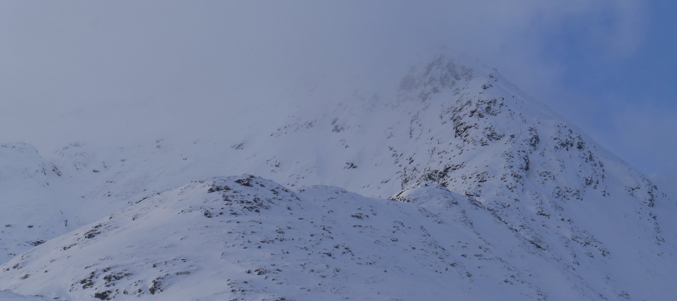
(Above) A glimpse of the East Ridge of Beinn a Chaorainn just as it was being enveloped in cloud. A lot of old cornice debris litters most of the East-facing coires of this mountain but only of historic interest now. Quite a lot of surface hoar around in shaded areas today. It becomes a super weak layer if buried under snowfall (or windslab) which is what it looks like we’ll be getting overnight and during the day on Thursday.
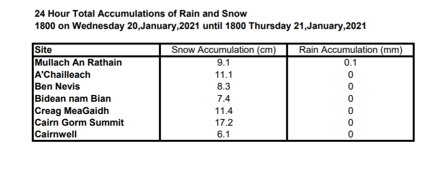
There’s a bit of uncertainty over forecasted snow amounts for overnight and during Thursday. Below are the projected snowfall totals for our summits and/or plateau areas across all SAIS forecast areas. (The first two are for different parts of SAIS Torridon, by far our biggest geographical forecast area). Extract is from the Met Office’s dedicated SAIS weather forecast we receive each day during of the winter.
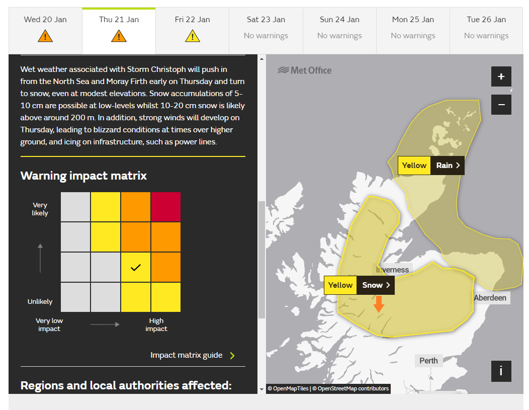
(Below) The current Met Office UK Weather Warning for this part of Scotland. “10cm of snowfall at low level and 10-20cm above 200m”
…and, by extension, a lot more near summits, presumably?
I added the orange arrow to denote Creag Meagaidh’s position within the yellow ‘envelope’ of snow hazard.
The MWIS forecasts for the West Highlands and the Cairngorms are less equivocal with mentions of ‘continuous’ snowfall for both but with the Cairngorms getting the lion’s share – ‘prolonged heavy snow and whiteout’.
Executive summary: Creag Meagaidh may get more snow than projected in our official weather forecast.
Comments on this post
Got something to say? Leave a comment


