3/5 bridges: the Corrieyairack Pass.
29th March 2022
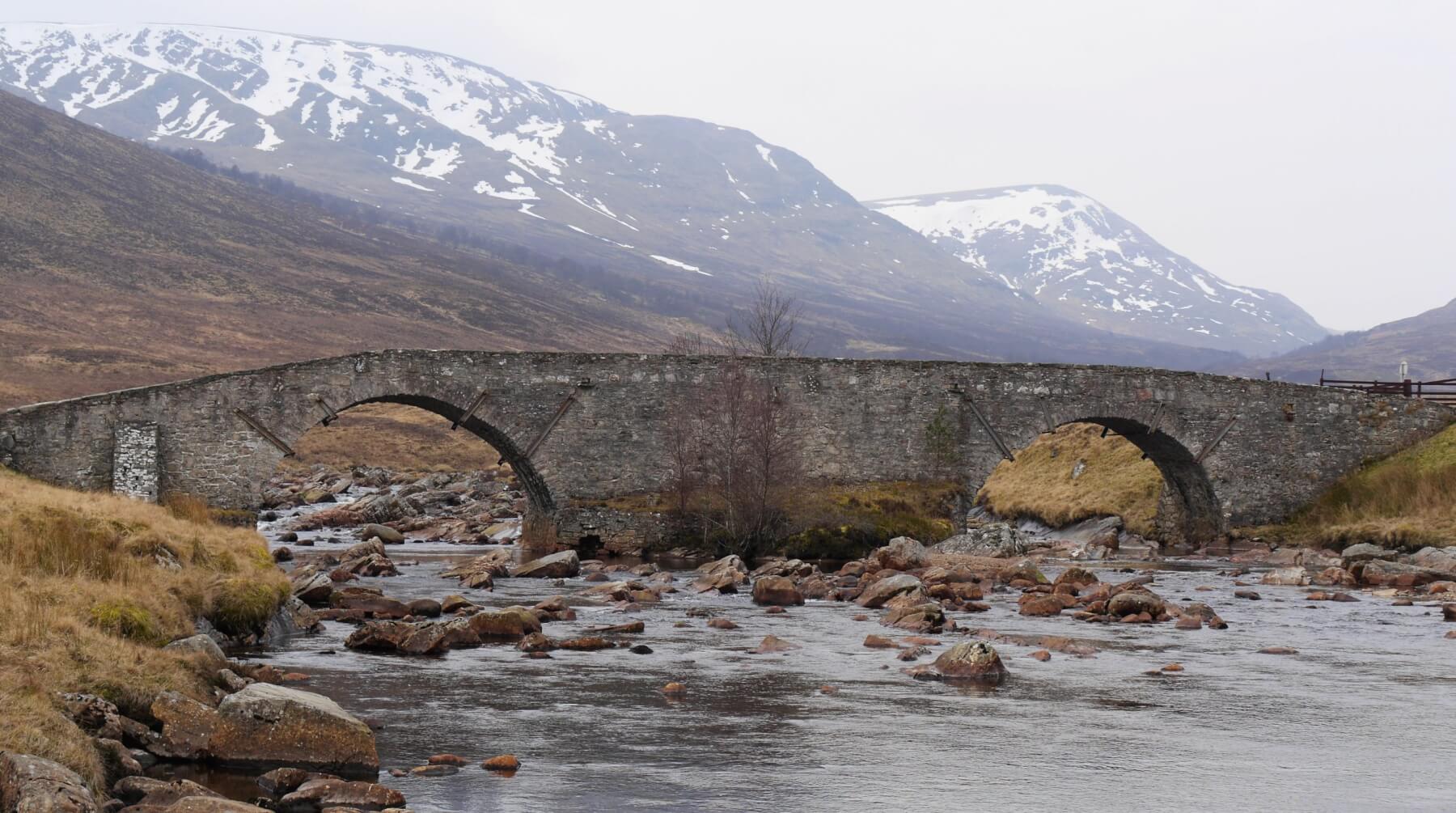 (Above) Garva Bridge over the Spey at Garvamore in the upper reaches of the catchment and immediately behind the Creag Meagaidh National Nature Reserve. The snowy slopes in the photo extend up to the Carn Liath plateau. The bridge was built by General Wade in 1732 and is still in use today. It formed part of a military road built between Dalwhinnie and Fort Augustus that crossed the Corrieyairack Pass at 780m. General Wade’s accounts for 1731 includes an item for £466, ‘For building Five Stone Bridges, one of 2 Arches and 4 of one Arch’.
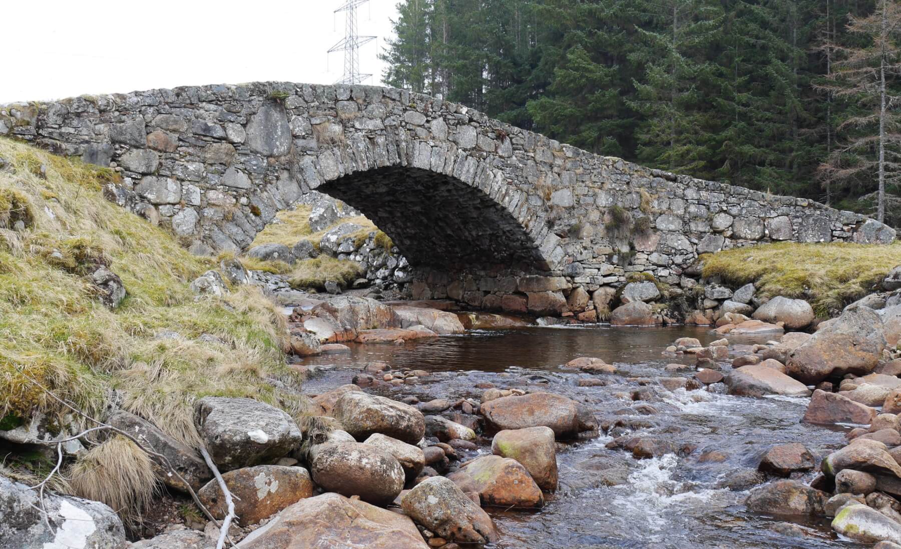 (Above) The Melgarve East bridge, #2 of 5. A simple but elegant construction.
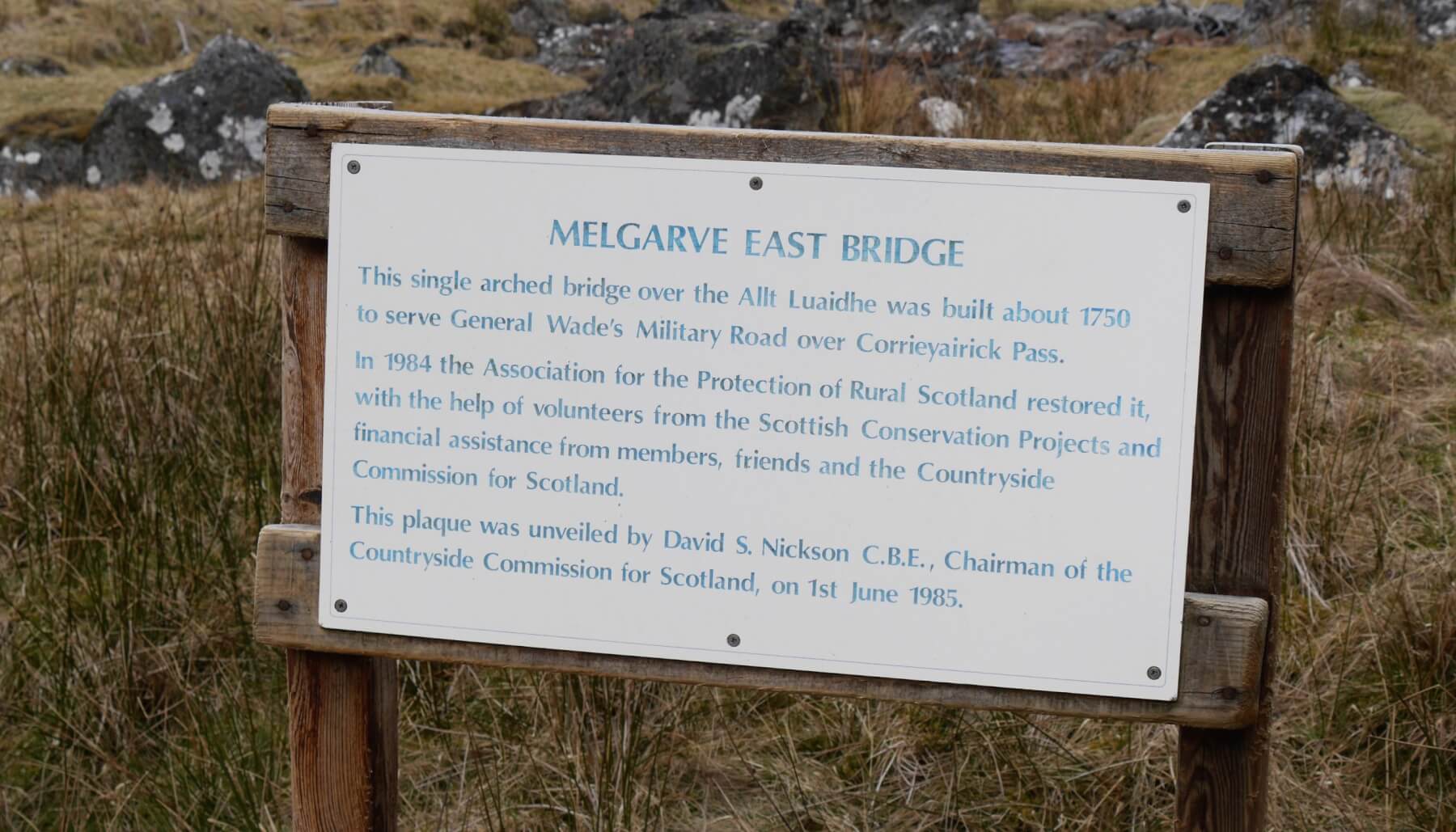 (Above)Â Was restored in the 1980s. The bridge is tucked away behind some woodland at Melgarve and is not immediately visible. Look out for a white sign set back from the road close to where the public tarmac road ends. It’s a fine piece of work and a good ‘save’.
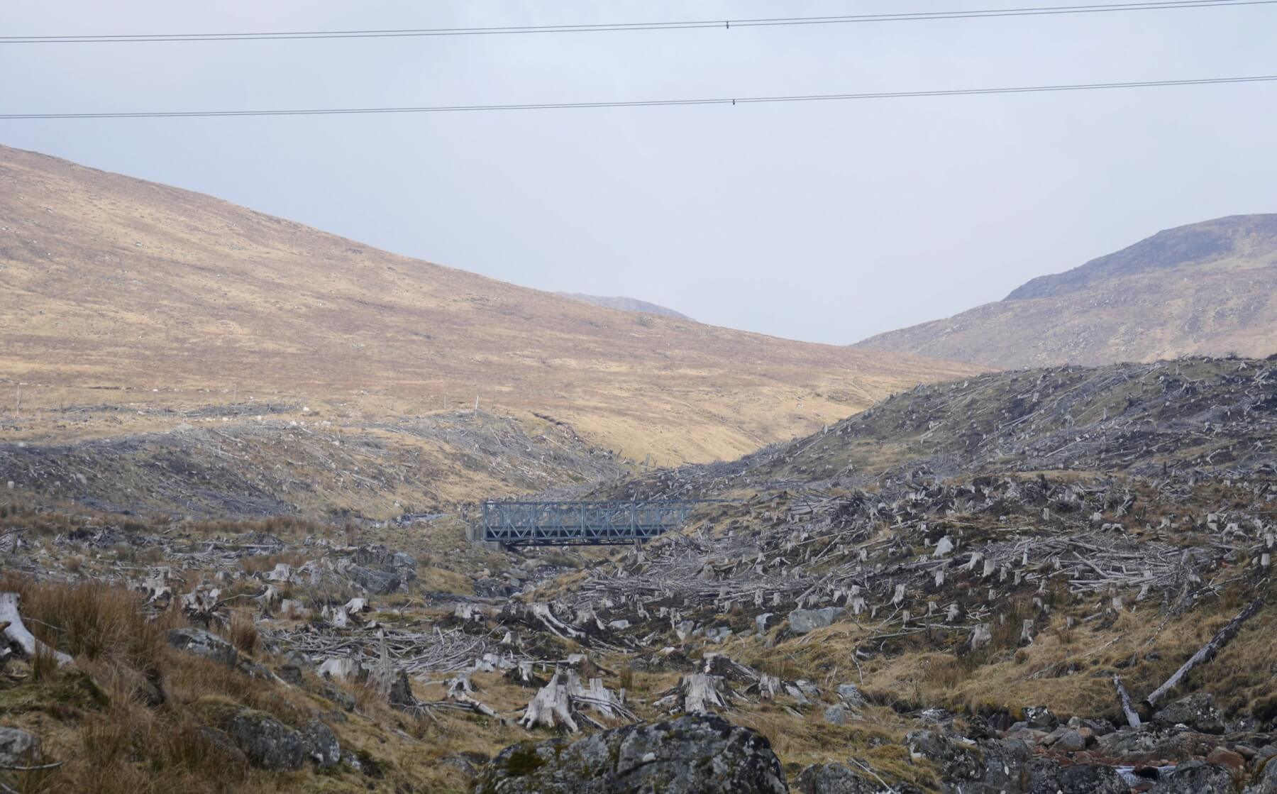 (Above) 400m upstream of Melgarve East is a blunt and workmanlike affair built to allow construction traffic access during the upgrading of the then-controversial Beauly to Denny power lines and pylons. A separate haul road was built parallel to the route of General Wade’s Military Road to enable this energy infrastructure work.
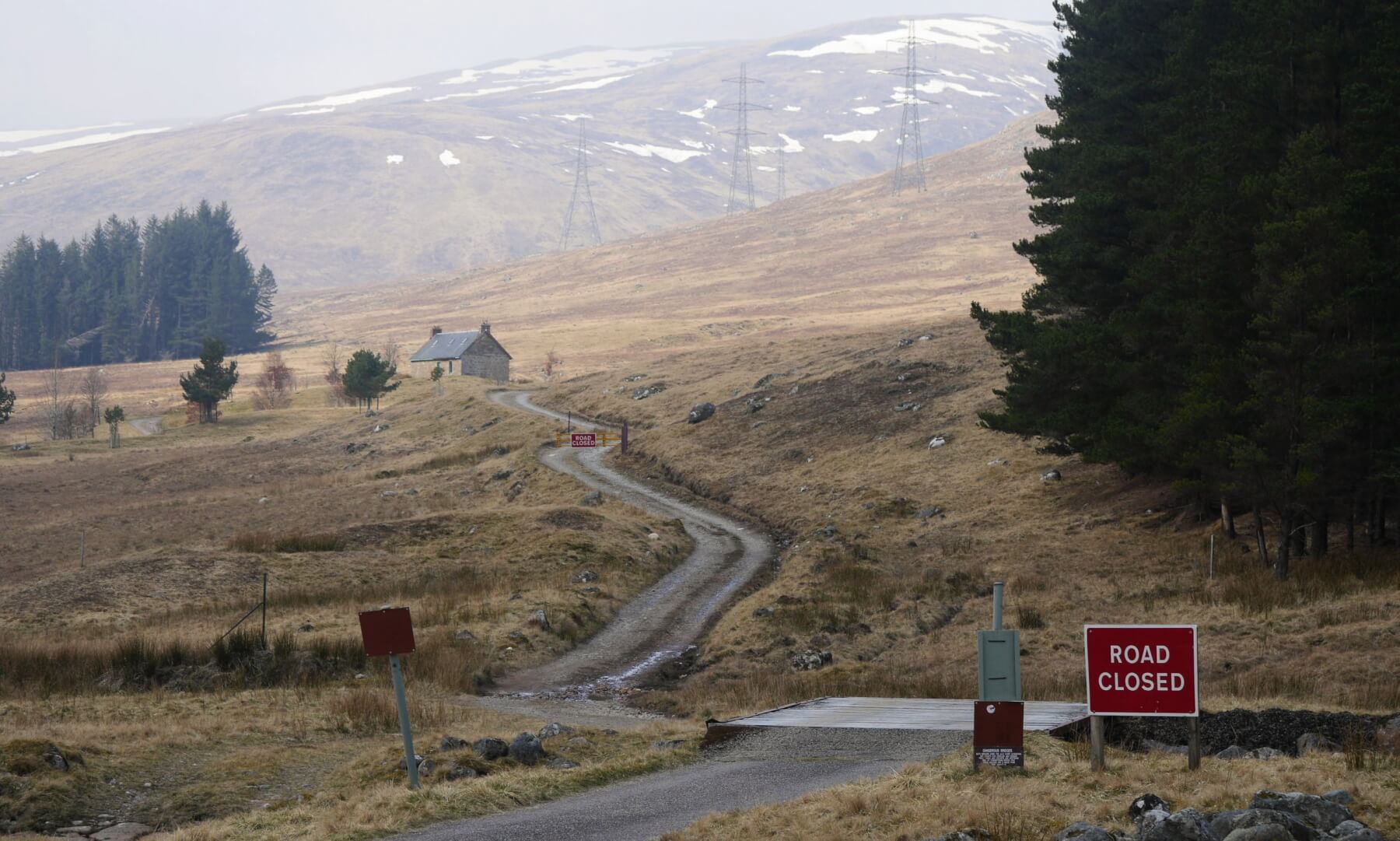 (Above) The public road end at Melgarve and the beginning of the track to the Corrieyarack Pass. The track used to be passable by road traffic (4×4) but has become an official Ancient Monument in the care of Historic Scotland and vehicle access is now prohibited and has been for some time.
 (Above) Ancient & modern. #3 of 5. The abutments of a Wade bridge, a ford, a modern footbridge, plus the ever-present and difficult to ignore pylons and power lines. The other two Wade bridges (‘the £466 contract‘) are located on the headwaters of the River Tarff , NW of the Corrieyairack watershed.
 (Above) Close to the summit of the Corrieyarack Pass. Remaining snow patches lie on north and east-facing aspects. The pass tops out at 780m. General Wade’s Road zig-zags up the steepest section – part of it visible left in the photo – which isn’t quite snow-free yet. All snow patches continue to slowly deplete and are well bonded.
A contemporary traveller who crossed the Corrieyairack in 1731 recorded, ‘I heard the noise of many people and saw six great fires, about each of which a number of soldiers were busy … I found in all about five hundred men, who had this summer, with indefatigable pains, completed the great road for wheel-carriages between Fort Augustus and Ruthven . . . General Wade had given to each detatchment an ox-feast, and liquor; six oxen were roasted whole, one at the head of each party.’Â Â
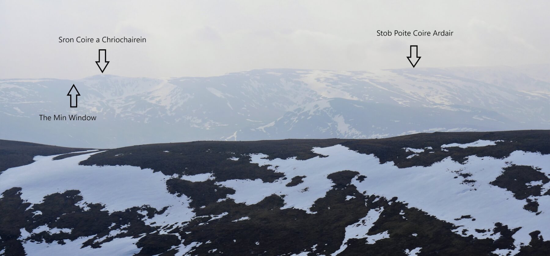 (Above) Haze spoilt the views today but nevertheless, it was just possible to spot some of the features of the Creag Meagaidh area in the distance. Patchy snow cover.
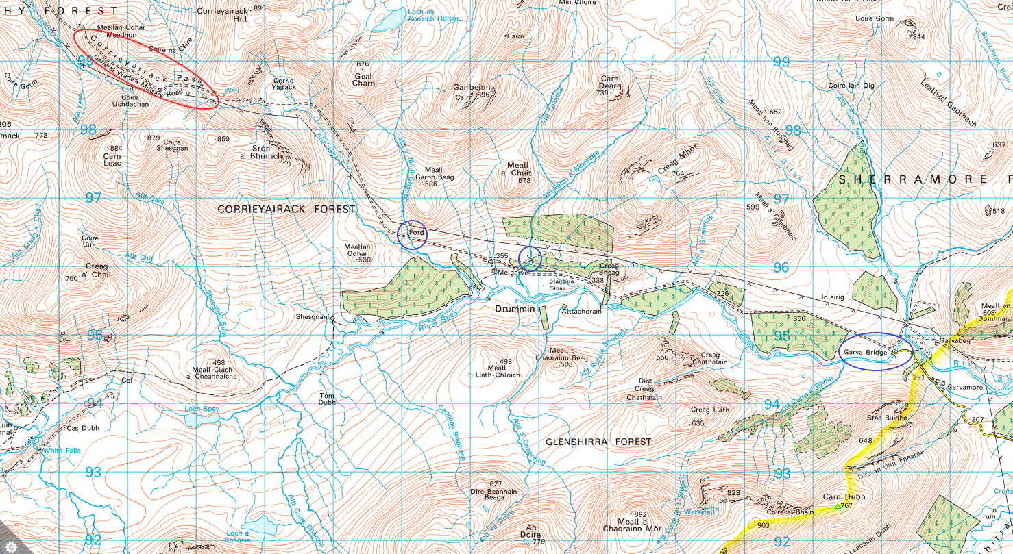 (Above) The locations of the three Wade bridges mentioned are circled in blue and the Corrieyarack Pass in red.
Comments on this post
Got something to say? Leave a comment


Stan Wygladala
30th March 2022 11:38 pm
Absolutely brilliant! Thank you.
meagaidhadmin
31st March 2022 8:11 pm
Thanks, Stan, glad you liked it. Given the patchy cover, the bridges were somewhat more interesting than the snow on the day!