An unsettled period ahead…
15th February 2023
Today marked the start of a more unsettled period as the high pressure of recent days makes way for the more common atlantic low pressure systems. As a cold front passed through in the early hours of this morning, fresh snow was expected. However, it appears that most of this precipitation arrived as rain at all levels, with light snow showers later as the freezing level dropped.
As such, there was just a cosmetic dusting at around 900 metres upwards in much of the area. Despite the highest summits being shrouded in cloud, there was evidence of snow transport around coire and plateau rims above 950 metres. Shallow accumulations of unstable windslab are anticipated here in steep wind sheltered terrain, the tops of gullies being an obvious example alongside those mentioned. The big picture remains largely unchanged – the Avalanche Hazard is Low.
Todays visit took me into Coire nan Gamhna, which is a curious hanging coire, but one with excellent views over to ‘The Window’ and the cliffs of Coire Ardair. Just above the lochan there is also an obvious geological division between the Semipelite which makes up part of Coire Ardair and Loch Laggan Psmammite of Sron a’Ghoire. This was largely obscured by dusting of new slushy snow today, but it is worth a look as the two halves of the coire have slightly different colours.
There was the sign of some ice hanging on in the highest seepage lines close to the plateau rim. This is of unknown quality but we can only hope provides a basis for more to build as the freezing level fluctuates in the coming days.
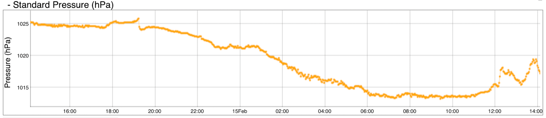
Pressure in hPa at the SAIS Holfoy weather station at Stob Coire Dubh (903m ASL). You can see that the pressure has steadily dropped overnight as a cold front tracked west to east over the Creag Meagaidh area.

Correspondingly on the back edge of this cold front the temperature dropped and was just under zero degrees Celsius at 0900 this morning. SAIS weather stations can be found on this page https://www.sais.gov.uk/mountain-weather-stations/

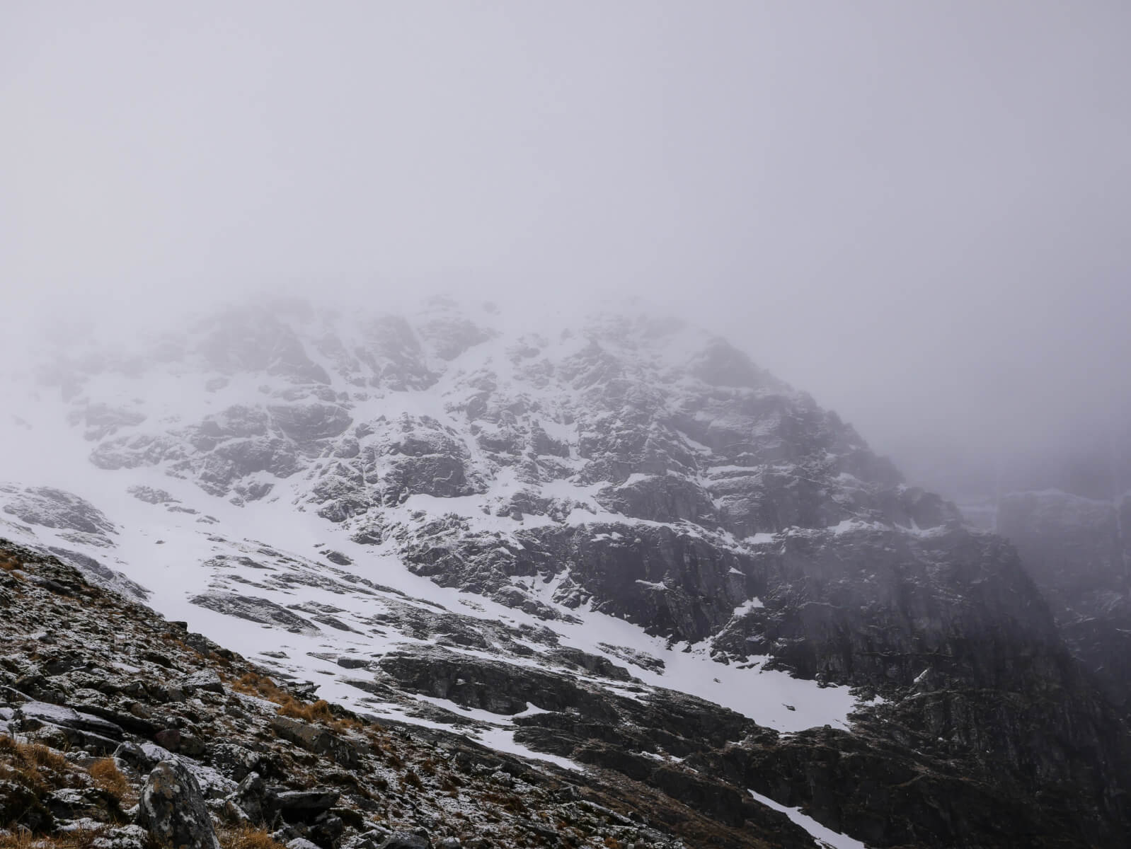
A fleeting view towards Coire a’Chriochairein and Uinneag Min Choire. A dusting of new snow is visible and generally confined to 900 metres and above.
The “whitest” bit of crag I could see was that of ‘Bellevue Buttress’ at the extreme left hand side of the Coire Ardair cliffs. Any where else this would be considered a major crag with a height of around 300 metres, but here is dwarfed by the bigger cliffs of Pinnacle Buttress.

Left to right – ‘Bellevue Buttress’, ‘Pinnacle Buttress’, ‘The Post Face’ and at the extreme right the edge of ‘The Inner Coire’.

Looking up towards the slanting line of ‘Easy Gully’. Hopefully there is some ice just hanging on in there up in the cloud…
Comments on this post
Got something to say? Leave a comment


