Turbulent westerlies and snow showers.
19th December 2023
A turbulent westerly airflow brought occasional but quite ‘punchy’ snow showers to our area today. However the snowfall and wind somehow didn’t manage to get their act together enough to induce any noticeable drifting. There were one or two pockets of windblown snow in some very sheltered steepenings and hollows but not enough to justify issuing an avalanche ‘nowcast’ for today. The rocks and boulders high in the Inner Coire of Coire Ardair had a thin covering of fresh snow (4cm?) but certainly not enough to disguise the distinctly quarry-like nature of the approach slopes to The Window – 950m, and an east aspect so a lee slope today. (See photo below for context).
Not anticipating significant change on Wednesday. Some new drifted snow may accumulate in a few favoured spots but much of this will again be forming on bare ground or rocks so is unlikely to present much of a hazard.
 (Above) The Inner Coire of Coire Ardair with The Window (centre) the bealach at 950m prominent.
 (Above) The view down from The Window towards Lochan a Coire and Coire Ardair. Snow fell down to around 750m with sleet and rain at lower levels.
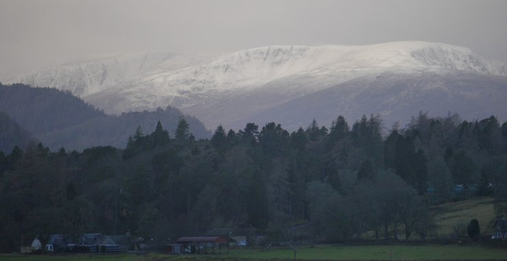
 (Above) The Carn Liath massif with – L to R – the Coire nan Gall and Coire Dubh photographed from Auchmore on the A86 this morning. The telephoto lens make the mountain tops look whiter than they actually were.
Overnight snow showers will morph into rain at all levels on Wednesday as the freezing level rises to well above summits, commencing just after daybreak. Quite a lot of the superficial snow cover in the above shot is expected to melt away by dusk.
Comments on this post
Got something to say? Leave a comment


