Dynamic snowpack and avalanche hazard
27th February 2024
The avalanche hazard today went from Moderate in the early morning to Low then back to Moderate again all in the space of about 90 minutes.
Cold temperaures and some drifting overnight morphed abruptly to rain at all levels and above zero air temperature values near summits (for maybe as little as 30 minutes?) then quite quickly back to dry conditions and sub zero temps.
(The landscape shots in this blog posting were taken in the relatively short weather window when it had cooled down but before it started snowing again – that is, above 850m because it rained down low).
Nothing new here but it does help illustrate one of the difficulties we have when avalanche forecasting. The avalanche hazard in any given 24hr period can change not at all, slowly, or very quickly, or sometimes switching back & forth, yet the published forecasted hazard category is always a single one.
A week or so ago we had a snow and avalanche situation at Creag Meagaidh where the hazard was almost certainly going to go through a not dissimilar evolution (but over many more hours) to the above. Poor stability in the forthcoming overnight period – and Considerable avalanche hazard – but significantly better snow and avalanche conditions from the early morning onwards. At the daily video conference the afternoon just before this particular avalanche forecast was published, I pressed for publishing a Moderate hazard on the basis that that was what people would experience out on the hill during the day. After explaining my thinking, and a bit of give & take discussion, the SAIS Co-ordinator reminded me that it was entirely possible mountain rescue teams could be out in our part of the mountains overnight and would need a forecast that reflected conditions they might encounter. He was right of course and so the chosen published hazard category was Considerable, and as expected it did morph quickly into a Moderate during daylight hours.
Take away learning points:
- The published avalanche forecast is for the period of greatest hazard during the course of the forthcoming night and the whole of the day, including the late afternoon/early evening. Whenever possible, if there is an improving trend during the day, we will indicate that in the forecast. *See trend below.
- Always read the details of the avalanche forecast to get a feel for the trend in stability over the course of the forecast period…getting worse, staying the same, or improving. Or all of those!
In an ideal world we would be able to communicate to you hour by hour the evolving snowpack and avalanche hazard but that’s some way off in the future, probably with the help of AI.
(Incidentally, I think quite a few of you would find our daily video conferences a fascinating insight into how we generate avalanche hazard categories. You’d have to listen to a fair amount of preliminary banter, ‘water-cooler’ chat and gossip too of course, but overall it would be an interesting and revealing learning experience. Needless to say, we’re not going public with that anytime soon!)
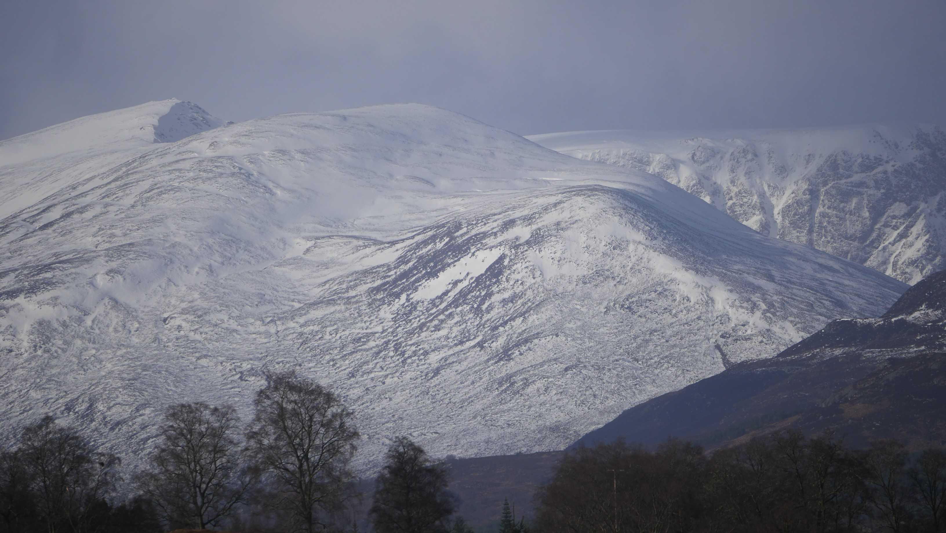 (Above) The Big Picture. Puist Coire Ardair, Sron a Ghoire and part of the Post Face of Coire Ardair during the short weather window this morning. Noticeably better cover in favoured accumulation zones (such as east aspects here) above 850m.
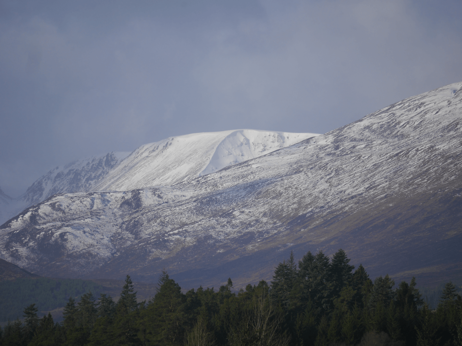
 (Above) Coire nan Gall – part of the Carn Liath massif.
 (Above) Coire Dubh – a little further east of the previous shot.
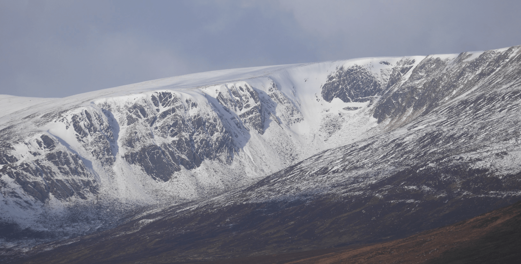
 (Above) Part of a snowy-looking Coire Chriochairein. Binos revealed some snowy debris tell-tales even at this distance. Turned out it was well worth having a poke around in this particular coire.
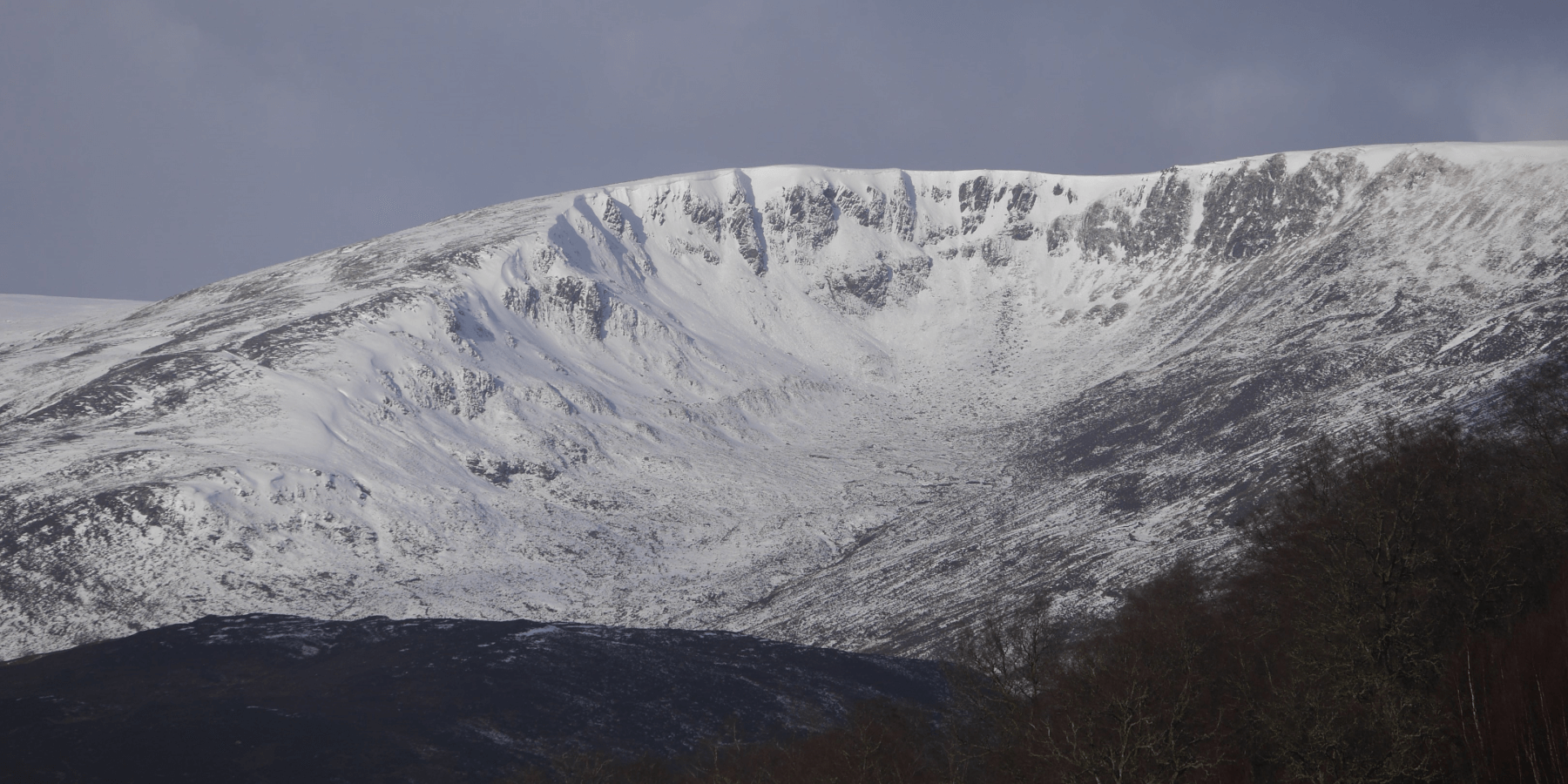
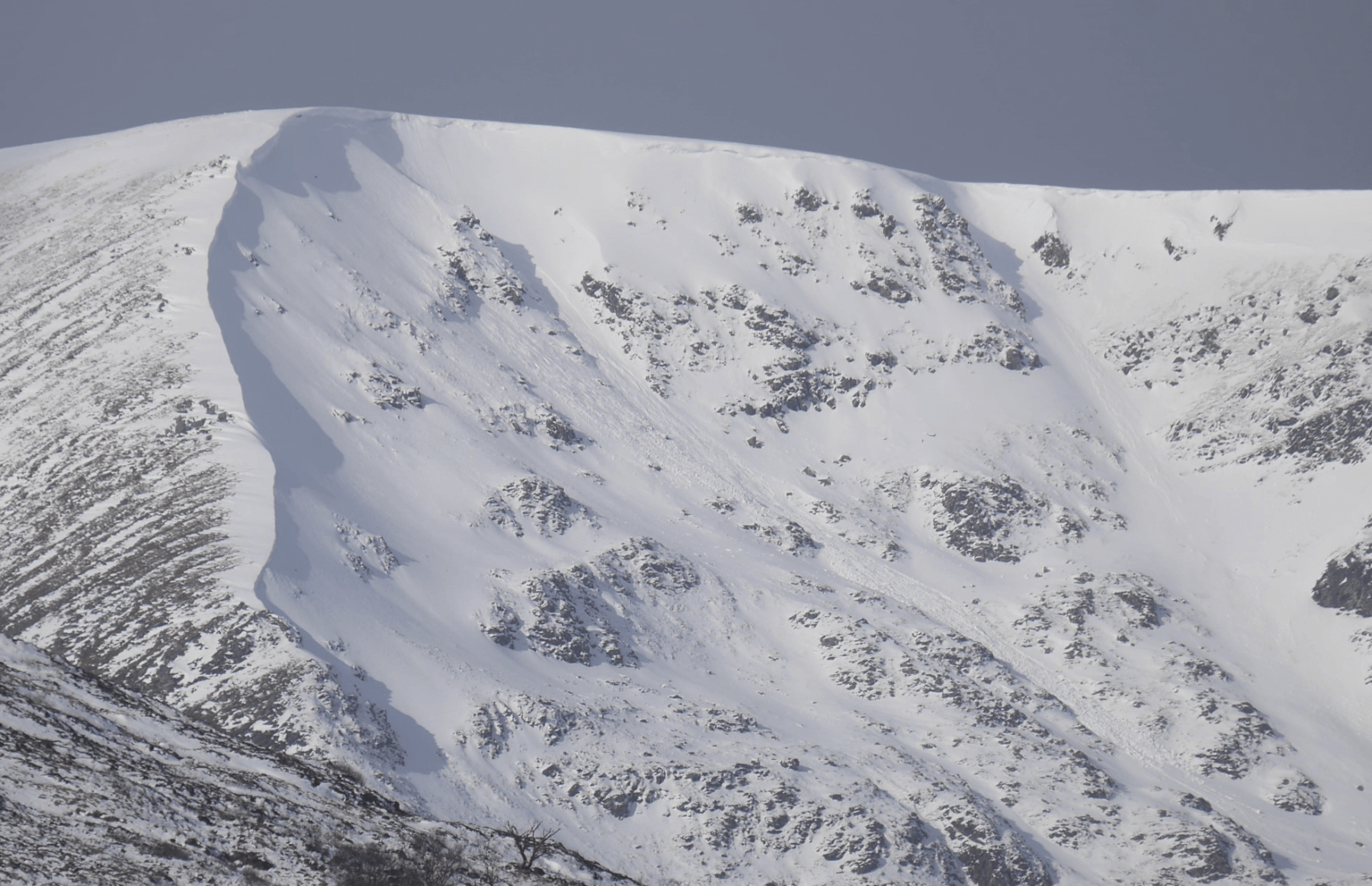 (Above) Same coire but a bit closer now. Avalanche and cornice debris. There’s a crown wall right under the cornice line at the highest point of the skyline unfortunately where the shadow is, though it is just visible if you zoom in.
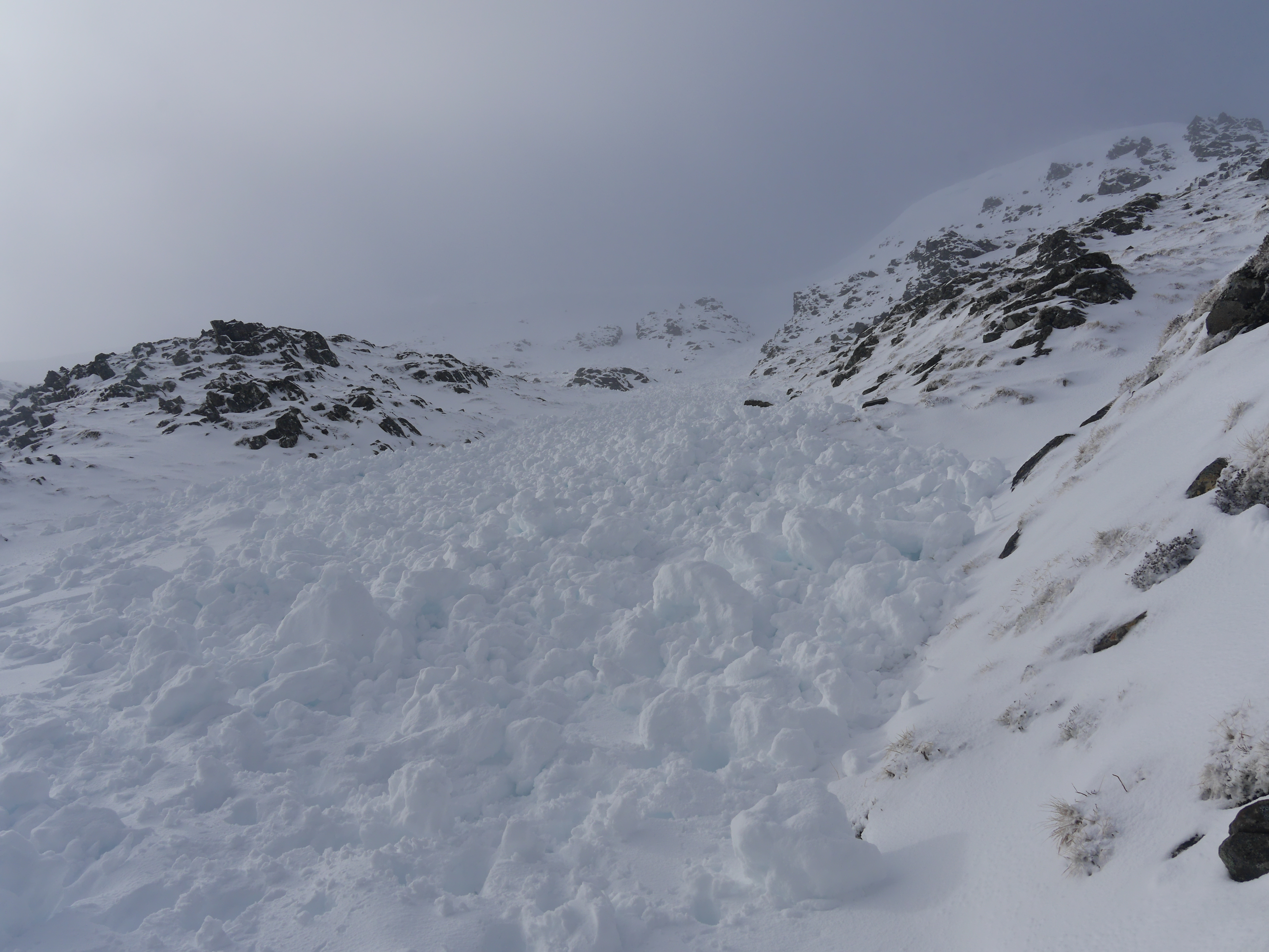 (Above) Channelled debris from a Size 2* event and deep enough to bury a few people. *Most of this is cornice debris so it’s not a proper Size 2 avalanche but enough debris (and sufficient volume) to fall into the size 2 category. An east aspect here. The crownwall was at 1030m and this cornice-triggered event occurred at around 9am this morning during the brief temp spike + rainfall. Stability at the time this photo was taken – after drier, cooler conditions kicked in – was pretty good and I was thinking Low overall hazard at that time. Not long after it started snowing and drifting again which some time later bumped up the hazard to Moderate.
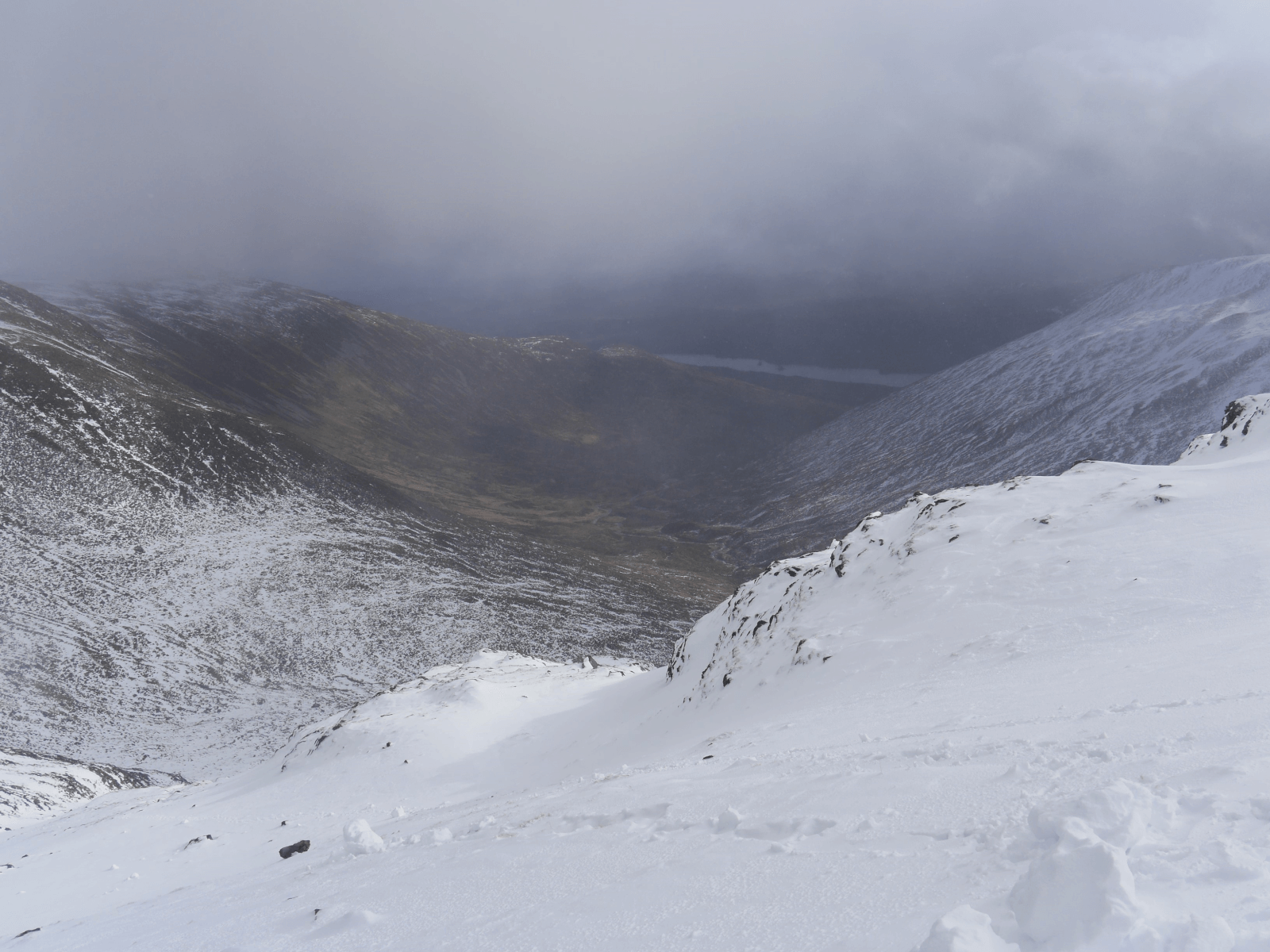 (Above) Looking down into Coire Ardair. Just dribs and drabs of snow down to 600m. Most snow lies above 850m mainly on plateau areas and N to E aspects.
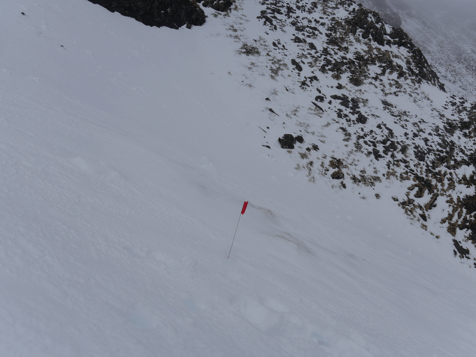 (Above) Solitary red flag marker at 800m in this infrequently visited coire. Maybe from a mountain rescue team avalanche debris probing exercise some time ago?
Comments on this post
Got something to say? Leave a comment


Keith Horner
27th February 2024 7:49 pm
Thanks for sharing this thought provoking insight into the complexity of avalanche forecasting and the balance of judgements which need to be made in establishing the published forecast in response to a frequently very dynamic set of circumstances and influences over a defined time period. It certainly brings home the notion that the snowpack is a constantly evolving entity – sometimes very slowly and other times immensely quickly – resulting from the complex interactions of different factors over time.
meagaidhadmin
27th February 2024 7:56 pm
Great precis, Keith. (Reads like the work of a sub-editor of a broadsheet national newspaper. Kudos!)
As ever, many thanks for your comment.
Brian Dickson
28th February 2024 3:16 pm
Thanks for the interesting post. Yes share a video of your meet sometime!