After the thaw
13th March 2024
It was mild and wet overnight, as the freezing level climbed well above the summits. A few rain showers during the morning quickly petered out to give an unexpectedly dry and bright day. Winds remained strong and blustery.
During thaw conditions overnight a period of poorer stability resulted in some minor wet slab avalanche activity high on a steep East aspect in Coire Ardair. This was most likely cornice triggered. Over in the Drumochter Hills a cornice collapse and associated wet slough was spotted from a distance. Inevitably the snowpack has become more patchy in nature but significant amounts remain on the high plateaus of Ben Alder, Geal-Chàrn and of course in our core area of Creag Meagaidh.
Cooler, drier conditions have resulted in the snowpack rapidly consolidating and becoming firm at higher elevations, while in some locations an icy crust has formed.
Two forecasters were out and about today, resulting in more images than usual with a wider geographical spread.

A’Mharconaich pictured from the track close to Coire nan Cisterchan. Just to the left of the main coire an obvious wind lip (or cornice line), can be seen where there is a convexity in the slope. Just visible in the image there is some debris from this feature that is likely to have come down overnight during the thaw. Arguably of little significance, this does indicate instability in the last 24 hours.

Wow. Patchy snow cover in many places, but the higher summits are still holding reasonable quantities of snow. Left to Right: The plateau of Gael Chàrn is visible, with patchier cover on Càrn Dearg. Unless mistaken, further back are the summits of Chno Dearg, Stob Coire Sgriodain and Stob Coire Easain. An Lairig separates the big summit on the right, Beinn à Chlachair and the distinctive bowl of Coire Bean á Chlachair facing the camera.
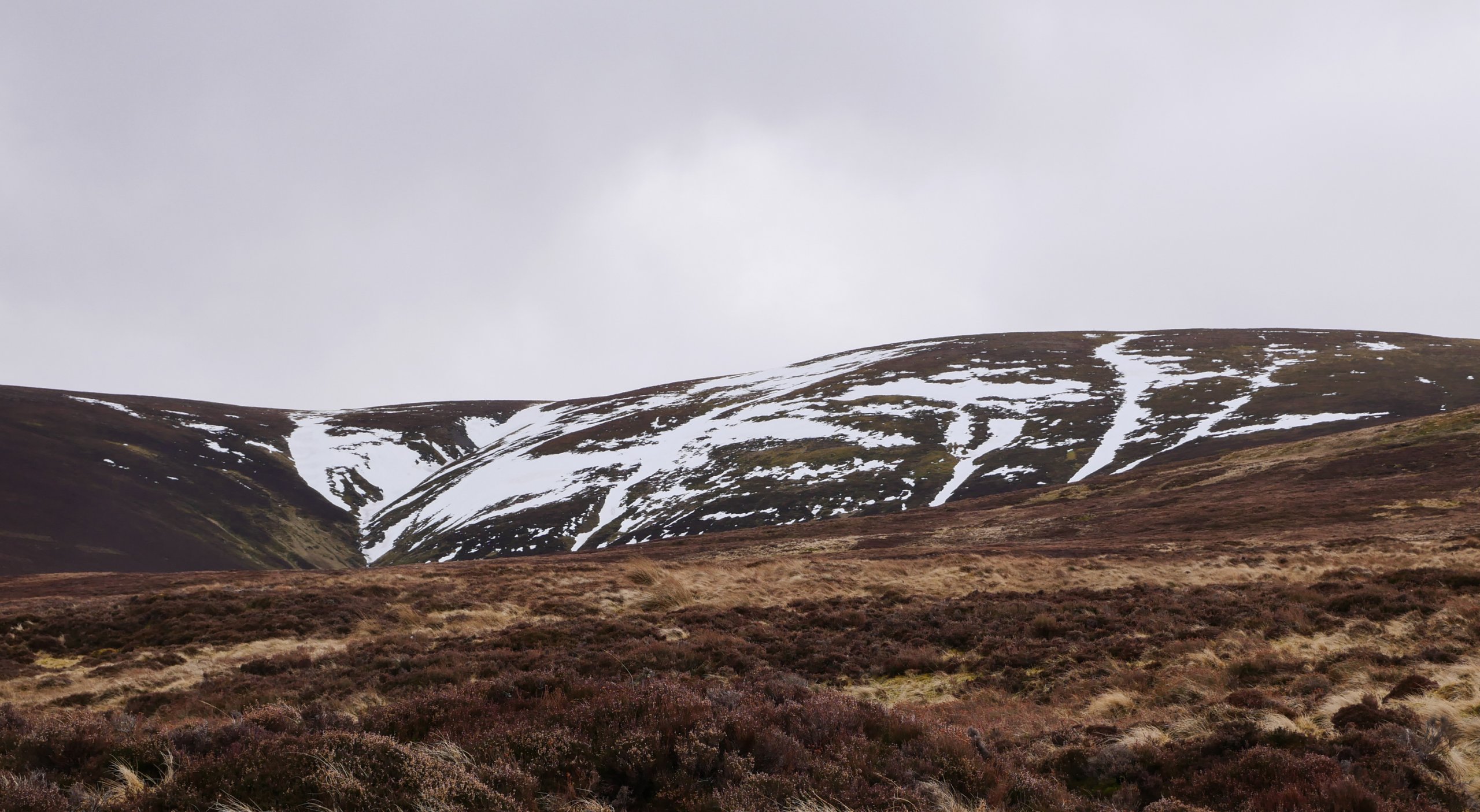
In the Drumochter Hills, snow patches and ribbons of snow in shallow burn lines are still present down to around 650-700 metres. As seen here in Coire nan Cisteachan.

Few things excite avalanche forecasters more than the complexity of an unstable snow pack. Even more exciting is one that could potentially threaten critical infrastructure in Scotland. Today at least, observations supported the view that the A9, The Highland Main Line, Sustrans Route 7 and power transmission where safe. More seriously the Drumochter Pass has been a through route since prehistoric times, and the A9 follows General Wade’s Military Road which was build between 1728 and 1730. I have always wondered if avalanche activity was recorded here in the late 1700’s?
Meanwhile over at Creag Meagaidh…
 (Above) The Post Face of Coire Ardair, the Inner Coire and The Window. After what can only be described as a wet, mingin’ start to the day, the weather cheered up dramatically. Occasional vicious gusts whipped up and carried spray across the surface of Lochan a Choire.
 (Above) The top of Easy Gully. Coire Ardair. Small size 0.5 cornice triggered wet slab avalanche debris released overnight/early am during the mild, wet conditions. Stability improved quickly everywhere as cooler, drier (clearer!) weather became established later in the morning.
 (Above) Minor drifting over the top of the Post Face. Must have been a little snow on the back edge of the front that passed over our area last night/early am but only an insignificant amount of drifted snow had accumulated at the time of reporting.
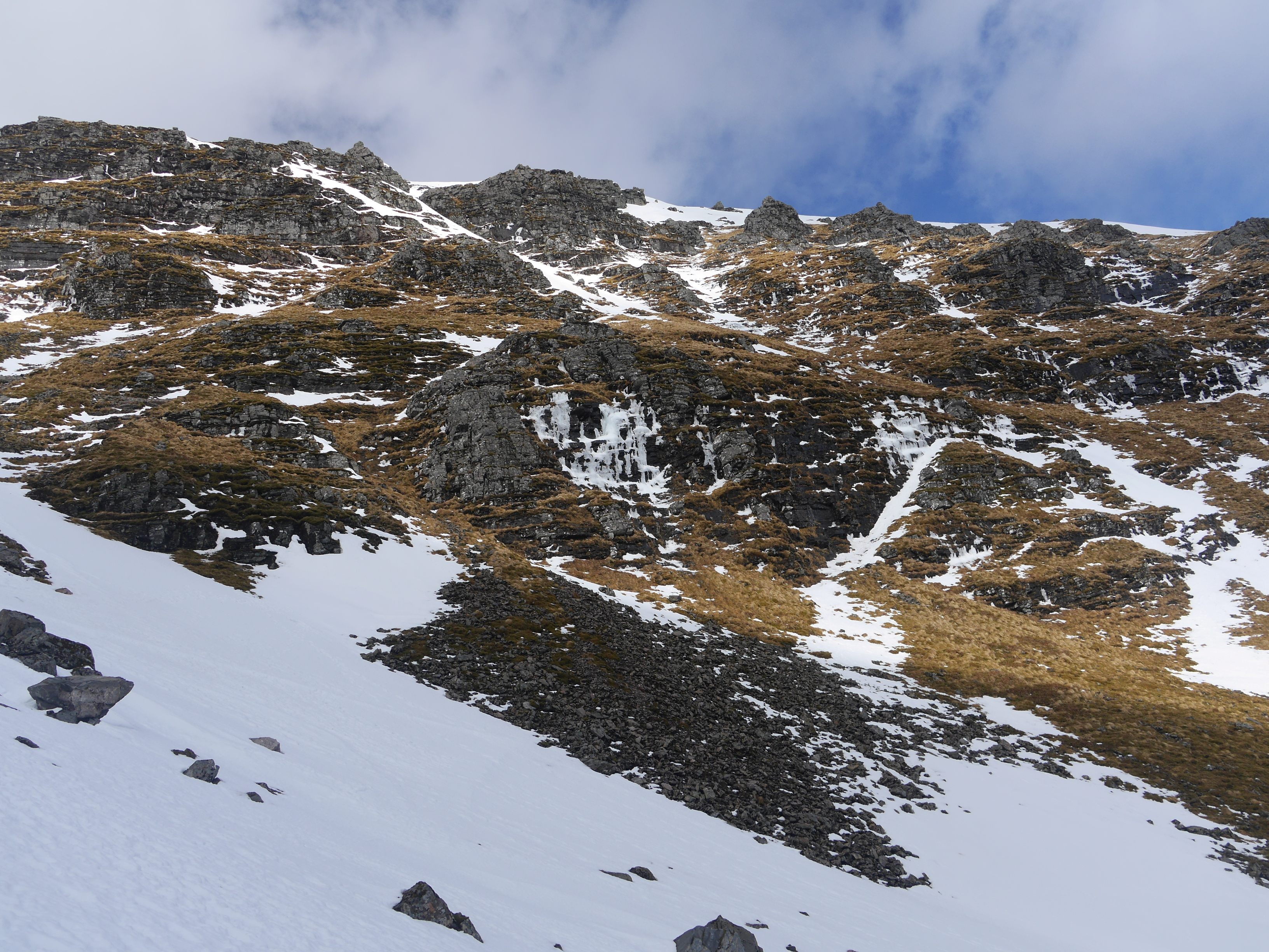 (Above) The south-facing side of the Inner Coire. Falling ice observed here during the late morning. The worrying sound of rockfall also heard from somewhere near at about the same time.
 (Above) ‘Never Rarely, Sometimes Always’ – a handy soundbite that summarises the cornice issue in Scotland. Cornice collapse was a problem very early in the day though cooler, drier weather later helped ‘heal’ the snow a little in these fickle cantilevers. Residual cornice line above ‘Cinderella’ in the Inner Coire.
Comments on this post
Got something to say? Leave a comment


Keith Horner
13th March 2024 7:56 pm
Re the A’ Mharconaich wind lip, this forms fairly regularly and is easily visible when travelling north on the A9. When descending from the summit to Coire Dhomhain, the often well defined edge to the snow line meeting the bare ridge forms a handy guide to follow to join the remnant of the old march fenceline defining the boundary line between Strathspey and Atholl which extends over Udalmain to the Boar of Badenoch and beyond.
Interesting thought if the modern planners of major infrastructure projects consider the possibility of avalanches when deciding on their routeing strategy. Clear evidence in recent years of the A93 being blocked by an avalanche south of Braemar so perhaps in some very specific circumstances this might be a possibility at Drumochter?
meagaidhadmin
14th March 2024 8:56 am
Thanks Keith. I notice the boundary line on the map, although not been down that way. Certainly evidence of activity on (or over) the A93 in recent years.A quick look at the avalanche map shows two avalanche events at Drumochter, 4th Feb 2021 and 12th Dec 2010 both in storm conditions on East-South-Easterly winds. Relatively rare events. But it does always interest me the proportion of reported events vs avalanche event occurrence. Absence of evidence is not necessarily evidence of absence of course…
Mark Bull
13th March 2024 9:00 pm
That wind lip is a potentially nasty surprise for ski tourers: not easily visible from above and not really where you might expect a cornice!
meagaidhadmin
14th March 2024 9:04 am
Mark – Yes I bet. I mentioned wind lip / cornice as I was viewing from the summits the other side of the A9. It is big enough to be visible from a distance, and I am conscious that the term “wind lip” might trivialise the feature. Agree that it is not where you might expect. It reminds me of some of the features that you see coastal areas of Norway e.g. Senja and Kvaløya. Kattfjordeidet is a good example where you get mid slope features from cross-loading, none of which you would want to unexpectedly drop off. A good reminder of the challenges of ski touring in poor visibility.
Keith Horner
14th March 2024 9:41 am
Coincidently, this morning I saw in the Alpine Club of Canada newsletter a link to a travelling exhibition – ‘Land of the Thundering Snow – Exploring Avalanche History and Safety in Canada’. The exhibition emphasises the impact that avalanches have had on influencing human settlement, migration, travel and transportation and that the history of avalanches is in many areas of Canada the story of people responding to their landscape. So interesting to note the Canadian experience and attitude to avalanches and how they have influenced how parts of the country have developed.