Creag Meagaidh-specific issues
30th March 2024
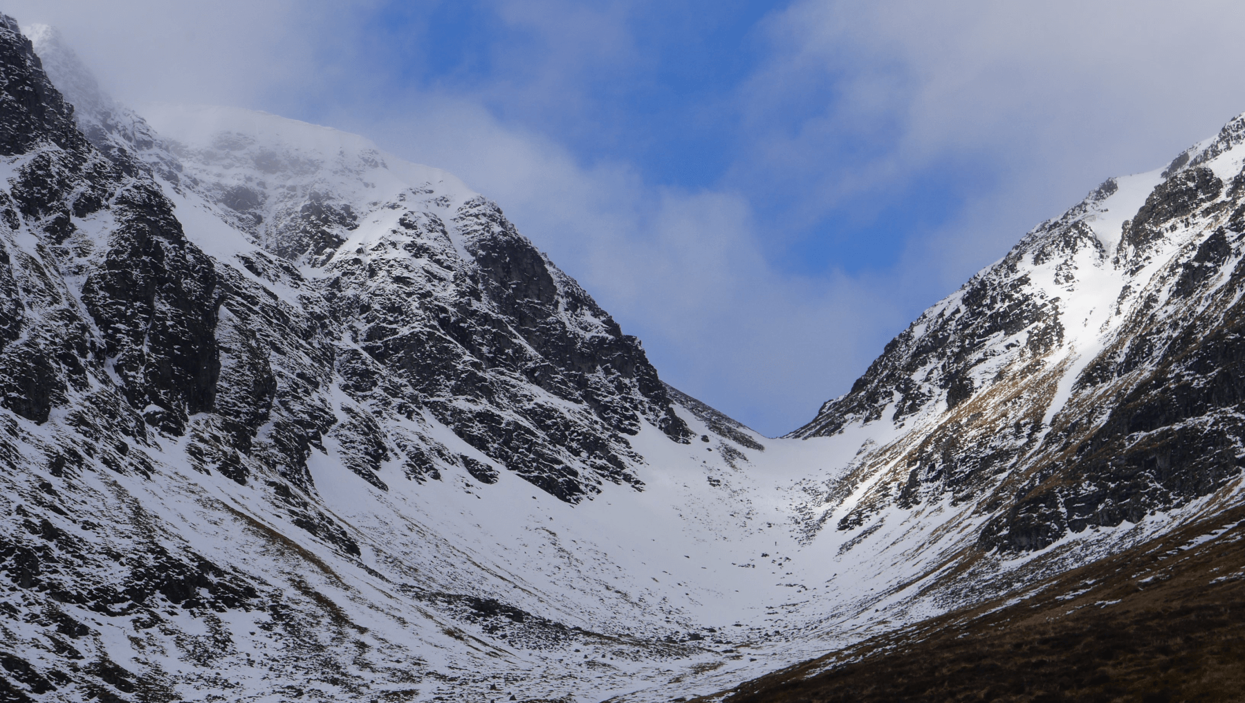
 (Above) Early morning showers disappeared to leave clearer skies for most of the rest of the morning and early afternoon.
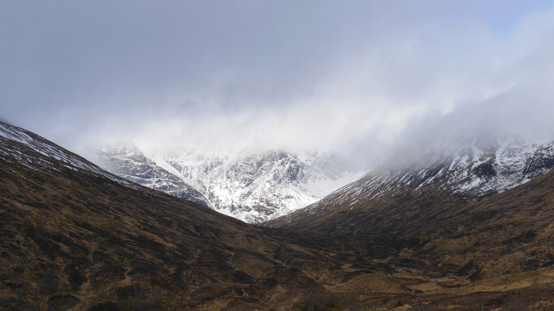
 (Above) The Inner Coire and The Window having their moment in the sun.
Some welcome sunshine and with it milder temperatures but there is a bit of a downside too that’s specific to Creag Meagaidh at this time of year.
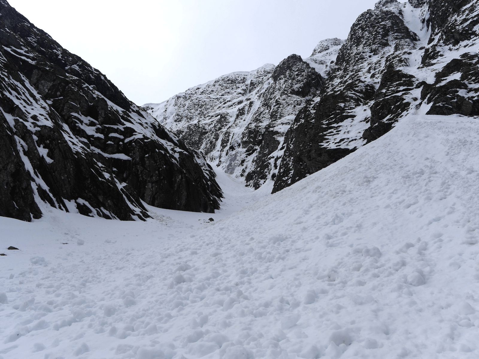
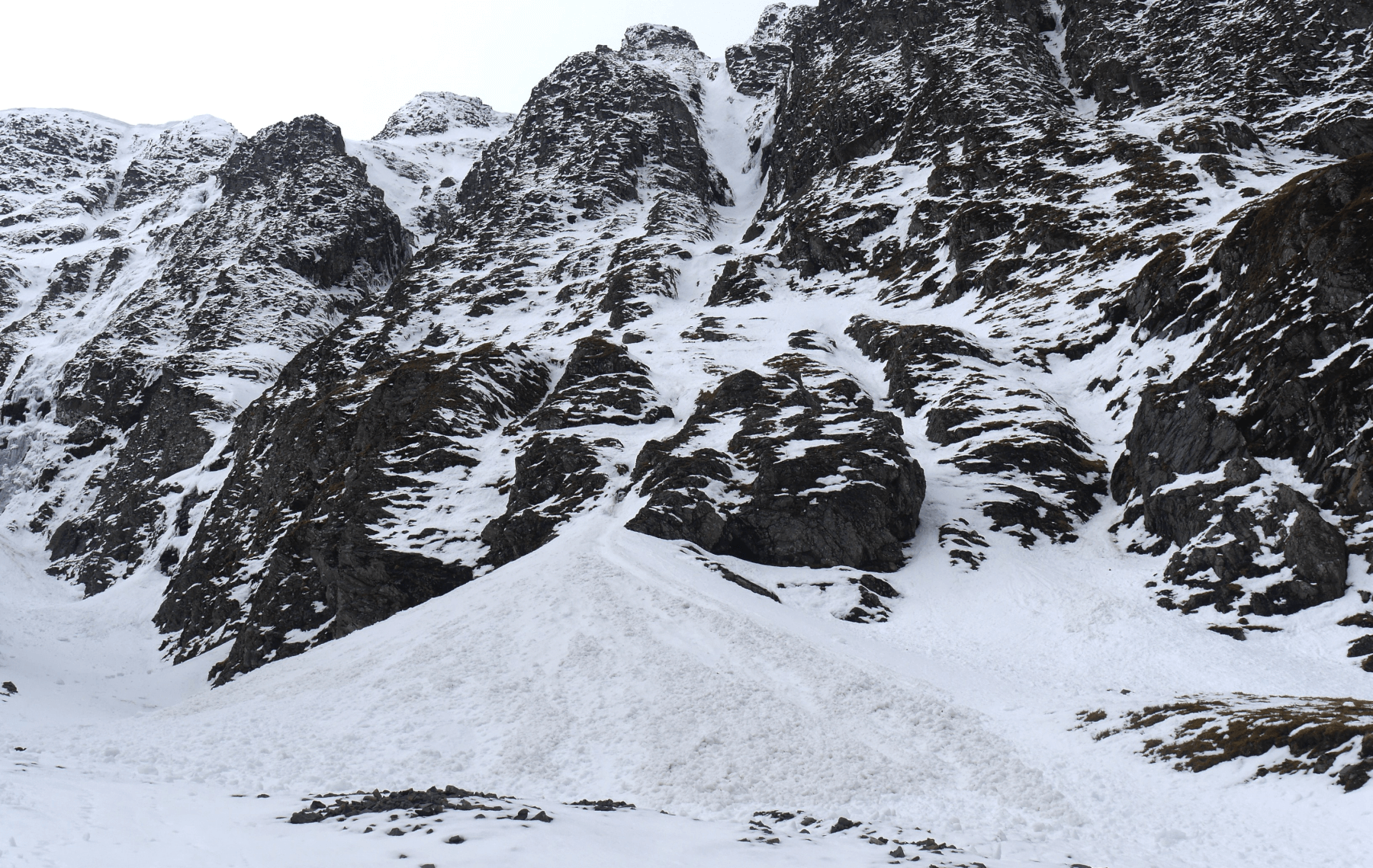 (Above) The South Post left and Centre Post on the Post Face of Coire Ardair. Debris from minor full depth snow slides in these two well-defined gullies. To be precise, the wet snow came from near rocks no higher than 850m or thereabouts on this E-facing crag. The debris came down in dribs and drabs so what you see is from 5 or 6 very small events triggered by warmer temperatures. Quite different snow lies above circa 850m: denser, whiter and less wet than the lower altitude stuff.
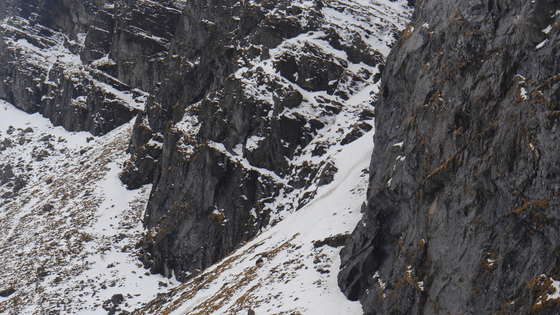
 (Above) A glimpse into Easy Gully. Had a ‘bit of a moment’ when a sizeable chunk of ice came crashing down off Last Post (an ice route, visible – centre ) just after this photo was taken. Check out the snow on the ledges in the photo, a lot of it wet and thawing in the lower reaches of the crags. No surprise to see this sliding off when it’s persistently warm.
It’s definitely that time of year again when Creag Meagaidh – quite unlike other SAIS areas – has to cope with a variety of mountain issues all at once brought about by better (warmer) weather, especially after it has been cold and/or snowy. Falling ice, collapsing cornices and full depth avalanches (of varying size, often small) are all included. (You can add rollerball/pin wheel surface snow instability as well, something we had a little of this morning quite soon after light snowfall. Other areas do of course get this as well.) They can all co-exist alongside an official ‘Low avalanche hazard’ category, too, something we’ve elaborated on at length in the past.
 (Above) A view over to the mouth of Raeburn’s Gully. More wet snow debris here emanating from Pinnacle Buttress.
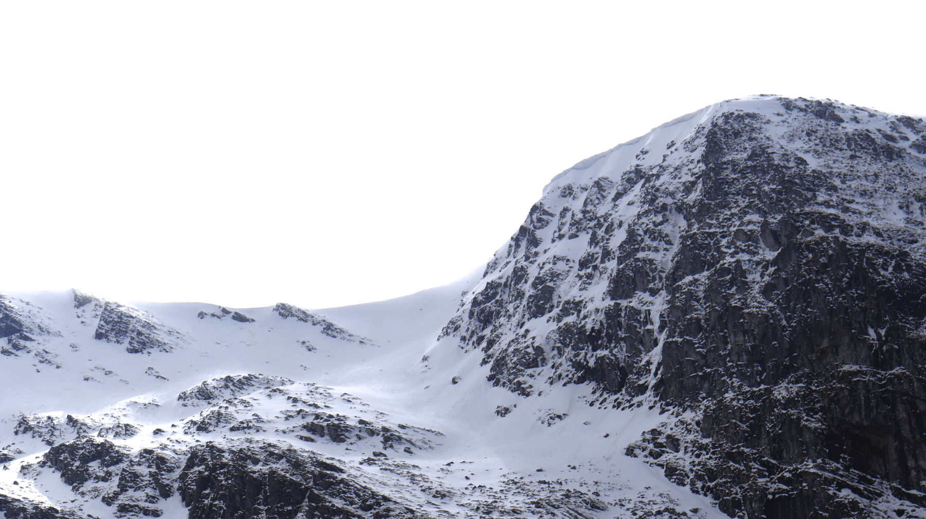 (Above) Bellevue Buttress. Some cornices still in place which are expected to weaken later in the day on Sunday.
The freezing level is just above summits overnight but we’re also expecting a clear night sky which should bring about some radiation cooling and help firm most things up – at least until warmer air temps prevail from dawn onwards.
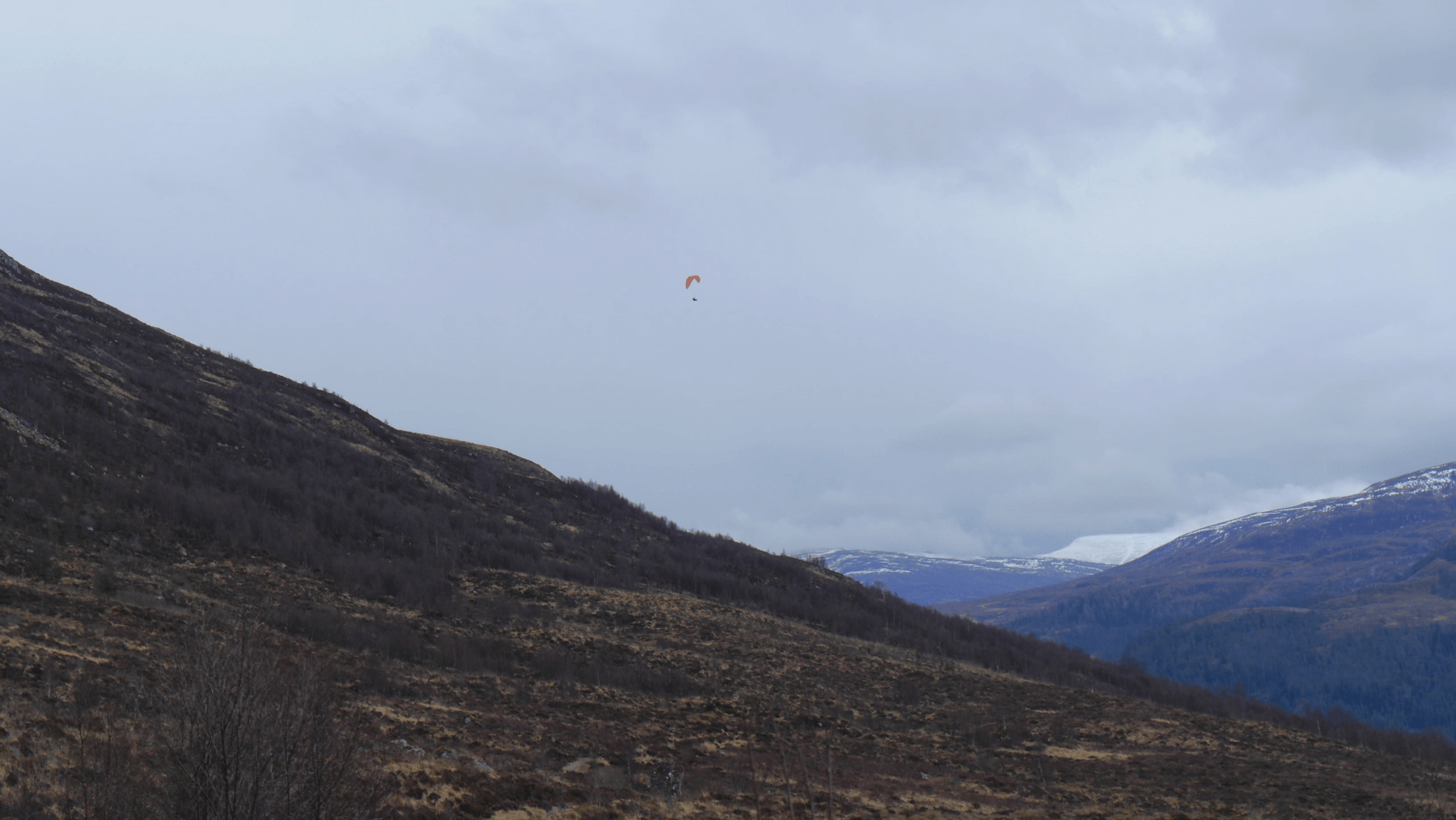 (Above) Breeze was light enough in the early afternoon for someone to enjoy what looked like a very pleasant flight off Carn Liath (don’t think they came off the summit though?)
Comments on this post
Got something to say? Leave a comment