East/West split
18th March 2024
Quite a noticeable difference in snow distribution from east to west in our area at the moment. Only relatively modest amounts lie to the east of a north/south line through Coire Chriochairein.
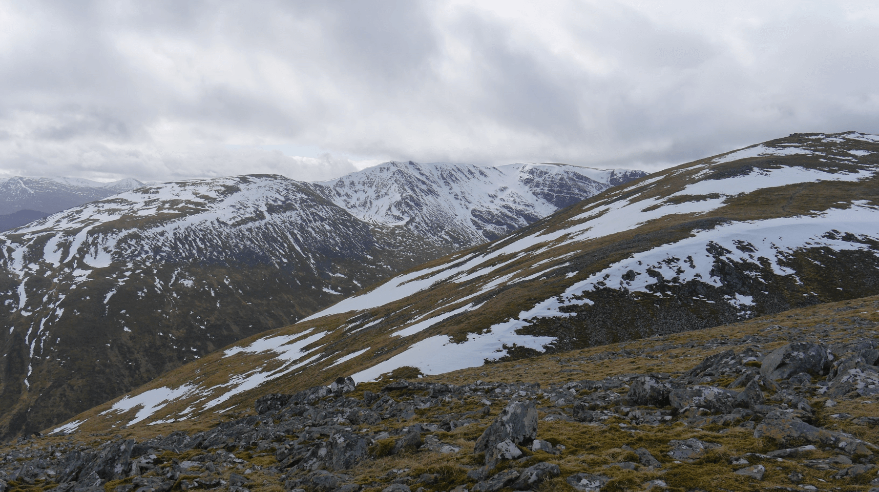
 (Above) The Carn Liath plateau, looking E from above the Min Window. Carn Liath summit is the highest point on the skyline. Even (unseen here) E aspects over there have quite modest amounts. However there is some old snow tucked away on the N aspects, just significantly less than in the western reaches of our patch.
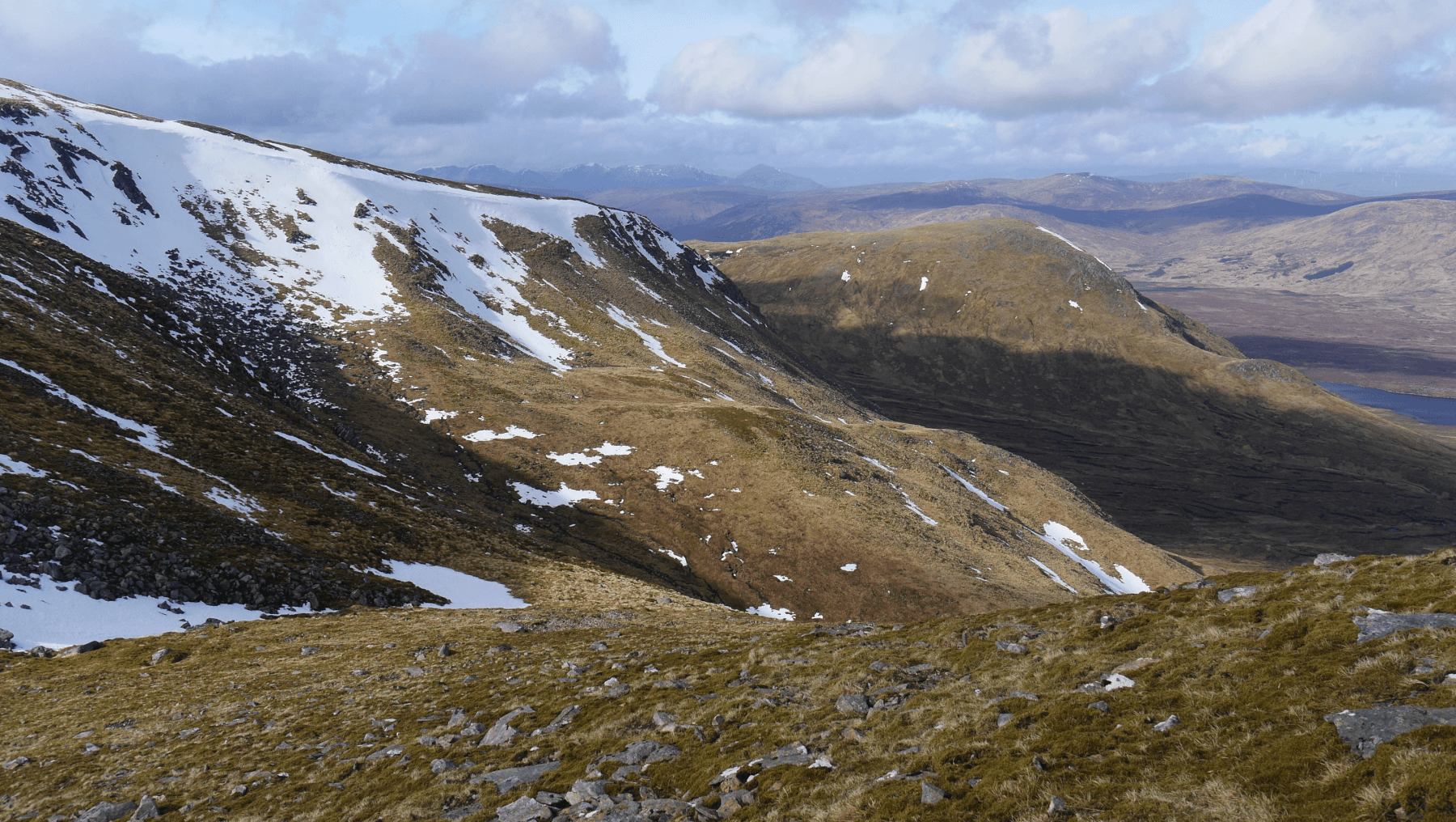
 (Above) Same location as previous photo, this time looking W towards Sron a Ghoire, Coire nan Gamhna and Bellevue Buttress. The ground in front of the camera descends down towards the Min Window (Uinneag Min Choire).
 (Above) The Min Window. A narrow defile linking Upper Speyside and Glen Spean. Back in the day there was a stalkers’ hut (or perhaps summer shieling shelter) at the top end of the Min Window at the site of which some old stove pipe could be found. Not today though as there’s still some old snow patches where the hut once stood. It’s a terrible location for a hut as fierce winds are channelled through this prominent gash in the landscape. Maybe it’s not quite as bad there in the summer? Research suggests that places such as the Carn Liath plateau supported enough grass for some limited transhumance grazing in the summer months, see here: https://radar.gsa.ac.uk/8544/72/Cultures%20of%20the%20shieling%20%238544.pdf
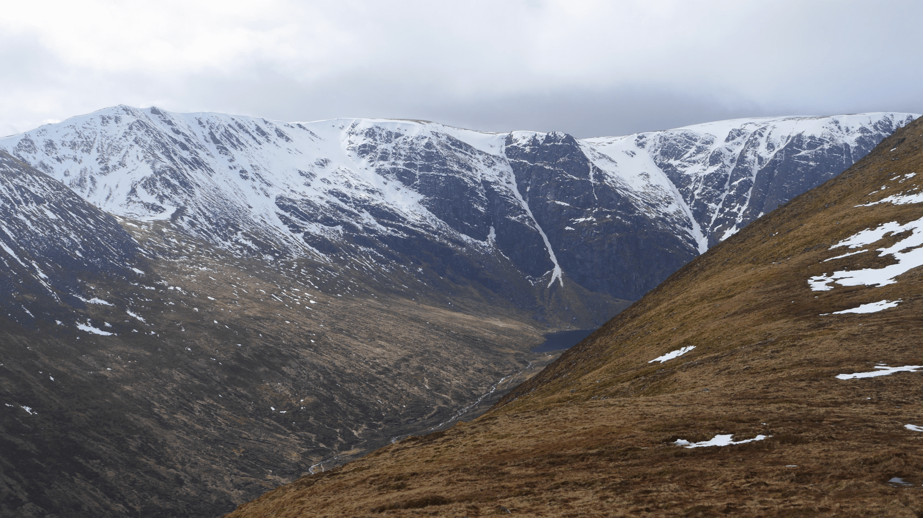
 (Above) The Min Choire. A remote N-facing coire high above Loch Spey far right and the sight of today’s formal snow observations. Quite firm old snow here courtesy of the shade but much softer of course on sun-exposed aspects on the other side of the mountain.
 (Above) The money shot. The upper end of Coire Ardair with Bellevue Buttress, Raeburn’s Gully, Pinnacle Buttress, Easy Gully and the Post Face prominent. A few residual cornices here and there, like over Bellevue Buttress and part of Pinnacle Buttress both pictured, but many have either slumped or collapsed some time ago. The few that remain will become weak after the wet weather kicks in. Rock and ice fall will be objective issues during the forthcoming meltdown/wet spell.
Wet and mild overnight then, when there might be a little minor wet snow instability on a few steeper snow-holding aspects, but this will be stemmed with the onset of somewhat cooler conditions during the day.
Comments on this post
Got something to say? Leave a comment