The post thaw thaw
14th March 2024
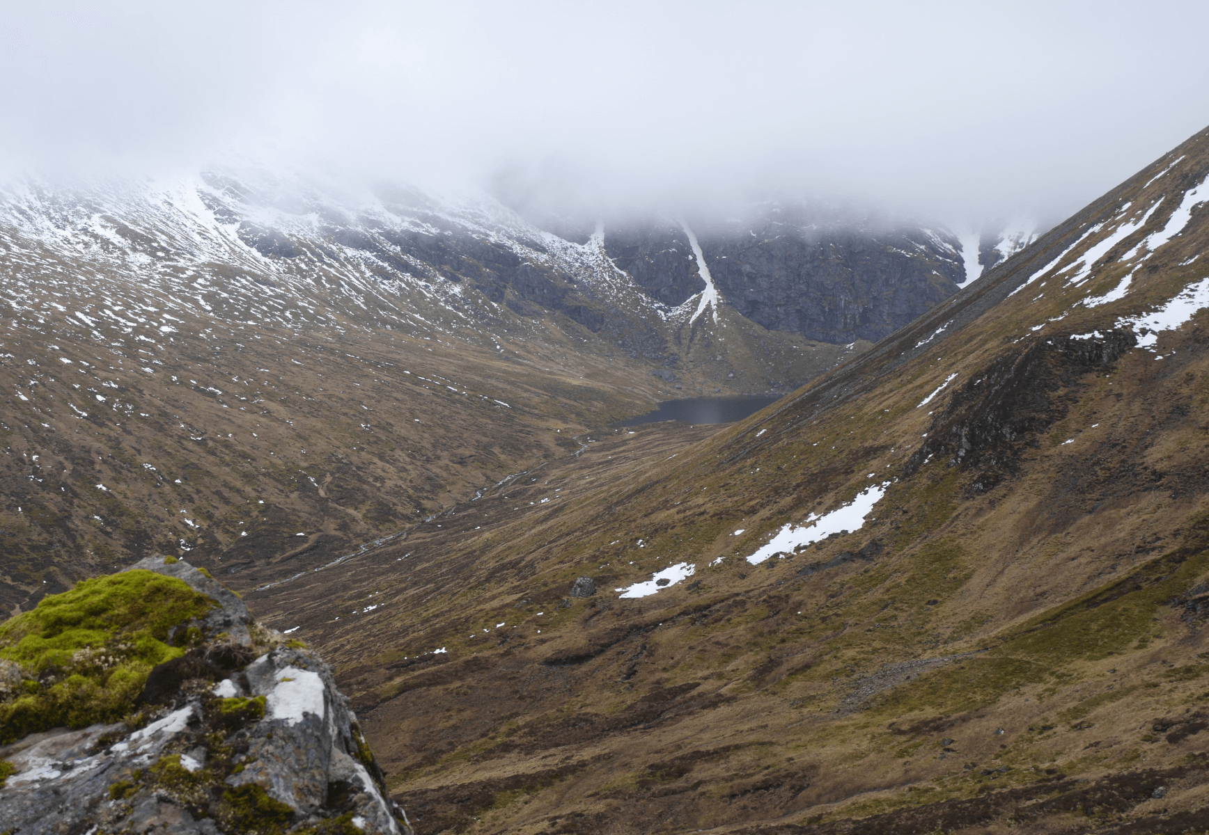 (Above) Looking down from near Wall Gully – a re-entrant carved into the southern flank of Sron Coire a Chriochairein. In the distance, Lochan a Choire with the talus fan of Raeburn’s Gully immediately above it. Forecasted snowfall didn’t really materialise in our area overnight and during the day. There was a little but it was confined to summit areas and associated accumulation zones. Looking quite patchy on some aspects. Best cover currently is above 800m on N to E aspects.
 (Above) The steep & bare S to SW-facing aspects of Coire Chriochairein – from the centre to the right of shot. Only of interest because it’s places similar to these that tonight and tomorrow’s snowfall is expected to start accumulating as windslab. There’s mention of it in the avalanche forecast, too.
Snow accumulating on bare ground tends to offer less hazard in the first instance for at least two reasons:
(First, a primer on the prerequisites for a slab avalanche: a bed surface for the avalanche to run on, a weak layer that fails in shear or shear-fracture, and a cohesive body of snow acting as overburden on top of all that.)
- The ground surface offers better ‘anchoring’ for new snow due to its inherent surface roughness (not always but often) thus providing a high friction bed surface for the accumulating snow.
- Exposed ground, because of its geothermal mass, is relatively warm and will encourage new snow accumulations in contact with it to metamorphose quite quickly and become better bonded both to the ground and to adjacent snow grains. There will be a little melting but the ground surface will also be experiencing some cooling due to the cold snow, not quite in equilibrium but near enough to maintain stability.
There are plenty of caveats, some applying to much colder mountain areas.
- Once new snow covers the ground, it automatically provides a bed surface of sorts for subsequent drifted snow.
- Rapid warming, or rain, after a snowfall/drifting event onto bare ground can (will!) upset the equilibrium at the ground/snow interface and can lead to full depth avalanche activity.
- Steeply inclined continuous permafrost and glacier ice induce different snowpack dynamics and early onset avalanche activity due to very cold contact surface temperatures.
- The onset of persistent very cold temperatures after drifting onto bare (warmish) ground can lead ultimately to basal weakening due to the very steep temperature gradient between the ground and the air, leading to the development of very weak depth hoar crystals right at the bottom of the snowpack. This one is not normally a ‘new snow’ issue since the depth hoar grains need time to develop.
The bottom line. We’re expecting localised accumulations of moderately bonded windslab to be developing in places similar to where there is exposed ground in the photo above – in steeper locations and above circa 950m. A covering of fresh snow elsewhere.
 (Above) The Big Picture. Sron a Ghoire et al as viewed from the east today.
Comments on this post
Got something to say? Leave a comment


