An Cearcallach & Moy Coire: rain/snow/rain
2nd April 2024
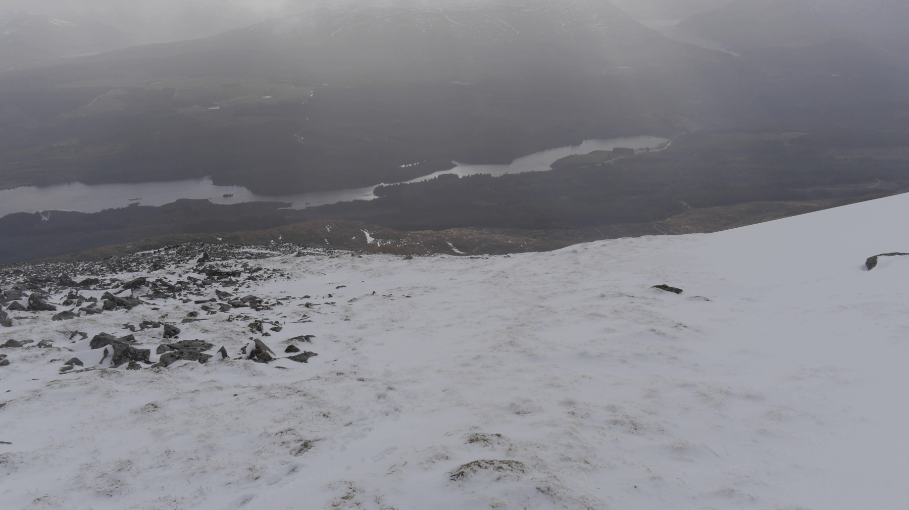 (Above) Looking down from An Cearcallach into Glen Spean and the reservoir end of Loch Laggan. Persistent light precip throughout the morning coming in the form of rain down low and snow up high. An uncomfortable and somewhat demoralising Scottish combo given that you get wet followed by cold on the outward leg and wet again when homeward bound. A thin cover of fresh snow in most places above circa 900m with some drifting but mainly onto bare ground.
 (Above) Looking north on An Cearcallach en route to the Moy Coire. Visibility was poor all day above 800m though the skies did lighten a bit once I was off the hill.
 (Above) Looking north into the Moy Coire. The well defined ‘V’ shaped burn line on the right is normally choked with snow by this point of the winter: a reflection of the paucity of this season’s snowfall, I think, and an indication of the ‘new normal’ perhaps?
Quite a lot of discussion at our daily conference about forecasted snow amounts for the 3 eastern-most SAIS areas for overnight and tomorrow. The track of the low pressure frontal zone is a bit uncertain and the Met Office forecasters have commented that we may get more snow than the formal charts and graphs show. Best advice is to incorporate this uncertainty into your hill day and plan cautiously if venturing into the highlighted hazard areas indicated on the official SAIS avalanche forecasts.
Comments on this post
Got something to say? Leave a comment


Seth.
2nd April 2024 9:20 pm
Do you think the more sparse cover is more indicative of mild weather or less precipitation? Would be interesting to know what the winter rainfall/snowfall trend is alongside the temperature trend which has clearly been on the up in recent decades. Also you might be the chap who helped a buddy and I after a nightmare scenario briefly turned into reality in February so thanks for that, it was very good of you. If anyone spies some axes at the bottom of Raeburns gully I’d like them back!
meagaidhadmin
2nd April 2024 10:20 pm
Would need to be confirmed but my impression is that this year’s trend has been for both milder and wetter weather at Creag Meagaidh, with less snow, something that is in broad alignment with what we have been told about climate change in general in this part of the world. The NW highlands seem to have had more of a bum deal than ‘Meggie snow-wise. The Fannaichs have had some snow – more than Torridon – but pretty modest amounts overall.
The screenshot below (from today!) gives an indication of rainfall for March across the UK. March, at least, was a comparatively dry month for the NW and clearly there’ll be an associated decline in snowfall amounts during that time too. Looking at the map, Meggie appears to have had less rainfall in March. Would like to see the stats for the other winter months for our area. My own personal built-in ‘dripping goretex’ sensor pointed to a really wet February, a month when it seemed to rain whenever I was on the rota – which was frequently.
On the upside the NW had more sunshine, giving rise to SAIS Torridon’s blog titled, ‘Costa del Torridon’ on March 6th.
Edit. It was milder in March at Meggie. See below. The salient that pushes up from the central highlands would include Creag Meagaidh.